
Julian Mayes
Aug 4, 2019, 8:10:08 AM8/4/19
to Weather and Climate
With over 50mm of rain in Dumfries and Galloway from a thunderstorm in the early hours, there's clearly a serious risk of heavy downpours with a great deal of moisture in the air. That does not justify a BBC reporter at Whaley bridge saying recently that there WILL BE 40mm of rain there starting in the next 2 hours. Clearly a problem with understanding risk with convectional rather than purely frontal rain.
Latest radar suggests showers breaking out locally in SW London - the sky here does look rather threatening but any shrs likely to be very isolated down here in the SE. I only mention it in view of the series of London - Surrey cycle races taking place today, as they do each year. Coverage of the mens' prof race later this pm on BBC 2. I live just inside the circuit in Surrey so along with neighbours am effectively under house arrest as roads are closed for the whole day. All in a good cause though.
I'm not convinced that the benefits of nowcasting and rainfall radar are being utilised fully - on a day with numerous outdoor events etc.
Julian

xmetman
Aug 4, 2019, 9:16:44 AM8/4/19
to Weather and Climate
I see those showers north of London as well Julian - maybe falling from medium level instability and not reaching the ground.
I agree we could do a lot more with weather radar than we do - it's an underused resource.
xmetman
Aug 4, 2019, 12:31:04 PM8/4/19
to Weather and Climate
Difficult to say without hourly rainfall totals how much of the rain from these thundery showers is reaching the ground
Julian Mayes
Aug 4, 2019, 1:28:08 PM8/4/19
to Weather and Climate
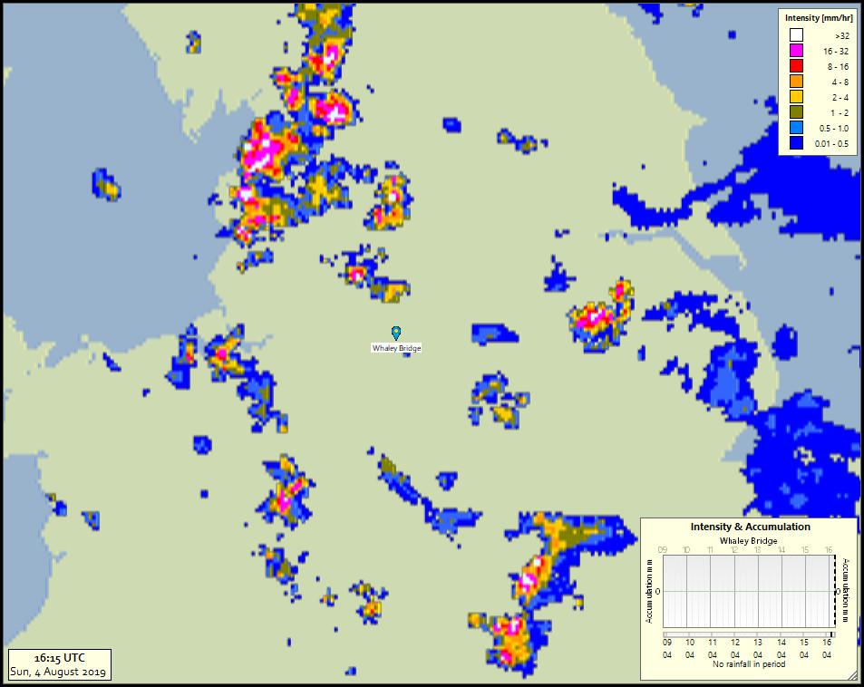
Reports of heavy rain in Lancashire - with hourly totals from Myerscough (just north of Preston) of 11.8 and 5.0 mm in the 2 hours up to 17h Z. Not much else though in England so far - zeros in the east Midlands area, but maybe heavier cells passing between observing sites there. Nothing much in S Scotland either to compare with the ovnt amts in Dumfries & galloway. Good to see Whaley Bridge avoiding the action so far - BBC reporters there possibly muttering falsely about an incorrect forecast which they had not understood?
Some of the light showers earlier in the SE did reach the ground - the cycling commentators in central London mentioned this earlier on BBC.
Julian
Reply all
Reply to author
Forward
0 new messages