xmetman
I don't think I've ever seen a yellow warning just for lightning so this a first for me.
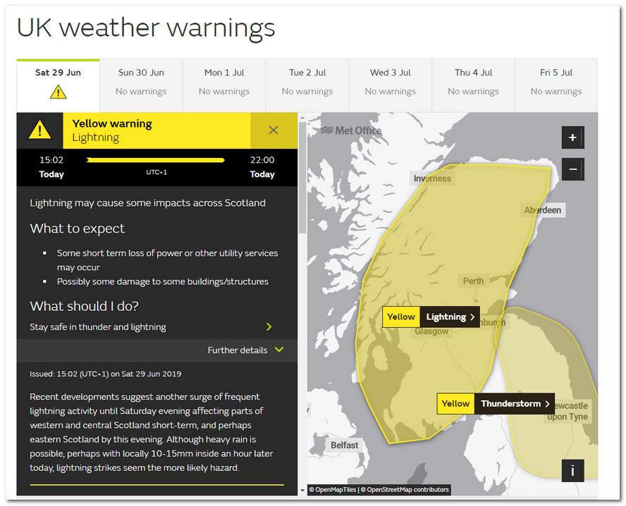
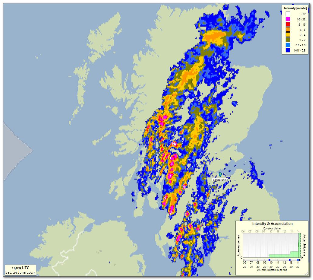
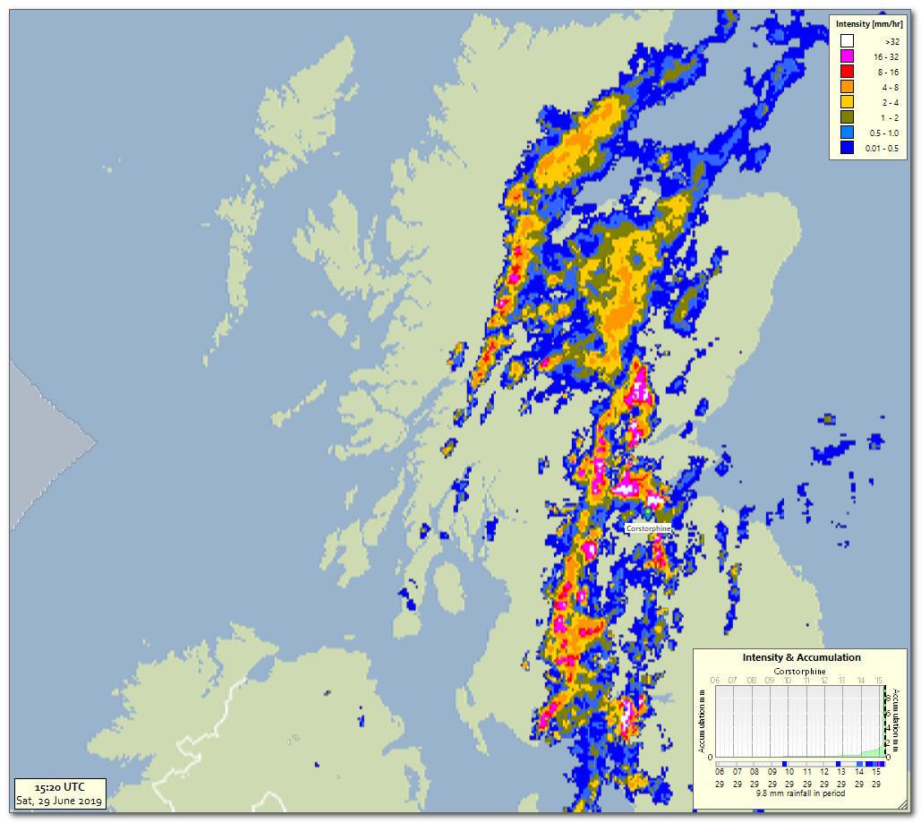
Perhaps the brave forecaster who issued the lightning warning - and not one for the accompanying heavy rain - is either supremely confident that those white pixels in the latest radar image won't cause flash flooding or he is colour blind.
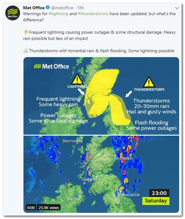
I can't understand how the Met Office can be so pedantic - marking one warning area thunderstorm and another just lightning - and don't tell me it's all to do with impacts!
xmetman
xmetman
Metman2012
Freddie
I don't think I've ever seen a yellow warning just for lightning so this a first for me.
Perhaps the brave forecaster who issued the lightning warning - and not one for the accompanying heavy rain - is either supremely confident that those white pixels in the latest radar image won't cause flash flooding or he is colour blind.
I can't understand how the Met Office can be so pedantic - marking one warning area thunderstorm and another just lightning - and don't tell me it's all to do with impacts!
Freddie
Dorrington
Shropshire
115m AMSL
http://www.hosiene.co.uk/weather/
Stats for the month so far: https://www.hosiene.co.uk/weather/statistics/201906JUN.xlsx
xmetman
xmetman
https://apps.sepa.org.uk/rainfall/
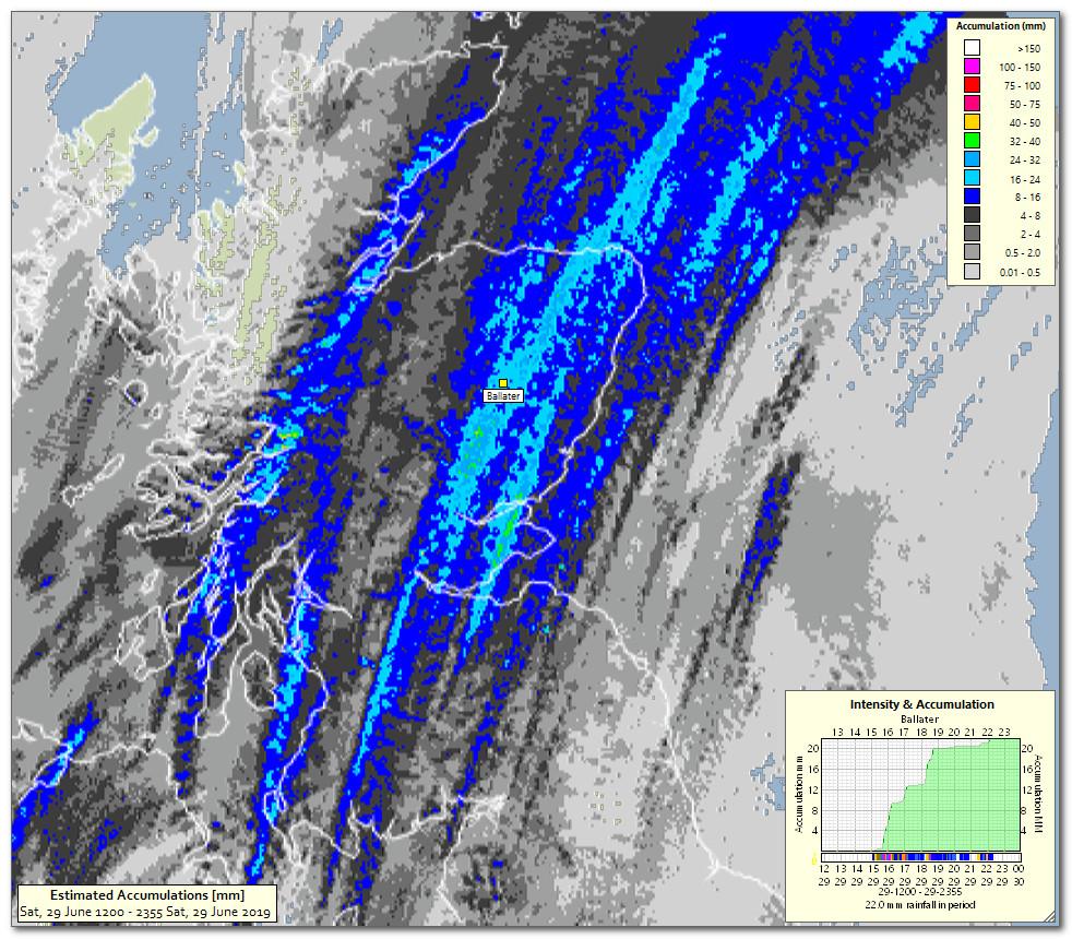
The point I'm trying to make is that there's no point differentiating between a yellow warning area for thunderstorms over NE England and one for lightning over southern and eastern Scotland for today, when as far as I could see (before having my tea and jumping in the bath) there was more imaginary rain over Scotland than anywhere else. Just issue a thunderstorm warning almost invariably they go hand in hand - and please don't remind me of July 1984 and the lightning storm that set York Minster on fire, I was observing that night at Binbrook and do realise that you can get electrical storms without much if any rain, but that wasn't what was happening this afternoon judging by the rainfall figures from the SEPA site. The rainfall wasn't as heavy as earlier this week at either Edinburgh or Stirling but why try to split hairs.
There is some kind of vague parallel with how warnings have now become some kind of strange art form with the senior forecasters at the Met Office, just as the analysis charts have gradually got more convoluted over the last 20 years or so as well. ALL I can think is that they all must have far too much time on their hands.
George in Edinburgh
xmetman
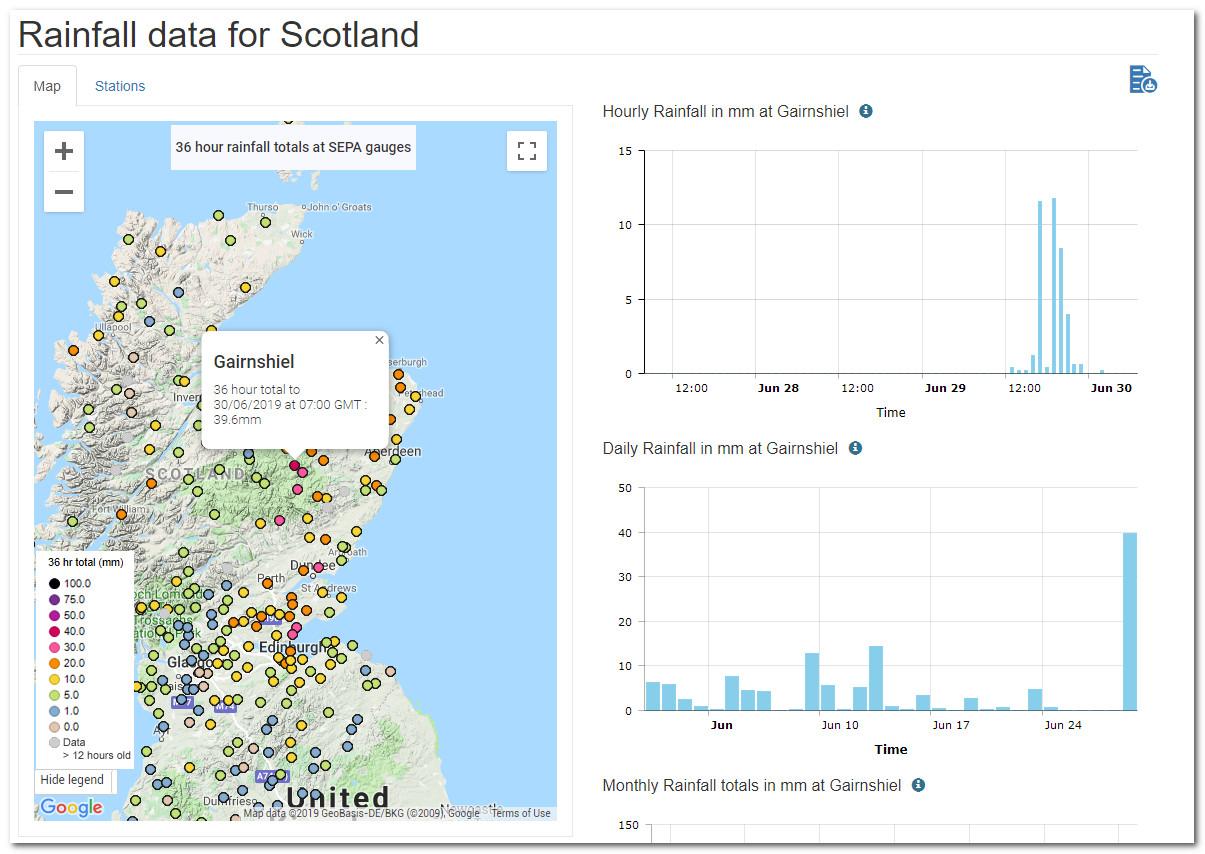
You could argue that the maximum hourly rate was no higher that 12mm here at Gairnshiel where the rainfall total was just shy of 40mm. But the thunderstorm for northeast England and SE Scotland was for flash flooding with totals of only 20-30 mm. If you look carefully at the SEPA map there were numerous reports from towns in that range including Kirkcaldy, Dundee and west of Aberdeen.
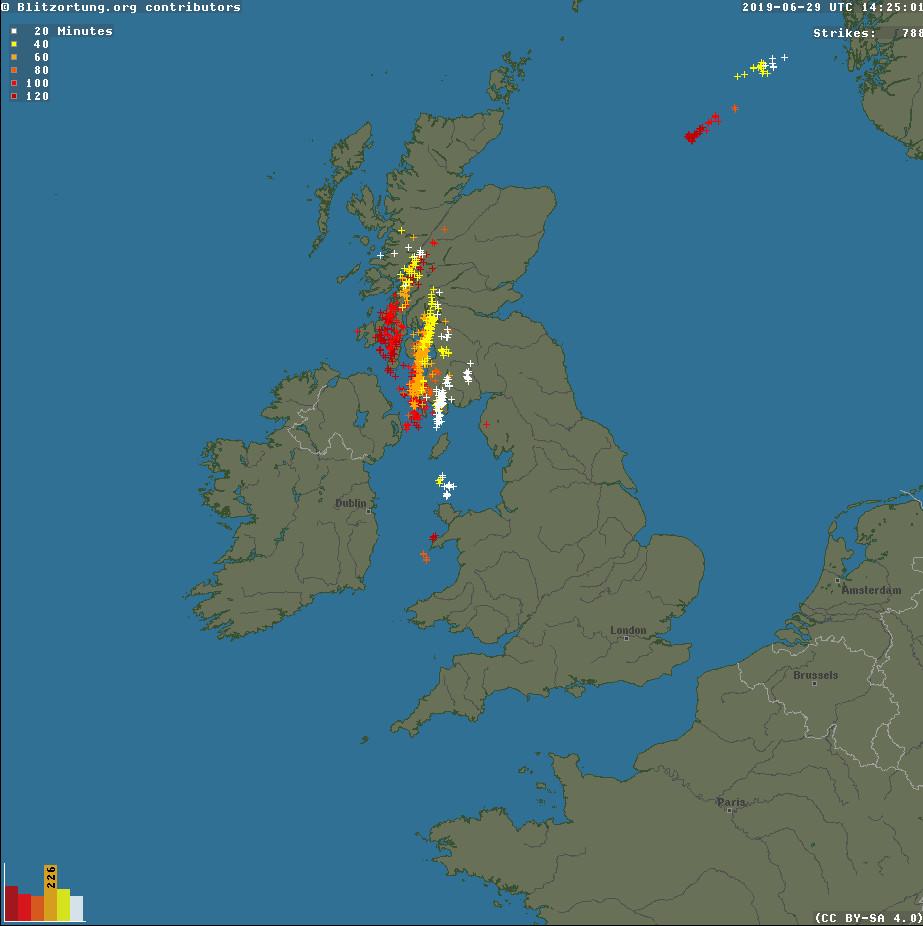
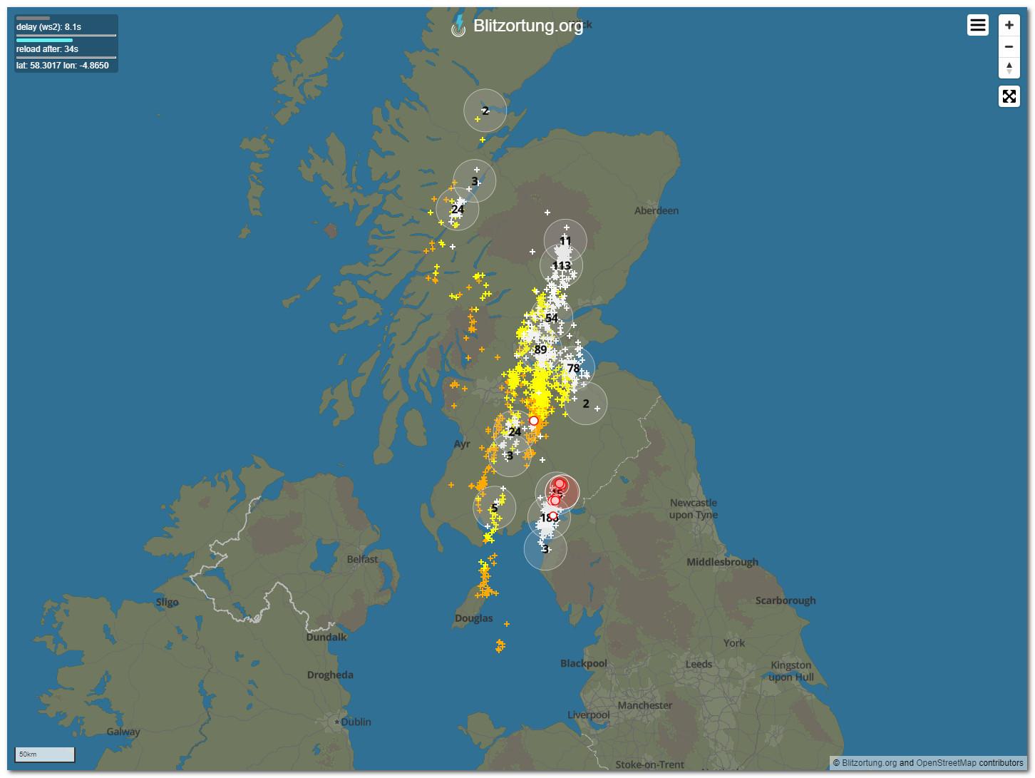
The forecast thunderstorm area was extended much too far south if you look at the sferic report for yesterday missing NE England almost entirely.
The lightning area when compared to the thunderstorm warning area is very oddly delineated, with the eastern boundary of the thunderstorm area extended many miles into the North Sea, whilst the lighting area in contrast is hard clipped around the coastline as if places on the Moray and Aberdeenshire coast (with all those links golf courses) would be spared any flashes of lightning at all.
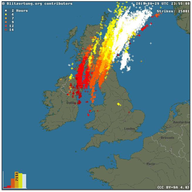
Here's my estimate of rain, real or imaginary for yesterday afternoon.
