Skip to first unread message

Graham Easterling
Feb 13, 2021, 5:19:10 AM2/13/21
to Weather and Climate
I've just noticed this very distinct clear slot through Ireland to just west of Scilly.
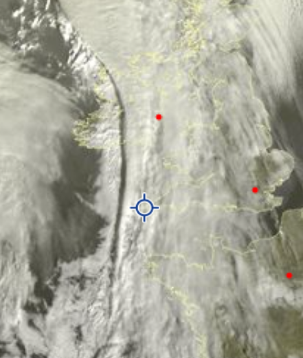
Any explanation as to the cause? It originally seemed to mark the back edge of the front.
Graham
Penzance

Len
Feb 13, 2021, 7:06:50 AM2/13/21
to Weather and Climate
Thought it was a shadow of cloud edge myself.
Frontal feature.
Faded as sun got higher in sky.
Len
Graham Easterling
Feb 13, 2021, 7:23:52 AM2/13/21
to Weather and Climate
I thought that a first, but I followed the sequence and I'm fairly sure it wasn't just a shadow. It was originally the back edge of the front, certainly a sharp edge to well broken cloud. Then cloud formed just behind it, but leaving a clear slot you could see through to the surface. For a while the area west of Cornwall was quite wide.
I could be wrong, but following the sequence it looked very unusual.
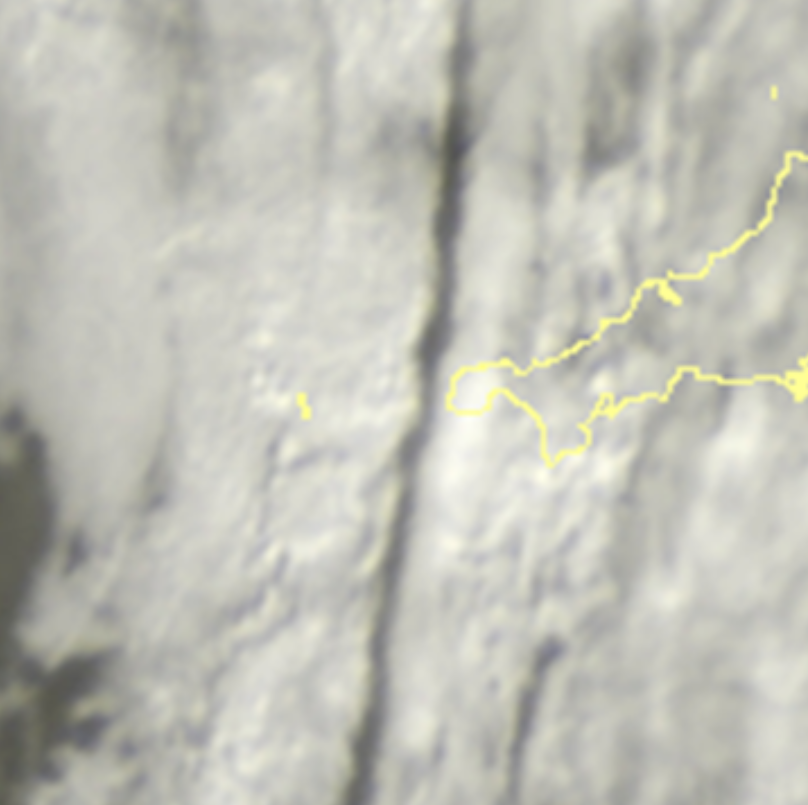
Zooming in more recently (it was very narrow by this time) if it was a shadow you'd expect the 'darkest' bits to coincide with the thicker patches of cloud to the east, but the reverse is the case.
I could be wrong, but following the sequence it looked very unusual. Also as it crossed west Cornwall a wide break developed to the lee of high ground.
Graham
Penzance

Julian Mayes
Feb 13, 2021, 7:53:01 AM2/13/21
to Weather and Climate
Meteosat now shows the clearances to the north of high ground quite clearly - north Pembs and north Cornwall coasts, perhaps around Dublin a short time ago. That, in itself, is not surprising today of course - but it is intriguing happening to the west of the shadow (?) zone. Maybe simply less convection in the shadow area inhibiting the cloud development?
I'm sure that Bernard Burton would have an answer if you put it on uk.sci.weather.
Julian
Len
Feb 13, 2021, 10:16:08 AM2/13/21
to Weather and Climate
Some difference in frontal development as well as sun angle over 1½ hours.

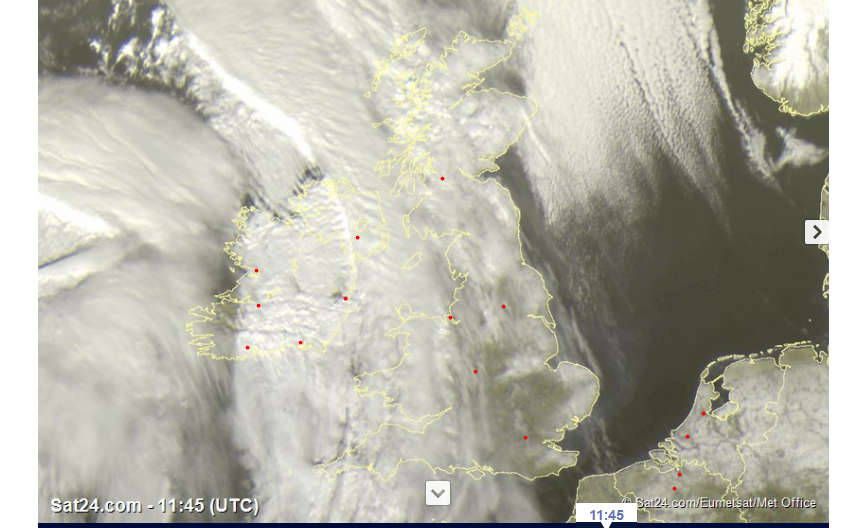
Remembering these are visible images. See what is happening over Ireland where it was snowing throughout.
The high convective tops associated with the front were reflecting much more 1½ hrs later.
Len
Reply all
Reply to author
Forward
0 new messages