
xmetman
Jun 10, 2019, 7:43:30 AM6/10/19
to Weather and Climate
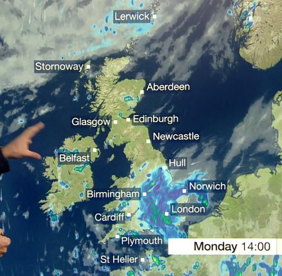
The BBC very rarely show radar images (or high resolution visible satellite imagery) these days.
But when they do (as they did at 1130am today) they don't use the same colour coding of rainfall intensity used by the Met Office preferring instead to use shades of blue.
I can't understand why this is, because when they switch back to displaying forecast NWP rainfall intensities, they use a range of colours including varying shades of blue, greens and possibly yellows (if memory serves), which is not consistent and confusing. A legend in the top corner of the map might help.
Here's what I mean:-

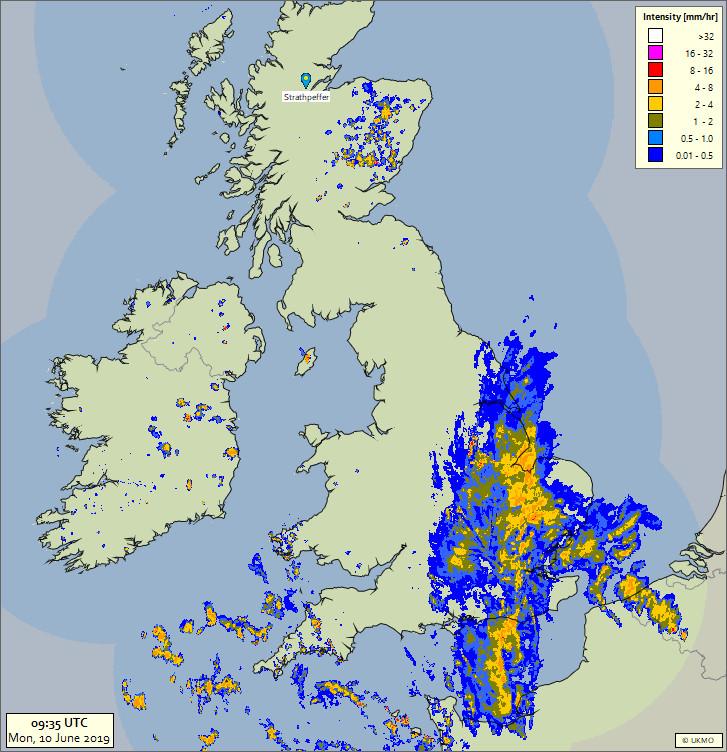
This is the closest weather radar mage I could find...
Here's the NWP using a different colour pallette.
Reply all
Reply to author
Forward
0 new messages