Highest UV of the year at Camborne

55 görüntüleme
İlk okunmamış mesaja atla

Graham Easterling

okunmadı,
12 Tem 2022 11:30:4112.07.2022
alıcı Weather and Climate
It might be almost 4 weeks since the summer solstice, but with a warm sector ridge from the Atlantic, clean air, and some thin medium level cloud to reflect off, the highest UV of the year at Camborne.

2022-07-12 16_28_28-Capture.png

Hasn't managed to reach 10 for a few years now, and it's too late this year.

Graham
Penzance

Nick Gardner

okunmadı,
12 Tem 2022 14:33:2712.07.2022
alıcı Weather and Climate
My highest UV today was 8.2, it was cloudy around the point of highest sun so I suspect it would have been higher.

The highest UV this year was 9.4 on the 14th June and the highest this month was 9.3 on the 7th.

These are the dates when I have recorded UV at 10.0:
11/6/21
21/6/16
27/6/20
7/7/20
14/7/14
16/7/16

With the sun still just over 61°, a little less than 2° lower than at solstice, there seems to be time for another UV of 10.0 or two, though it'll have to be quick!

I think the data from UV Index Graphs from DEFRA are 'rounded' using a rolling average as they produce a far less 'spiky' plot than mine. Therefore, any brief peaks are smoothed-out.

--
Nick Gardner
Otter Valley, Devon
20 m amsl
http://www.ottervalleyweather.me.uk

Graham Easterling

okunmadı,
12 Tem 2022 16:09:5312.07.2022
alıcı Weather and Climate
There have been a few days when there was no UV report from Camborne, so I should have said the highest UV recorded at Camborne this year. Sadly no reports from St. Martin's these days.

Lovely still evening today. Unusual to have E visibility with temperatures this high, it's not the normal mucky continental air. I've just got back from Newlyn Green, and the Lizard point is really sharp, visibility must be >20 miles. Prom 21:00.

2022-07-12 21_00_28-Capture.png

Jack might be interested to know that what wind there is is offshore, and that rippled area of sea was in much the same place all the time I was out (19:30-20:30). I can only assume it's where air descending off the moors behind Penzance hits the sea. If you read this Jack, I'd welcome your opinion. The glassy areas either side are not due to algae (which can have that effect), those areas really are calm. The area which catches the wind moves slightly, but very slightly.

Graham
Penzance


Graham Easterling

okunmadı,
12 Tem 2022 16:15:1812.07.2022
alıcı Weather and Climate
Actually, looking at the clouds they do look on the lenticular side, if not good examples, so my theory is probably correct.

graham

jack.h...@gmail.com

okunmadı,
14 Tem 2022 02:45:1214.07.2022
alıcı Weather and Climate

Lenticualrs.  I have only just seen the original post.

I can’t offer a great deal of help.  Lee waves as used by glider pilots, do not always manifest as lenticular.  Equally, lenticulars do not always imply [useful] wave.  But there is of course a signifcant correlation.  One thing that gliders have noted is the a wave train is often more clearly defined over a flat surface, such as a sea.  In mountainous terrain, the pattern is often confused.

Yesterday here was what appeared to be an obvious example of wave clouds.  But the satpics showed nothing to indicate wave, nor did the glider pilots.

22-07-13-112-Golford.jpg

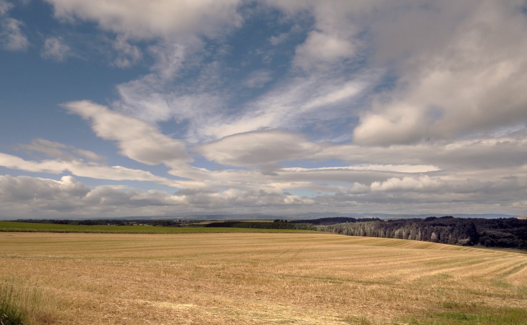
Note the early harvest (for these parts).  Barley cut by 14th July.  It’s been very dry but not especially sunny (as would show on a recorder) but the skies have been predominantly bright.

Jack

Tümünü yanıtla
Yazarı yanıtla
Yönlendir
0 yeni ileti