
Tudor Hughes
Jul 16, 2021, 9:19:16 PM7/16/21
to Weather and Climate
I have seen little comment on the meteorological causes of the heavy rainfall in Germany and Belgium. I can recall seeing a fairly modest cold pool moving slowly east across France and becoming slow-moving further east and didn't pay a lot of attention to it. Its central thickness was not particularly low, about 550 dam. There was little thunder with this rain as far as I know.
Can anybody add to this very sketchy assessment?
Tudor Hughes

Smartie
Jul 17, 2021, 3:33:33 AM7/17/21
to Weather and Climate
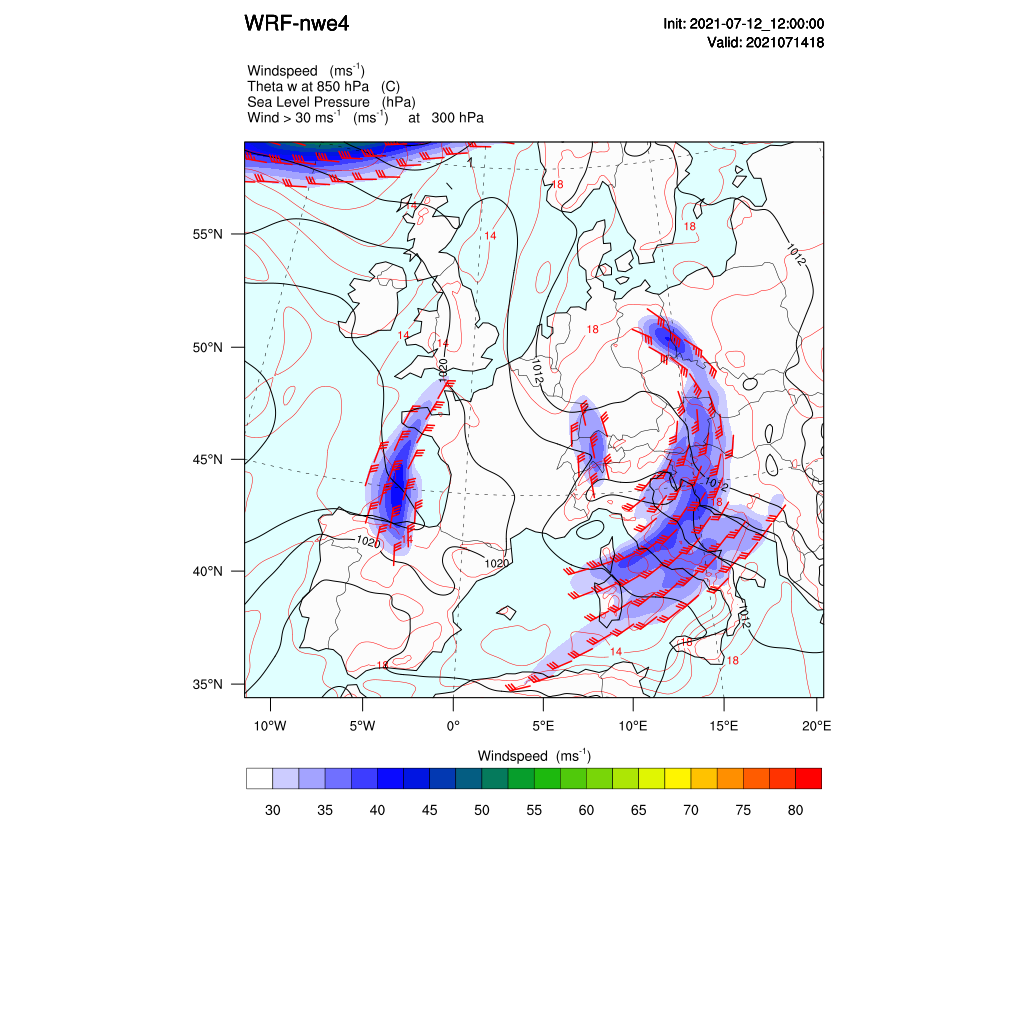
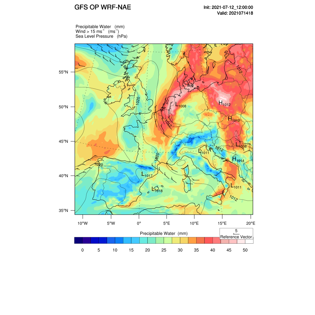
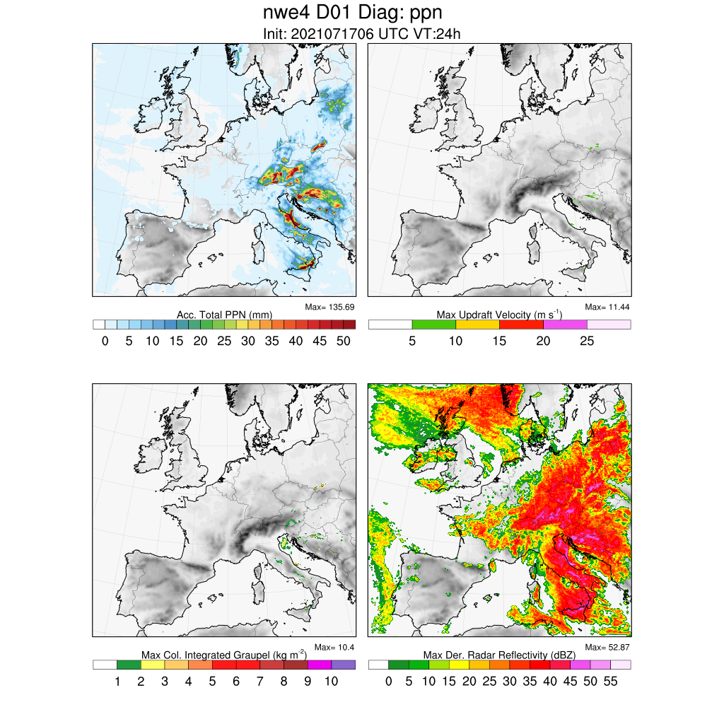
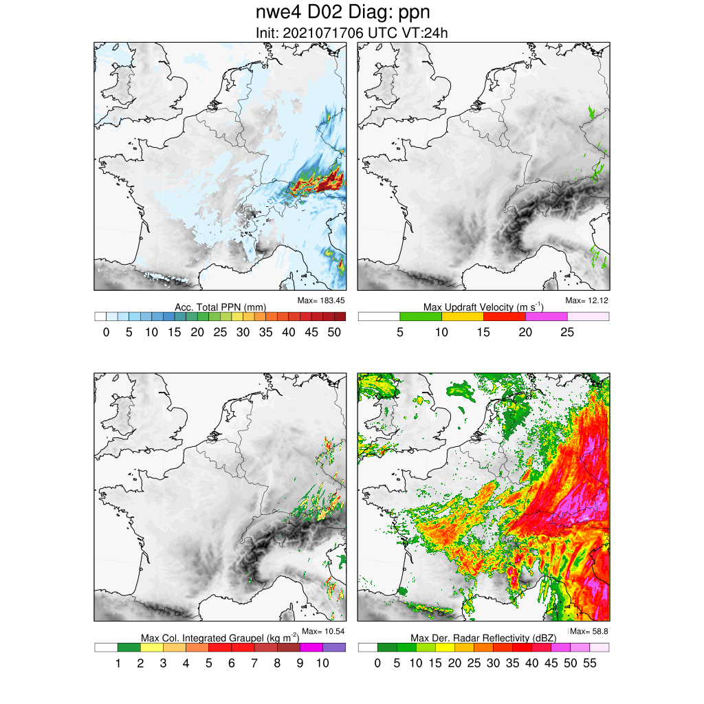
12km WRF initialised with , and nudged to the model analyses. The model produces event totals >150mm in more or less the right areas.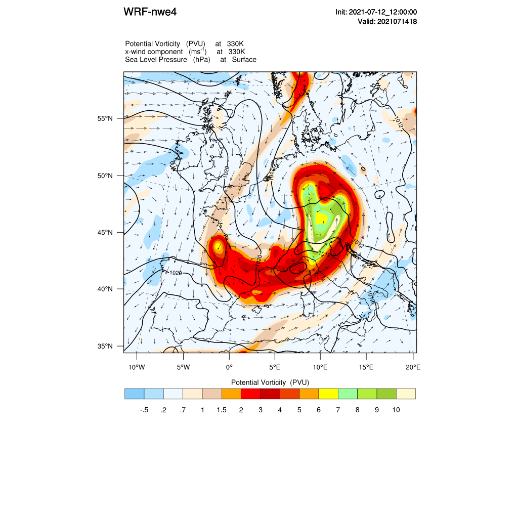
Preliminary results, caveat emptor.
I have chosen to show plots for 18UTC/14 July as this the time of maximum moisture flux over western Germany according to model.
At the tropopause there is a cut off PV lobe with a jet max at 300 hPa over western Germany/Switzerland. The PV lobe has torn off the stratospheric polar vortex in the previous days due to (Rossby) wave breaking at the tropopause
Smartie
Jul 17, 2021, 3:39:27 AM7/17/21
to Weather and Climate
The cut-off was accompanied by strong water vapour transport in a very warm atmosphere. I haven't done the trajectory analyses yet but previous studies of summertime European flooding cases show that the the origin of these airmasses is typically at low-levels over the western Mediterranean.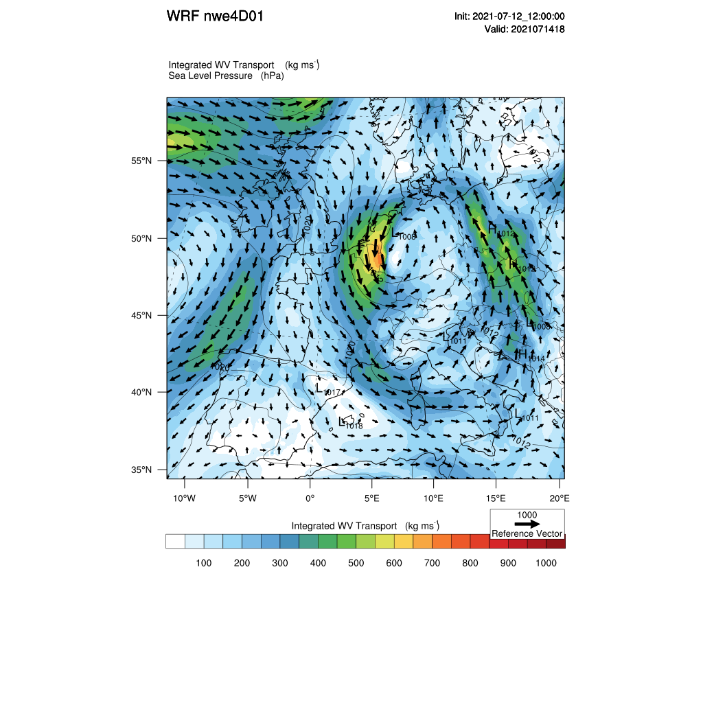
Smartie
Jul 17, 2021, 3:46:04 AM7/17/21
to Weather and Climate
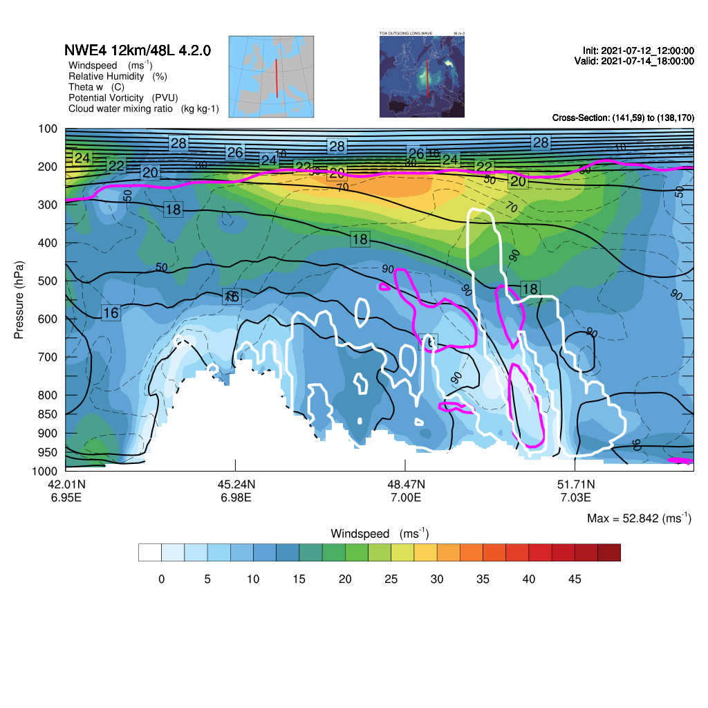
Cross-sections through the flood producing system (18UTC/14) show slantwise convection over the orography with something of a low-level jet at 900 hPa (~1km). There is evidence of a tropopause fold and jet max associated with the cut-off. PV max (=> 2PVU) at lower levels are associated with intense latent heat release in the convection. 
On Saturday, July 17, 2021 at 8:33:33 AM UTC+1 Smartie wrote:
Smartie
Jul 17, 2021, 3:55:33 AM7/17/21
to Weather and Climate
I see there is a lot of comment on the possible role of climate change. Major warm season flooding events are not uncommon in central Europe- the most recent well-studied case is the 'catastrophic' Elbe floods of August 2002 in a similar stormy summer. Warm season flooding in central/eastern Europe is typically associated with these types of so-called Vb cyclonic systems. Flooding of this magnitude in NW Europe has probably been less well-studied but major 'catastrophic' floods occurred in the Aahr river basin in 1910 and 1804.
Smartie
Jul 17, 2021, 5:00:16 AM7/17/21
to Weather and Climate
Link to a GIF loop of OPERA radar imagery 12-15 July (30 MB)
https://www.dropbox.com/s/70uys3th4v17iyz/opera_20210712_15.gif?dl=0

Julian Mayes
Jul 17, 2021, 7:17:25 AM7/17/21
to Weather and Climate
Superb, Smartie, thanks for uploading all this.
I've not heard any mention in UK media coverage about expectations in model output of summer rainfall to become more erratic - intense rainfall in short prds and long dry spells? Whatever the exact role of global warming, danger the public will back on the saying ' wish they'd make their mind, is it going to get drier or wetter?'.
Haven't last few summers in cen W Europe been quite dry?
Smartie
Jul 17, 2021, 8:07:30 AM7/17/21
to Weather and Climate
Certainly there's a lot of concern about drought in France this summer
but of course rainfall from convection can be highly localised in nature particularly if it's quasi-stationary. On this see-
BTW the I see above I've used the term 'slantwise' probably more appropriate is 'tilted up-right (convection)' and quasi-stationary systems over the orography of southern France have been
very well studied as well, they are also associated with cut-off lows.
Smartie
Jul 17, 2021, 9:38:46 AM7/17/21
to Weather and Climate
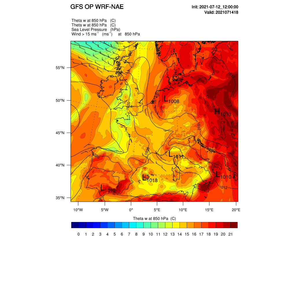
More heavy rain predicted for the Alpine foreland 06Z GFS-WRF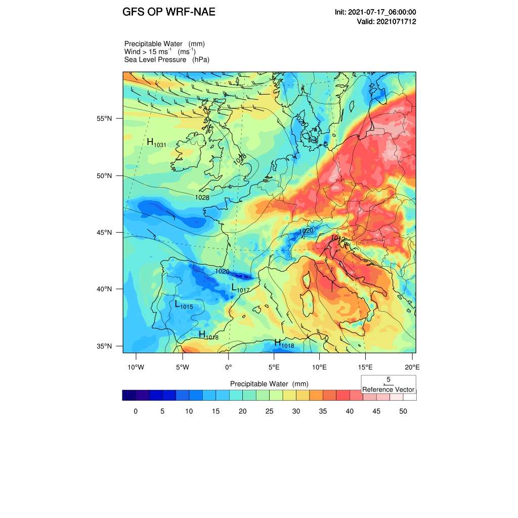
Tudor Hughes
Jul 17, 2021, 10:25:56 AM7/17/21
to Weather and Climate
Allow me to echo Julian's thanks for showing all this data. Things are now a little clearer.
Tudor Hughes
Smartie
Jul 19, 2021, 4:27:11 AM7/19/21
to Weather and Climate
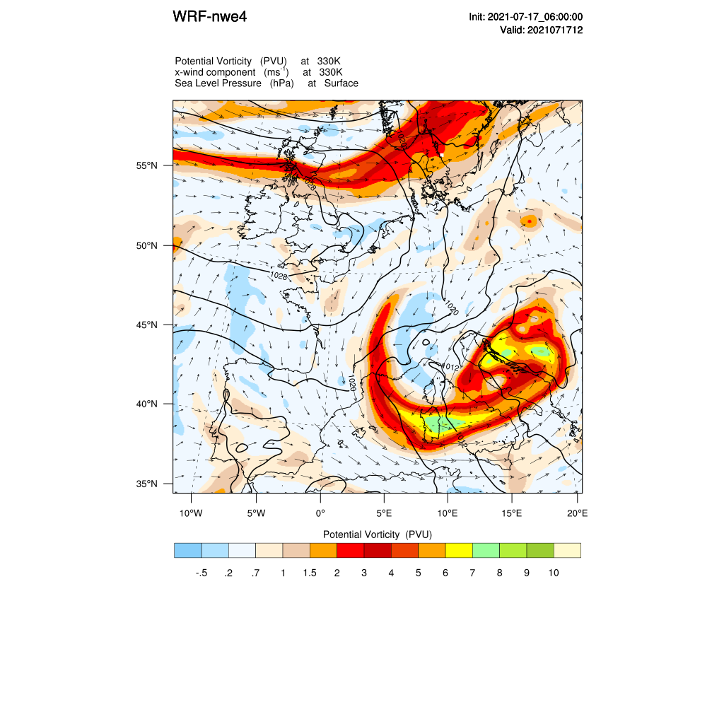
I may have to retract my earlier retraction on 'slantwise convection above. Reading the literature finds
The conceptual model appears to be consistent with the 12km WRF run(albeit this is east vs western Germany), see the north-south cross-section and also the larger scale RWB regime transition picture.
Reply all
Reply to author
Forward
0 new messages