Skip to first unread message

xmetman
Jul 24, 2019, 1:28:41 PM7/24/19
to Weather and Climate
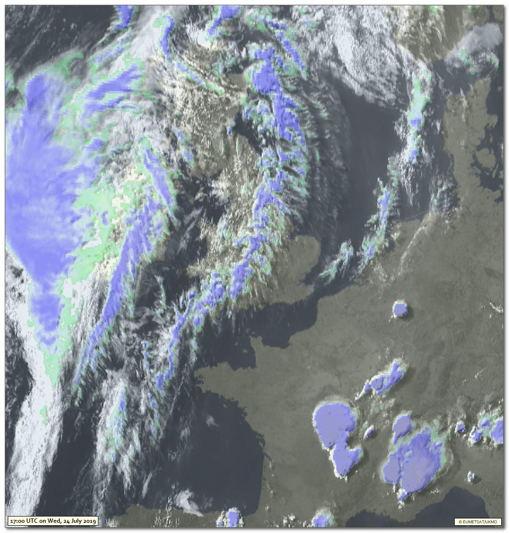
A spectacular satellite image like this must give rise - I would have thought - to some spectacular sunset shots this evening with all this dense cirrus around.
A couple of massive CB's over central France as well.
xmetman
Jul 25, 2019, 4:45:35 AM7/25/19
to Weather and Climate
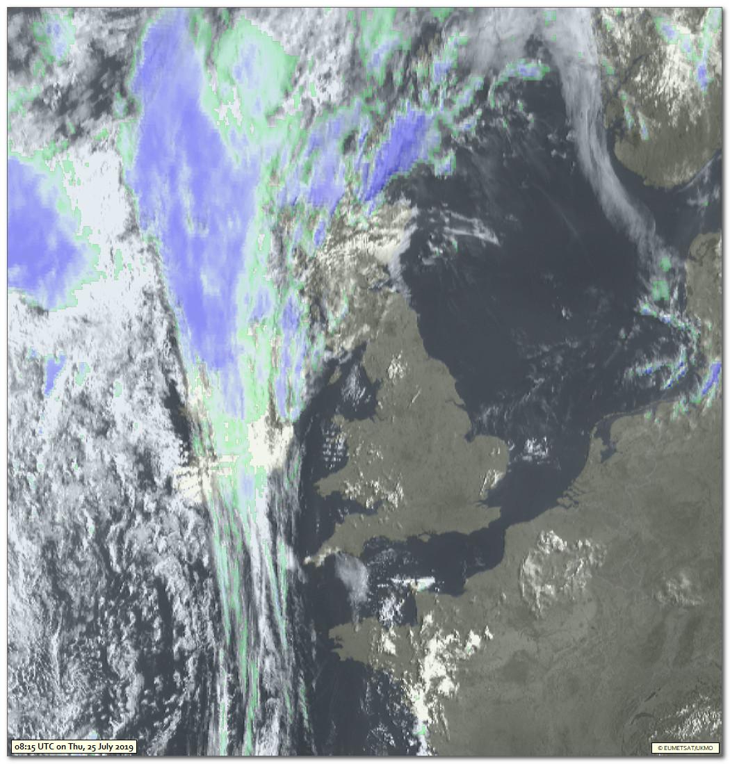
Well there was one in Easter Ross at any rate.
I would have been out with the camera but we were going out for a rare night out at our local Indian restaurant.
Lovely upper and medium layers and a bit of a Turneresque sunset going on over Ben Wyvis.
Still plenty of upper cloud up here again today.
That does look like medium high level convective cloud over Wales by the look of things.
The last time I said something about castellanus in a satellite image I got shot down in flames, but at least this time the observer at Shawbury is on my side.

Freddie
Jul 25, 2019, 4:57:39 AM7/25/19
to Weather and Climate
On Thursday, 25 July 2019 09:45:35 UTC+1, xmetman wrote:
The last time I said something about castellanus in a satellite image I got shot down in flames, but at least this time the observer at Shawbury is on my side.
So is the observer in Dorrington :-)
Just tried a photo but it wasn't clear enough.
--
Freddie
Dorrington
Shropshire
115m AMSL
http://www.hosiene.co.uk/weather/
Stats for the month so far: https://www.hosiene.co.uk/weather/statistics/201907JUL.xlsx
Freddie
Dorrington
Shropshire
115m AMSL
http://www.hosiene.co.uk/weather/
Stats for the month so far: https://www.hosiene.co.uk/weather/statistics/201907JUL.xlsx
xmetman
Jul 25, 2019, 5:04:49 AM7/25/19
to Weather and Climate
I'm no expert Freddie but it just looks like the convective clouds in that image where casting shadows and must have had a high base.
I would like buy a book on interpreting clouds from satellite images, but as far as I know there are none in print at the moment which is a shame.
One thing I've been meaning to ask you is how you put (I assume automatically) your signature as a footer on each of your posts?
Freddie
Jul 25, 2019, 5:20:04 AM7/25/19
to Weather and Climate
On Thursday, 25 July 2019 10:04:49 UTC+1, xmetman wrote:
I'm no expert Freddie but it just looks like the convective clouds in that image where casting shadows and must have had a high base.
A lot of it is common sense - i.e. would you expect surface-based convection to be occurring at that time of day, etc. etc. Keeping an eye on the upper air data is useful too - you can get tephis (or skew-t diagrams) from a number of sources (e.g. Uni of Wyoming). Then you can compare local surface temps with that needed for convection based on the tephis. It's not without error (there aren't many sonde stations left) but at least you can have a good stab at it. A case in point is the Ac Cast around here this morning. The base is high (you can see that just by looking) and the temperature too low (compared to, say, 950 hPa and 850 hPa temps) to support surface-based convection. Besides, they were there at sunrise and you rarely have surface-based convection occurring at that time of day inland.
I would like buy a book on interpreting clouds from satellite images, but as far as I know there are none in print at the moment which is a shame.
There are a few useful web sites that may serve this purpose. A quick Google showed me this one: https://en.allmetsat.com/interpretation.php
One thing I've been meaning to ask you is how you put (I assume automatically) your signature as a footer on each of your posts?
It's not automatic - just copy/paste :-) I wish it could be automated, though!
Reply all
Reply to author
Forward
0 new messages