
Smartie
Aug 31, 2019, 4:50:11 AM8/31/19
to Weather and Climate
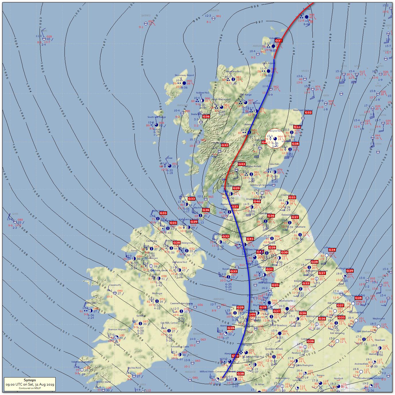
Low centre analysed at 06 UTC 31 August 1001 hPa Northern Ireland forecast to deepen 986 hPa by 00 UTC 1 September (UKMO).
Morning visible satellite imagery highlights the conveyor belt structure with a small cloud head west of Scotland. In radar imagery multiple cloud front structure is weakening. During early morning hours some sharper line convection was apparent. Isentropic mass ascent and orographic effects conributing to ongoing rainfall over Scotland.

Blended WV and IR imagery shows the large scale trough west of the UK, the cloud head and a filamentary dry intrusion spearing into southern Scotland.

300 hPa wind field shows the low is deepening, rather classically, in the left exit/right entrance region of two jet streaks.

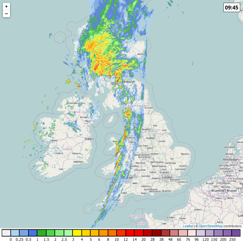
Smartie
Aug 31, 2019, 4:56:48 AM8/31/19
to Weather and Climate
0845 UTC. Segmented line convection (LEWP) again appparent along the trailing cold front. (radar courtesy Netweather).

xmetman
Aug 31, 2019, 6:17:53 AM8/31/19
to Weather and Climate

Graham Easterling
Aug 31, 2019, 7:03:27 AM8/31/19
to Weather and Climate
A very brief heavy burst went through Penzance associated with the segmented line convection. Only 1.8mm between 07:30 & 09:00, but most fell in 5 minutes around 08:45.
NW wind picking up now. Surf, which is currently smaller & less powerful than yesterday, getting blown out and forecast to decrease steadily now the lows in the wrong place.
Graham
Penzance

Freddie
Aug 31, 2019, 8:49:28 AM8/31/19
to Weather and Climate
On Saturday, 31 August 2019 12:03:27 UTC+1, Graham Easterling wrote:
A very brief heavy burst went through Penzance associated with the segmented line convection. Only 1.8mm between 07:30 & 09:00, but most fell in 5 minutes around 08:45.
Similar in Shropshire, with 1.0 mm falling in 6 minutes (max rainfall rate of 16 mm/hr at 1037z), just ahead of the front which went through at 1045z.
--
Freddie
Dorrington
Shropshire
115m AMSL
http://www.hosiene.co.uk/weather/
Stats for the month so far: https://www.hosiene.co.uk/weather/statistics/latest.xlsx
Freddie
Dorrington
Shropshire
115m AMSL
http://www.hosiene.co.uk/weather/
Stats for the month so far: https://www.hosiene.co.uk/weather/statistics/latest.xlsx

Len
Aug 31, 2019, 5:54:51 PM8/31/19
to Weather and Climate
Absolutely nothing here in SW Devon.
Just a few drops.
Zero in my 5 inch gauge.
Forecast somewhat wrong for this location from UKMO.
Len
Wembury
Reply all
Reply to author
Forward
0 new messages