Skip to first unread message

xmetman
Jul 29, 2019, 4:10:34 PM7/29/19
to Weather and Climate
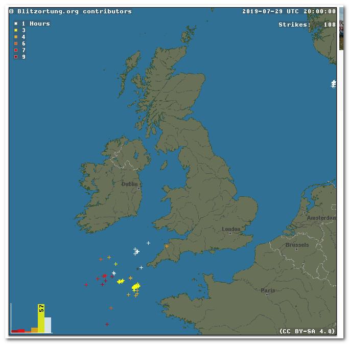
Despite one or two heavy slow moving isolated showers, one over the Cairngorms and another to the NNE of Ullapool, the north of Scotland got away with what was a rather lovely day with no thunderstorms. The shower that developed towards the west coast is a little strange and has hardly moved since 16 UTC and is still ongoing, it's total lack of movement is a bit suspicious, although both tops are visible in satellite imagery. Perhaps maximum temperatures of between 22 and 25°C in the area weren't high enough to produce a TS.
xmetman
Jul 30, 2019, 5:02:51 AM7/30/19
to Weather and Climate
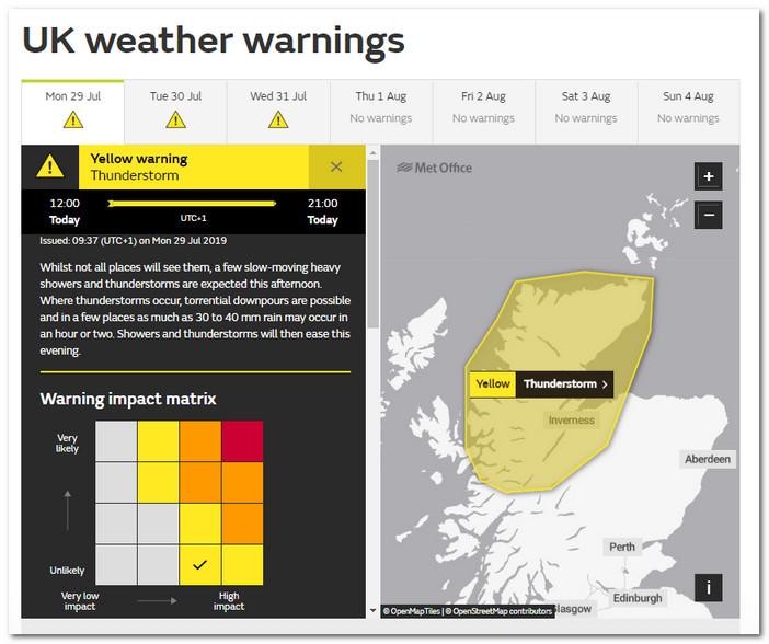
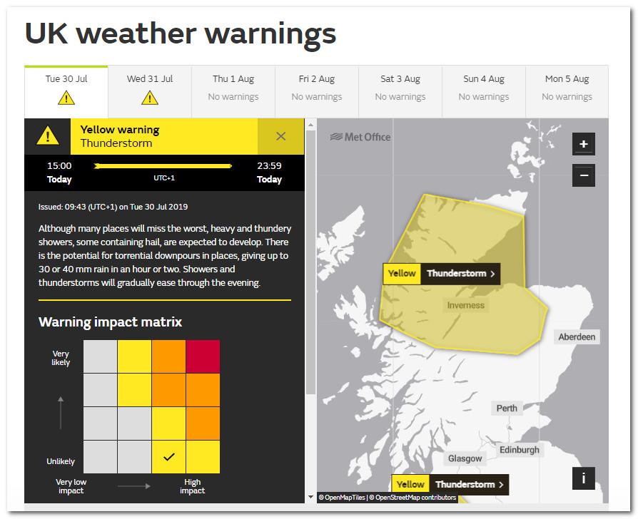
The Met Office warnings team - never wanting to admit defeat - have issued another thunderstorm warning for today for exactly the same area as northern Scotland as yesterday. It will be interesting to see if they have more luck with this one than they did yesterday.
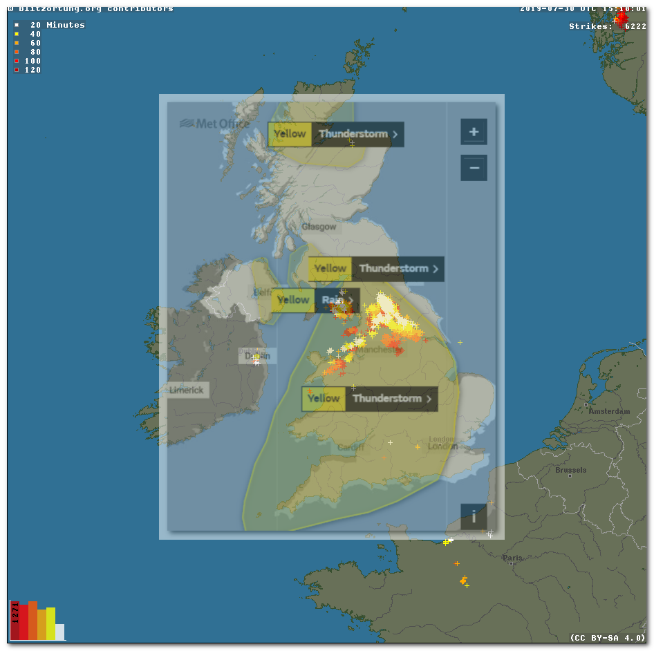
xmetman
Jul 30, 2019, 6:27:35 AM7/30/19
to Weather and Climate
Here's an evidential copy of the warning just in case.
Odd turn of phrase in the first sentence.

Smartie
Jul 30, 2019, 6:47:33 AM7/30/19
to Weather and Climate
xmetman
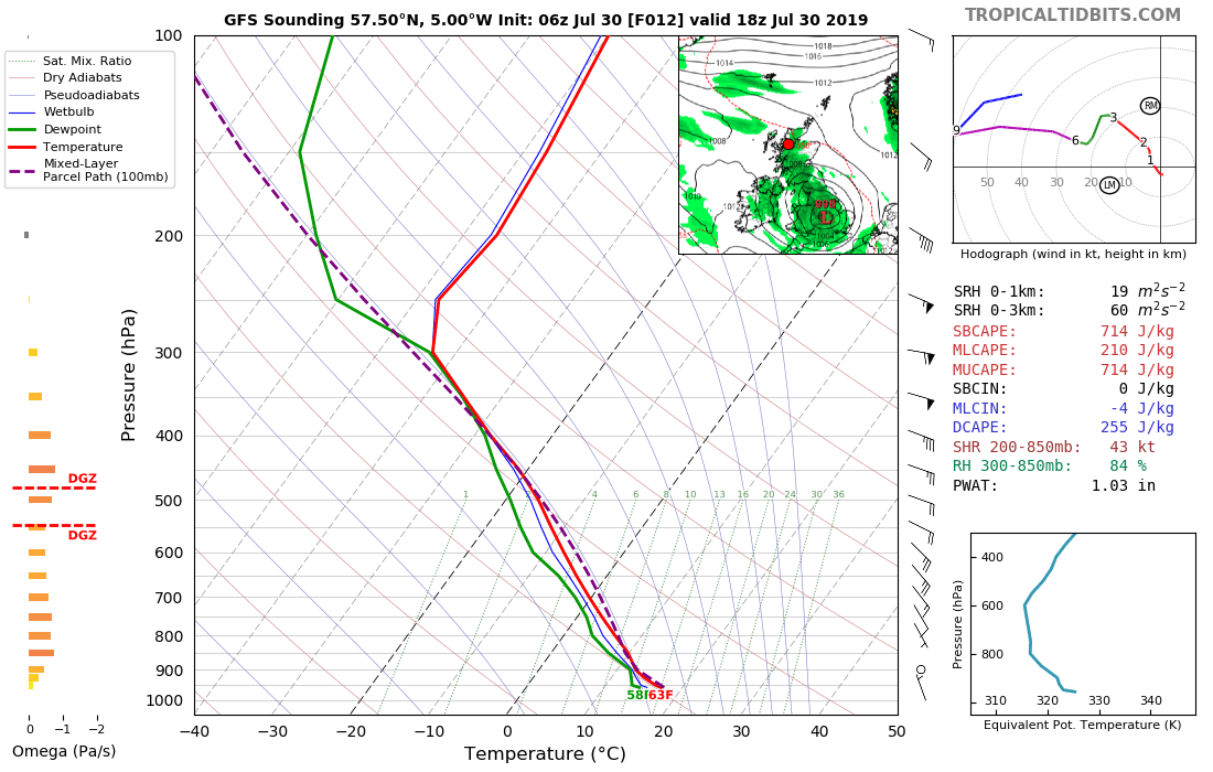
Jul 30, 2019, 11:15:17 AM7/30/19
to weathera...@googlegroups.com
They've got it right today!
A thunderstorm has developed in almost the same place as a heavy shower did yesterday - somewhere on the Spey just south of Lossiemouth.
It's a shame that you can't see the warnings areas overlaid on top of the latest SFERICs or rainfall radar come to that.
I bet you won't see that feature when the new Beta is finally released.
Reply all
Reply to author
Forward
0 new messages