xmetman
Here's my estimated 24 hour totals ending at 06 UTC this morning.
The southwest of Scotland and Lake District seem to have borne the brunt of it with the Lake district fells seeing over 100 mm of rain.
I did run a level 2 diagnostic on my old code (Star Trek jargon), and although the overall logic seems right to me, precise geolocation over the map may need someone with a lot higher mathematical ability than me!
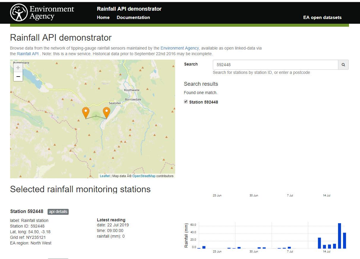
I did try and check my estimates with the totals on the EA rainfall demonstrator site but couldn't find a rain gauge site that high.
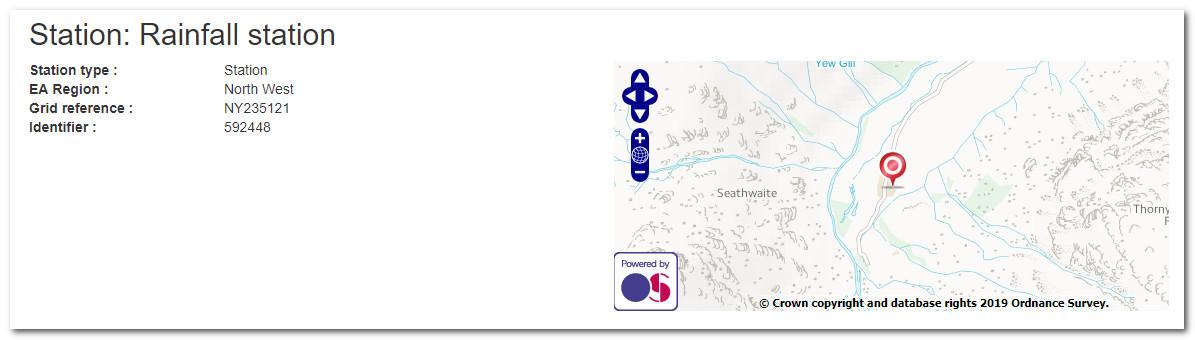
It doesnt help that unlike SEPA, the EA only give an ID for each site and not its name.
They don't display the elevation of the site either - which is quite important to know in any rainfall event - although you may be able to get at it if you interrogate their database with the API.
The graph for rainfall in the last month in Borrowdale (gauge 592448) is not particularly easy to read but the total look well short of 100 mm.
It's hard to believe that this is the same site that reported 316.4 mm in 24 hours in November 2009, for one thing it looks well down in the valley at only 129 AMSL.