xmetman

Smartie
xmetman
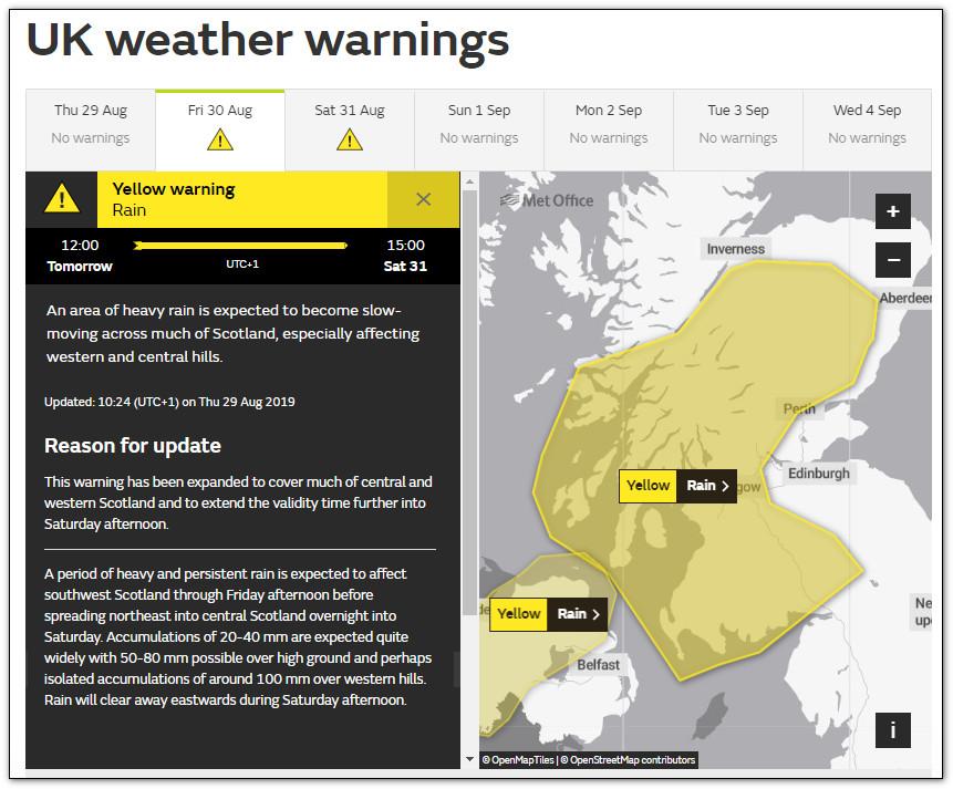
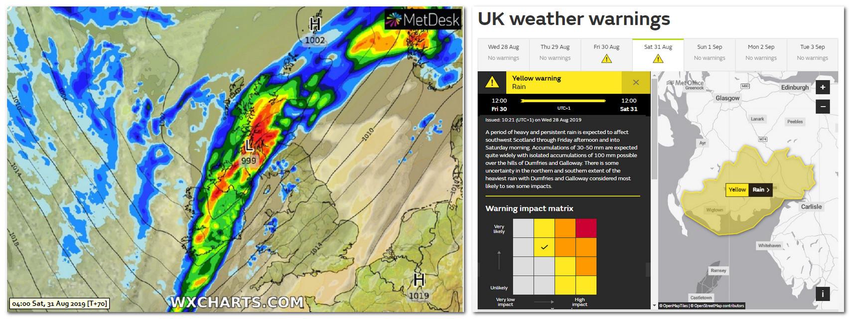
The UKMO have just updated their yellow warning for heavy rain both for area and validity times that they issued yesterday.
I always find the reason for update section odd because they always say what they've changed, but never why they've changed it - i.e. the latest NWP model solution at T+48 is different from that at T+72.
Yesterday's warning was too specific and issued far too early in my opinion.
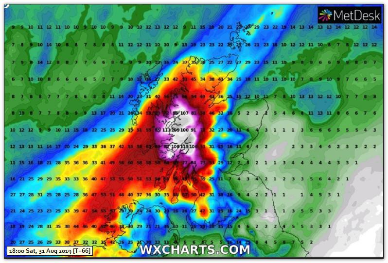
The ICON model is obviously pretty good at T+72 for our part of the world.
xmetman

Trevor Harley
Smartie
On Thursday, August 29, 2019 at 10:49:49 AM UTC+1, xmetman wrote:
The UKMO have just updated their yellow warning for heavy rain both for area and validity times that they issued yesterday.
I always find the reason for update section odd because they always say what they've changed, but never why they've changed it - i.e. the latest NWP model solution at T+48 is different from that at T+72.
Yesterday's warning was too specific and issued far too early in my opinion.
xmetman

Freddie
The whole point of the post is that the original yellow warning was too specific (see the map of Dumfries and Galloway) and maybe too far south (see the ICON model in the first post).
Freddie said in a recent reply that the UKMO forecasters look at a range of other NWP models when issuing a warning, well all I can say is they didn't look at the ICON model for very long.
I realise that forecasts can change and warnings do require refining which is what they've done - but start with a much larger area (at T+72) and make it more specific at T+36.
Freddie
Dorrington
Shropshire
115m AMSL
http://www.hosiene.co.uk/weather/
Stats for the month so far: https://www.hosiene.co.uk/weather/statistics/latest.xlsx
xmetman
xmetman
Freddie
Why is it then - and before I go any further I will say that I'm not as conceited to think I am always right - I guessed what might happen?
And what I mean by "guess what might happen" is anticipate that the original warning was far too small and too far south a full 24 hours earlier.
You're definitely a half full man Freddie
Trevor Harley
xmetman
This warning reminds me of Triggers broom
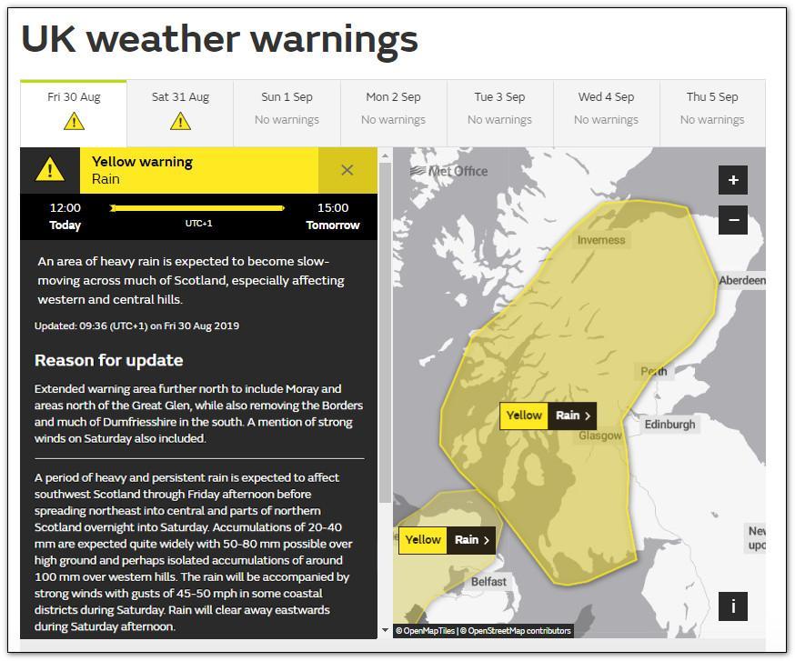
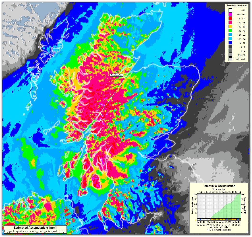
The ICON model still extends the heaviest rain further north of the Great Glen (although slightly lower accumulations than yesterday) but the UKMO remain adamant that it won't.
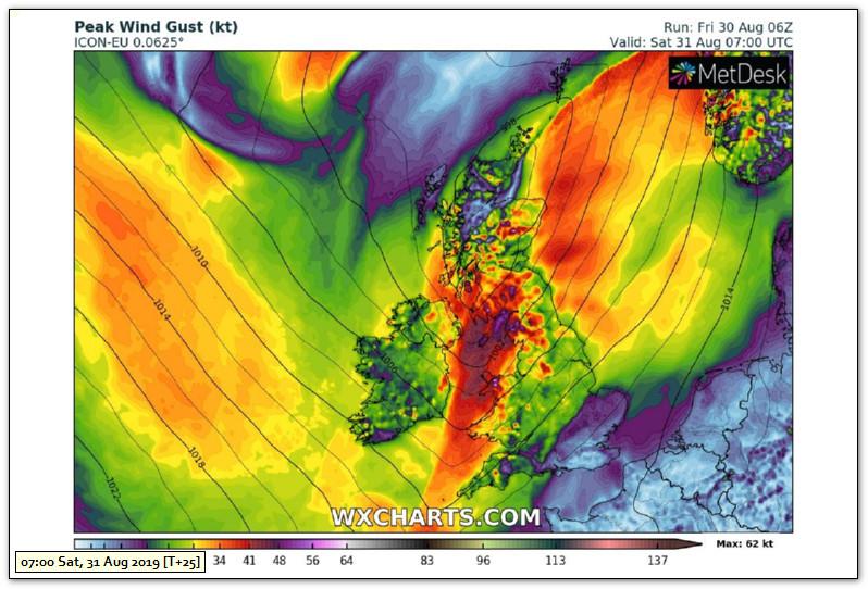
They mention gusts to 45-50 mph but ICON has gusts to ~60 knots ahead and on the cold front during Saturday morning in Irish Sea we shall see.
I wish wxcharts.com would pick a better colour scale for their max gusts...
xmetman
xmetman
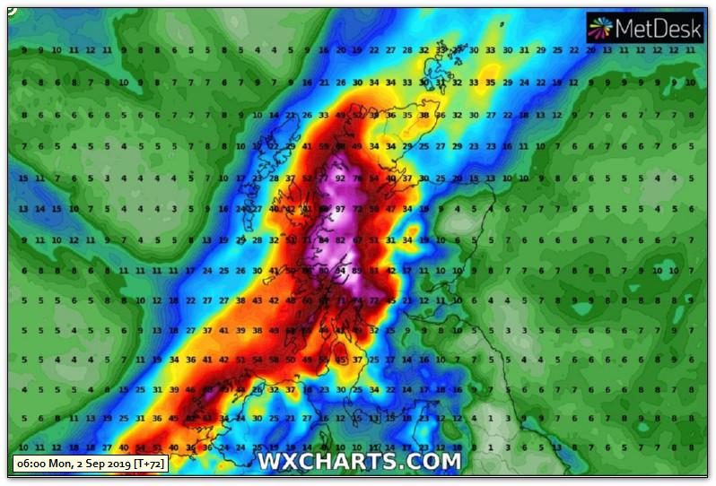
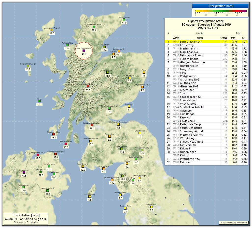
24 hour totals to 06 UTC this morning
xmetman