
xmetman

Freddie
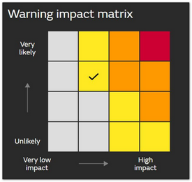
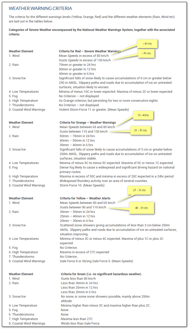
I would have thought at least for the northern Isles gusts to 60 mph:-Low impact + medium to high likelihood = Yellow warning
Freddie
Dorrington
Shropshire
115m AMSL
http://www.hosiene.co.uk/weather/
Stats for the month so far: https://www.hosiene.co.uk/weather/statistics/latest.xlsx
xmetman

Graham Easterling
Freddie
I realise that you're only guessing but surely the criteria should be more objective than what you're suggesting?

Julian Mayes
I think it probably would be objective. Something along the lines of the return period of the gusts.--
Freddie
xmetman
It's true that the locals up here are more used to gales than people in places further south, and make very little fuss about it either, but the effects are just the same.
Now that thunder and lightning warnings have been added to the NSWW system, strong winds should be treated just as seriously.
The Met Office make a big song and dance about the "issuing" of a warning, when all they need is a GIS map of the UK split into regions that indicate where a yellow/amber/red warning is in force - an old fashion warnings board if you like - rather than maps which look like blobs of custard have been dropped on them. A lot of countries around the world use a warning board like this.
The map itself could be fully automated by linking it to the latest mesoscale run and would require very little forecaster intervention.
Graham Easterling
xmetman
xmetman
Freddie
On Saturday, 14 September 2019 09:49:52 UTC+1, xmetman wrote:
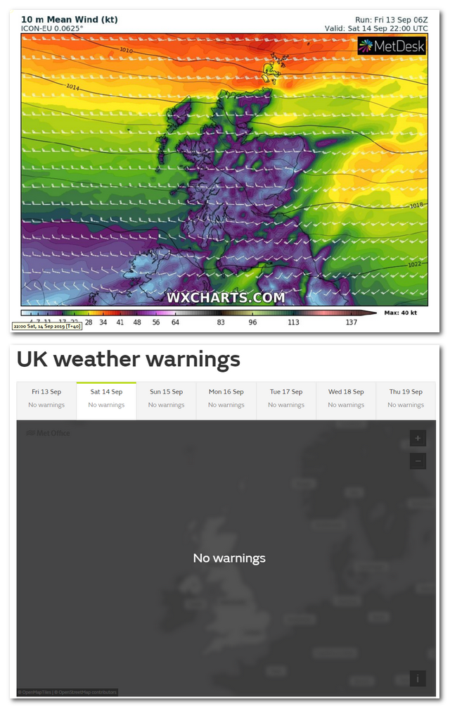
Logic dictates that a 10 minute mean wind speed of 34 knots or more (or gusts in excess of 47 knots) will have exactly the same effect on a chimney, high sided vehicle, tree, roof, wall, garage, garden shed, telephone pole, electric pylon, trampoline in the north of Scotland as it does anywhere else in the UK.It's true that the locals up here are more used to gales than people in places further south, and make very little fuss about it either, but the effects are just the same.
xmetman
xmetman
xmetman
xmetman
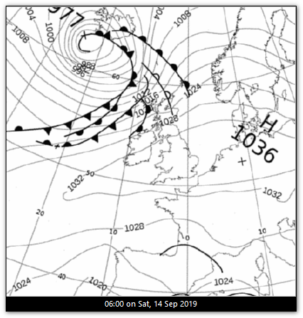
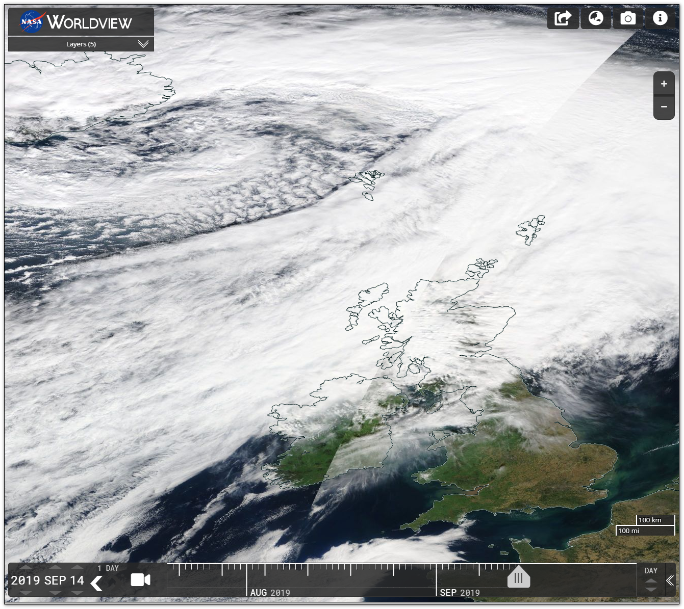
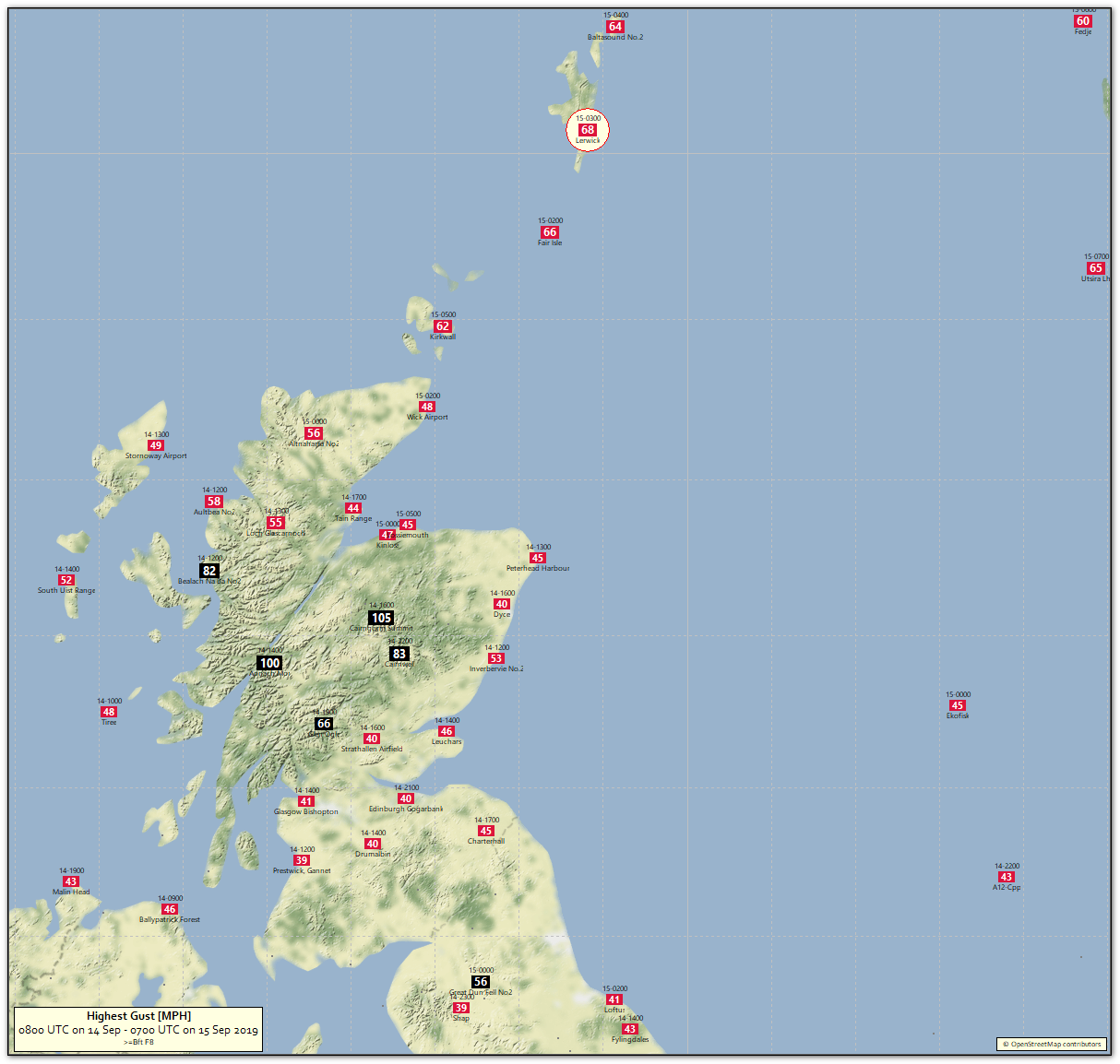
A chart of maximum gale force gusts for the last 24 hours.
You could sum it up as a force 6 or 7 on land and over Orkney and Shetland a gale force 8 or 9.
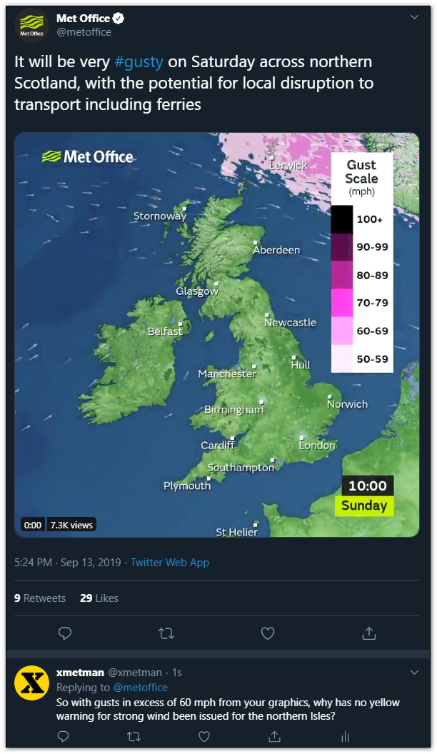
I reckon gusts of 60 mph or more require a yellow warning - the model told them to expect just that but they blatantly disregarded that guidance - and we ended up with gusts of 62 mph at Kirkwall and 68 mph at Lerwick.
I've seen a lot of named storms not produce gusts as high as that, the question we now face - have the northern Isles been annexed to Norway - it seems the Met Office don't believe it's a part of the UK anymore.
Graham Easterling
it seems the Met Office don't believe it's a part of the UK anymore.
Freddie
xmetman
xmetman


Len

Jack Frost

Jack Harrison
have the northern Isles been annexed to Norway?
xmetman
Freddie
Thanks for the links - I know about the history because I attended a couple of planning meetings for their current system. I remember I did speak up and say that they should use ESRI GIS to select the areas, but look where that got me.As you know I don't like the impact based warnings system and much prefer the old fashioned fixed criteria approach of Met Eireann which makes verification of warnings much easier. The Met Office are a slippery customer when it comes to verification, and I'm sure they prefer the impact based approach they use, because it's almost impossible to verify especially with regards to strong wind and heavy rain. Take yesterday's gales as a prime example, I'm sure that they don't even consider that as a miss.
Freddie
I'm sorry that you don't like my constant criticism of the Met Office or Meteogroup, but as from today I've finished posting to the group I started, so stick around because I'm sure it'll become a lot more interesting from now on.
Graham Easterling
Julian Mayes
Julian Mayes
Jack Harrison
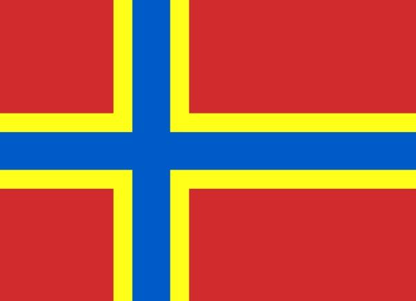
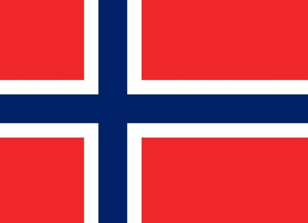
Orkney on left, Norway on right.
It might be thought that Orcadians would have shown a little more imagination in order to avoid the [understandable] confusion especially when the flag has faded.
Jack

Metman2012
Jack Harrison
... as from today I've finished posting to the group I started
Come on Bruce. Surely you're not in the same league as certain religious people who get in a huff at the slightest hint of criticism?
Jack
