Skip to first unread message

Paul Knightley
Aug 12, 2022, 4:18:51 AM8/12/22
to Weather and Climate
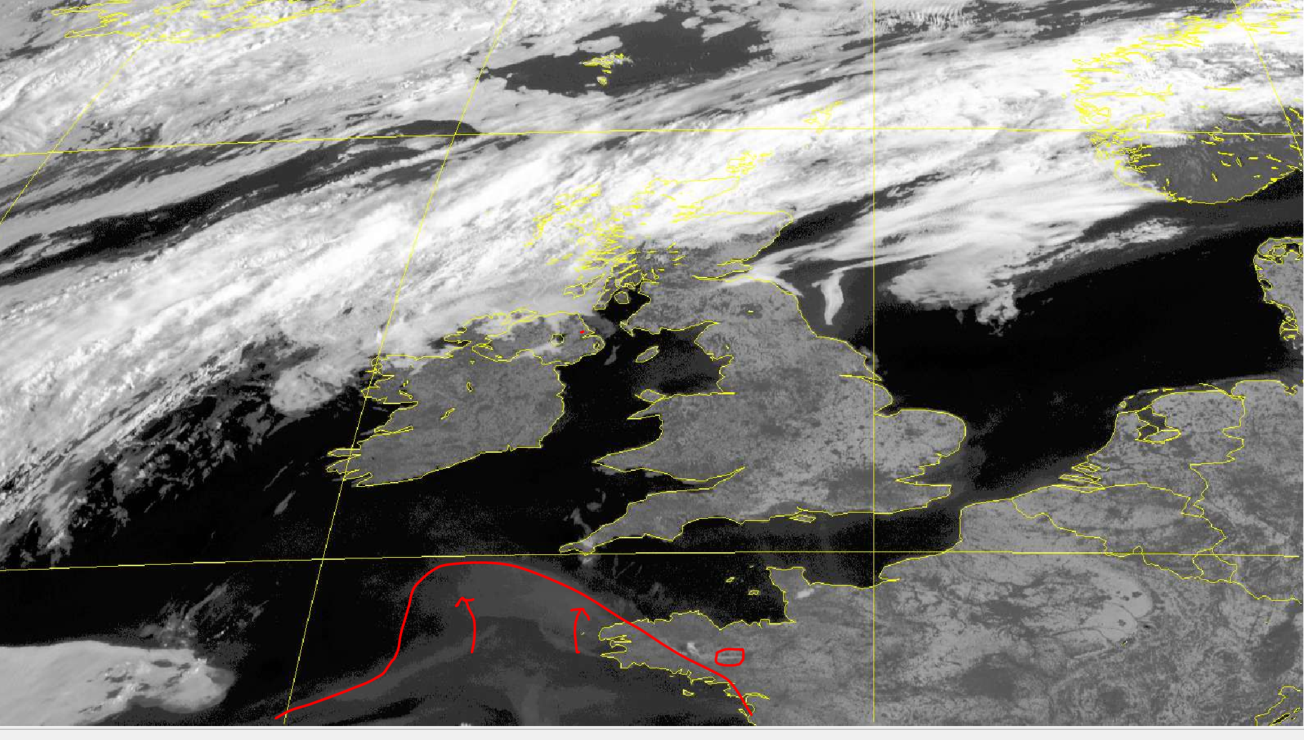
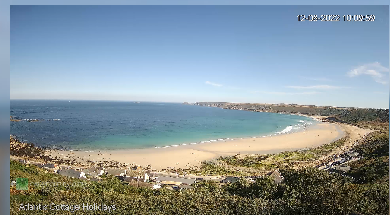
Evidently, this 'smudge' on this morning's visible image is smoke from the fires in SW France, but also one over central Brittany. I know we have some folks in SW Cornwall on here, and it would be interesting to see whether the sky shows any evidence of this through the course of today - at the moment, webcams show a generally blue sky, but perhaps it'll look a bit 'dirtier' later.

Len W
Aug 12, 2022, 5:14:22 AM8/12/22
to Weather and Climate
Evidence of polluted boundary layer on western horizon looking from Sennen
Len
Wembury

Graham Easterling
Aug 12, 2022, 7:23:53 AM8/12/22
to Weather and Climate
I can't say the the sky look noticeably different to the last couple of days, but I'll keep an eye on things.
.jpg?part=0.1&view=1)
I think one of the most dramatic days for dust filled air was 8/4/2011. There was no cloud but the sun was bare visible, there were no real shadows and the lighting reminded of the eclipse. Visibility at sea levl was VG
Graham
Penzance

Metman2012
Aug 12, 2022, 2:01:43 PM8/12/22
to Weather and Climate
At the risk of being pedantic, how high do you mean when you say sea level? If you mean standing on the shore the horizon is only 4.7km away. Obviously it's further the higher you are, here's some examples:
Height m Distance km
1.7 4.7
10 11.3
100 35.7
609 88.1
1.7 4.7
10 11.3
100 35.7
609 88.1
I learned many years ago why the visibility seemed to worsen the higher you go. If it's 10 km, then being on the shore it looks clear, but if you're at10 or more metres then the horizon goes from clear to hazy.
Metman2012
Aug 12, 2022, 2:10:41 PM8/12/22
to Weather and Climate
Just looked at the Observer's Handbook and coastal stations should report the landward visibility and only a comment about different visibilities seawards is put in the comments section. I believe that there are codes for seaward visibilities but that was the old Synop code - I don't know if it's true of the current one (well the translations from GRIB data).
Graham Easterling
Aug 12, 2022, 3:33:08 PM8/12/22
to Weather and Climate
I only mentioned visibility at sea level to make it clear the pollution wasn't at a very low level.
For what it's worth the cliff top at the Lizard was very clear from the coastal path. I recorded the visibility as VG that day. Whilst the horizon over the sea would agree with your figures, there's cliffs 300' nearby from which it is possible to estimate visibility even if you are at a fairly low level.
It is Interesting how far away you can see the Cornish cliff tops when you are out in a small boat, quite useful on occasion.
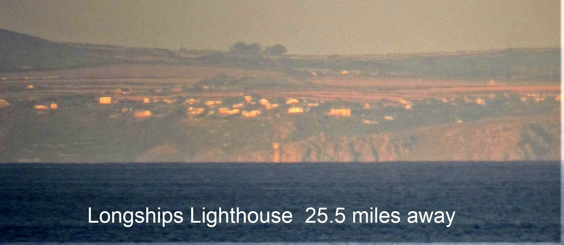
You might be interested in this photo taken from Scilly. The highest point of Scilly is 47m (approx). This was taken near 30m. The hill to the left is Chapel Carn Brea between Lands End & Cape Cornwall, >30 miles away.
I love the way you can only see the top half of Longships lighthouse.
There was a saying when I lived out at Sennen, 1 mile from Lands End , if you can see Scilly it's going to rain. The clearest visibility here is typically prior to a warm front, not in a cold sector. Salt spray often serious affect cold sector air out here on the Atlantic fringe.
To get a photo like that, quite clearly the visibility near sea level was E++ , certainly way >50miles. I have seen Lundy from the moors above St Ives.
Graham
Penzance
On Friday, 12 August 2022 at 19:01:43 UTC+1 Metman2012 wrote:
Reply all
Reply to author
Forward
0 new messages