WEATHERAmerica Newsletter, Saturday, August 6, 2022 at 11:40 PM CT; Longer Term Outlook
100 views
Skip to first unread message

Larry Cosgrove
Aug 7, 2022, 12:42:48 AM8/7/22
to weather...@googlegroups.com
EXTENDED PERIOD FORECAST
(Between Day 11 And Day 15)
Slowly But Surely, Upper Air Configuration Is Changing To Ridge (Hot) West/Trough Or Weakness (Cooler) Central/Ridge (Hot) East; Still No Atlantic Basin Hurricanes In Sight
WMO/GRAPES

CIMSS (3)


TropicalTidbits (Dr. Levi Cowan) (3)

NOAA/PMEL
NOAA/CPC
ECMWF

HPRCC/University Of Nebraska (2)
Environment Canada


TropicalTidbits.Com (Dr. Levi Cowan) (5)


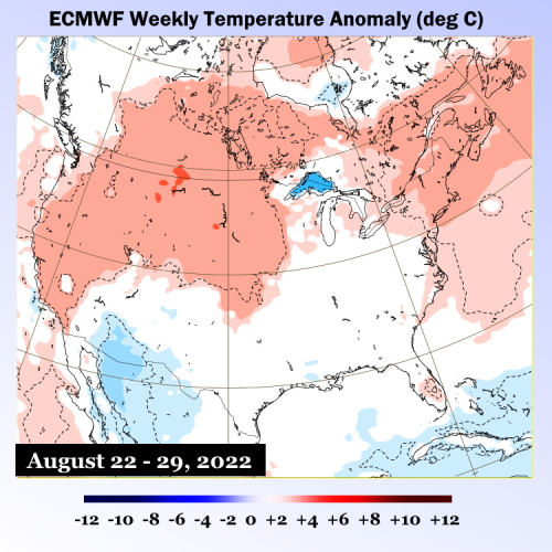
ECMWF (3)
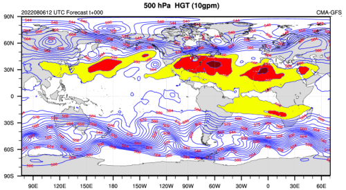
Look carefully at the WMP/GRAPES 500MB heat ridge depiction, and you will see some of the first dents in the hemispheric heat ridge complex: the Gulf of Alaska, northern Atlantic Ocean, and over South Asia. As we move later in the season and into autumn, those gaps or weaknesses will expand and fill with either cold troughs or be flattened out by the southward collapse of ridging. You may think it interesting that the next prominent interruption of the subtropical high system will likely be over portions of North America.
The analog system prediction has worked out superbly this summer, most notably with the conjoined heat ridge position and strength. With that pattern has come the suppression of tropical cyclone formation into the third week of August. The key to seeing an easement of heat in the U.S. With the ridges going into more normal positions and intensities, cold fronts will drop into a weakness with an axis roughly between the Mississippi River and Appalachian Mountains And tropical cyclone candidate systems can grow as the sand/dust/dryness quotient in the upper atmosphere starts to fade. Though to be honest, the best formation potential may be closer to the Americas. The major islands, Caribbean Sea nations, and the Eastern Seaboard all have prominent windows for a named storm or hurricane strike in a window between August 23 and October 15. But I will repeat that the number of storms will likely be reduced from the two years past, since the Maximum Development Region convection will be reduced, and chances for a Gulf Coast impact are crushed because the heat ridge complex will either be over Texas or the "Four Corners". Steering and subsidence can greatly reduce your chances at seeing a prominent tropical cyclone. Despite whatever you read on an internet weather forum or because waters near your community are incredibly warm.
I think we have a period from later August into mid-October of very hot/dry conditions in the West (Sonoran heat ridge retrogression), slowly cooler and stormier/wetter conditions from the Great Plains through the Mississippi River watershed (weakness with shortwaves increasing, creating a mean 500MB trough), a hot/humid Eastern Seaboard (western rim of the Bermuda High). But before we get there, another two to three weeks of dominant heat ridging.
Prepared by Meteorologist LARRY COSGROVE on
Saturday, August 6, 2022 at 11:40 P.M. CT
Disclaimer:
The previous statements are my opinions only, and should not be construed as definitive fact. Links provided on this newsletter are not affiliated with WEATHERAmerica and the publisher is not responsible for content posted or associated with those sites.
Copyright 2022 by Larry Cosgrove
All rights reserved.
This publication may not be reproduced or redistributed in whole or in part without the expressed written consent of the author.
This publication may not be reproduced or redistributed in whole or in part without the expressed written consent of the author.
Reply all
Reply to author
Forward
0 new messages