WEATHERAmerica Newsletter, Saturday, February 3, 2024; EXTENDED PERIOD FORECAST
404 views
Skip to first unread message

Larry Cosgrove
Feb 3, 2024, 7:30:20 PM2/3/24
to weather...@googlegroups.com
EXTENDED PERIOD FORECAST
(Between Day 11 And Day 15)
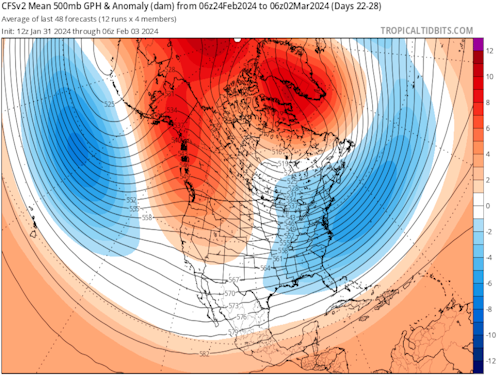
All Three Ensemble Platforms Show High-Latitude Blocking And An Active Storm Track For The Lower 48 States
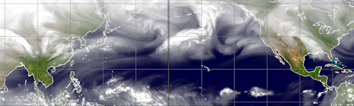
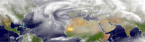
CIMSS (2)
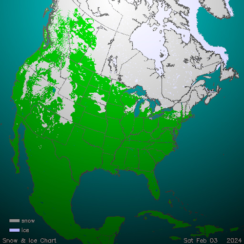
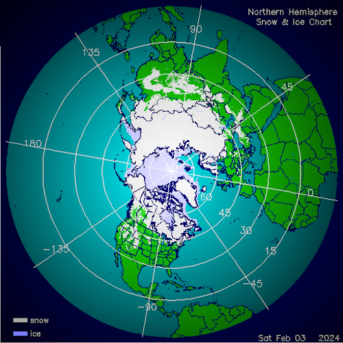
NOHRSC (2)
TropicalTidbits.Com (Dr. Levi Cowan) (3)
NOAA/PMEL
NOAA/CPC
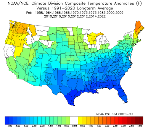
HPRCC/University Of Nebraska (2)
Environment Canada
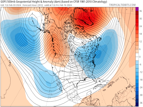
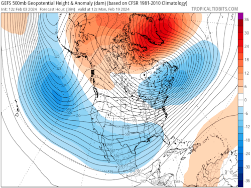
TropicalTidbits.Com (Dr. Levi Cowan) (5)
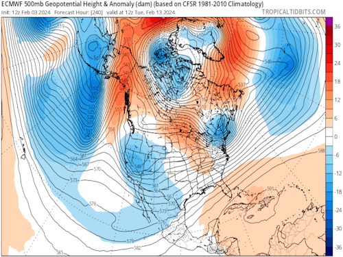
ECMWF (3)
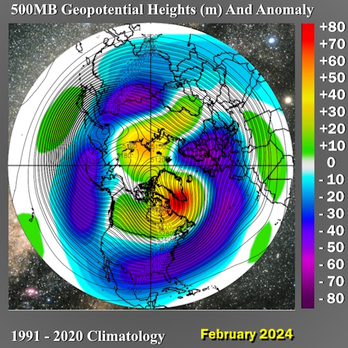
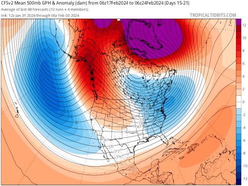
NOAA/PSL (2)
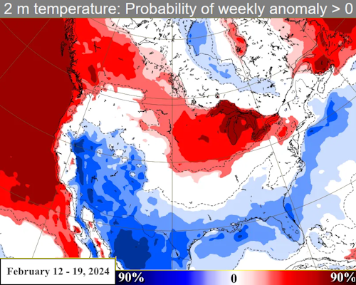
I almost titled this discussion, "This is your last and best chance for serious cold and snow if you live in the southern and eastern tier of the USA".
But for reasons of brevity, I decided against that starting banner. Instead, I look at the 11-15, 16-20, and 21-25 day periods as a chance to see "true winter" before the warmer and wetter March pattern arrives. The analog forecasts did very well in January with the cold plunge and cases of excessive (frozen and liquid) precipitation, so the similarity of the numerical models to the 500MB and temperature alignment should not be ignored. You have a rare -EPO/-AO/-NAO configuration forecast by all of the ensemble platforms, which have been consistent for about a week now. Remember my mantra: the worst and most extreme systems show up, with clarity, for many days before.
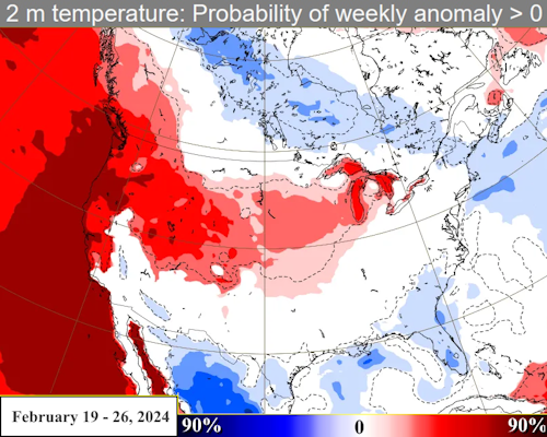
Besides the massive conjoined blocking ridge, there is the matter of the impressive southern branch jet stream. A cAk vortex will form over James Bay and nudge into Quebec by February16. The powerful wind field will have two prominent pieces of cyclonic energy that start in western Mexico, move into Georgia and Florida, then churn northward along the Atlantic shoreline and interact with the developing cold dome. As to which system, if any, hits paydirt and intensifies while moving parallel to the East Coast, I cannot say. But there is a chance for an impressive storm with cold drainage to match vorticity and deep moisture input. In a sense, the south central, Mid-Atlantic and New England states have the chance for "something really special" in terms of precipitation amount and type. The 500MB core on all of the schemes is just below Long Island NY on or near President's Day. The second shortwave is approaching South Texas at that time. I am following the colder GGEM panels in terms of surface temperature.
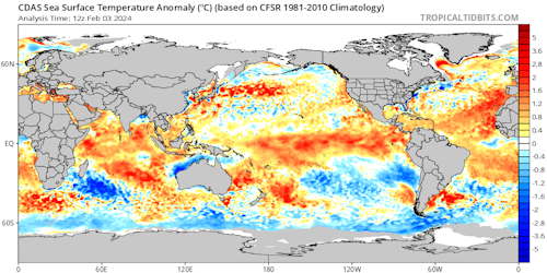
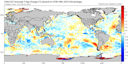
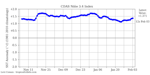
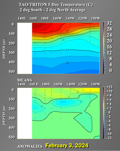
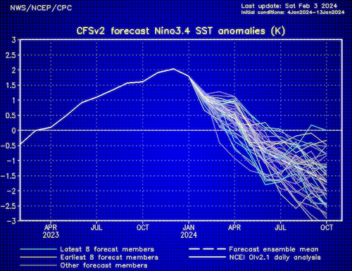
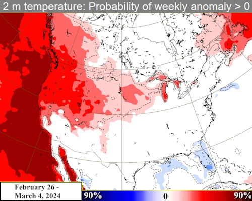
Now again I will warn those of you that are winter weather enthusiasts that with a decaying El Nino, a la 1973, March will be much warmer outside of the West. The western states will be dumped on by heavy wet snow in this process (think Sierra Madre and San Juan Ranges), but by spring a Mogollon Rim closed cyclone is a good possibility. The remainder of February from the High Plains into the Upper Midwest may be cold, but most likely dry.
Prepared by Meteorologist LARRY COSGROVE on
Saturday, February 3, 2024 at 6:30 P.M. CT
Disclaimer:
The previous statements are my opinions only, and should not be construed as definitive fact. Links provided on this newsletter are not affiliated with WEATHERAmerica and the publisher is not responsible for content posted or associated with those sites.
Copyright 2024 by Larry Cosgrove
All rights reserved.
This publication may not be reproduced or redistributed in whole or in part without the expressed written consent of the author.
This publication may not be reproduced or redistributed in whole or in part without the expressed written consent of the author.
Reply all
Reply to author
Forward
0 new messages