WEATHERAmerica Newsletter, Saturday, September 11, 2021 at 11:45 P.M. CT; Longer Term Forecast
108 views
Skip to first unread message

Larry Cosgrove
Sep 12, 2021, 12:47:56 AM9/12/21
to weather...@googlegroups.com
EXTENDED PERIOD FORECAST
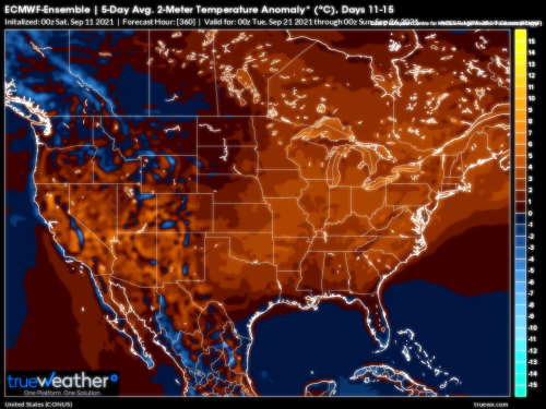
(Between Day 11 And Day 15)
Very Gradual Breakdown Of Heat Across Lower 48 States With Advancing Trough In Mid-Continent, Atlantic Basin Tropical Features
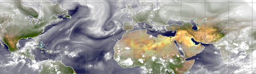
CIMSS (2)
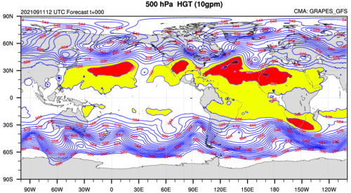
WMO/GRAPES
TwisterData.Com (Levi Cowan) (4)
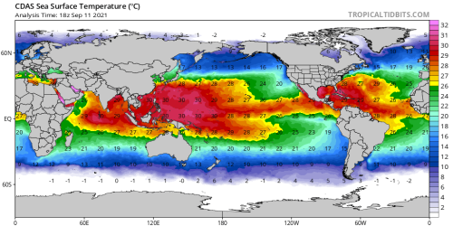
NOAA/PMEL
NOAA/CPC
HPRCC/University Of Nebraska (2)
Environment Canada
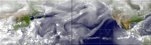
TropicalTidbits.Com (Levi Cowan) (5)
TrueWx.Com (3)
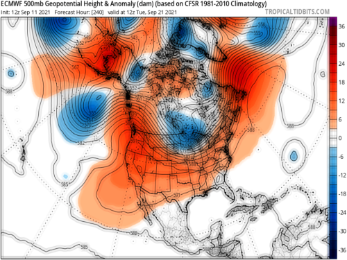
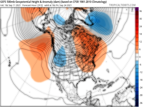
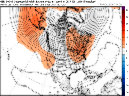
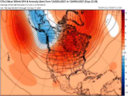
The keys to the longer term forecast in North America are fairly obvious. The Atlantic Basin tropical sequence is active, and becoming more so. The shortwaves in the 500MB polar jet stream are getting stronger, ejecting from a primary position in the Gulf of Alaska. I notice a tendency in the longer term models to both suppress the heat ridge complex, and develop gaps or weaknesses in the elongated subtropical high. However, there are two other anomalies that may not be as obvious to a synoptician. Both systems could have an impact, possibly major on the "down the road" situation later in autumn and into the winter.
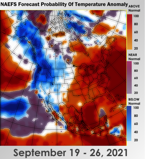
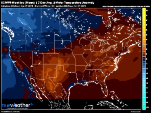
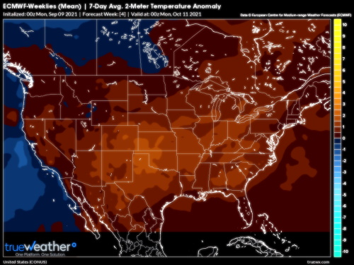
To start with the "obvious", the overall flow in the Northern Hemisphere is mostly quite similar to what was seen through the summer months. The polar jet stream eases into lower latitudes, so the core wind velocity in the middle and upper layers rests just below the U.S./Canada border. Upper air disturbances riding along the westerlies are colder with more potent displays of vorticity and difluence, which of course ups the chance for severe thunderstorms in the Midwest, Great Lakes, and Eastern Seaboard. These disturbances have largely kept the hot air below the International boundary, which in turn might mean a more chilly path for Canadian cities in October. And before long, as far south as the Interstate 90 corridor. If so, the ECMWF model weeklies are probably going to be closer to the truth than the incredibly warm CFS versions.
At some point, another large, powerful storm like Ida or Larry is going to crack the subtropical high. I would suspect that such a feature would be derived from the African ITCZ family, with two destination threats: the islands rimming the Caribbean Sea and/or the Eastern Seaboard. Using the model ensemble packages as a guide, the last week in September and the first 20-15 days in October would be the target zone. Given the fact that we keep seeing interaction with frontal structures, rather than a "sweep out" function, I am very concerned for the area from Florida to New Brunswick and Nova Scotia, back into Appalachia. All of those 1950s analogs scaled up in intensity with warmer oceanic and atmospheric regimes may prove quite bothersome for the eastern quarter of North America.
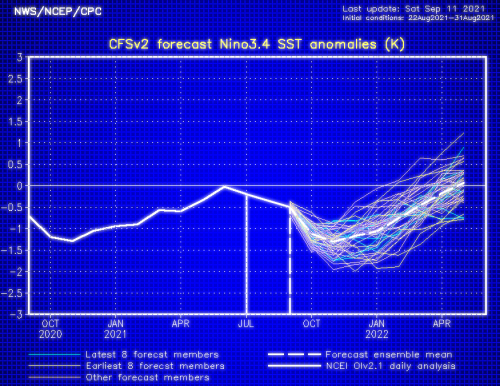
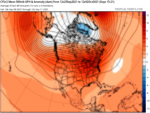
Keep your eyes on Russia and the Arctic Circle. I am seeing a tendency for closed low or vortex formation in Siberia. If snow and cold start to pile up in that vicinity, ridging will likely follow around the North Pole. That is a negative Arctic Oscillation (-AO) signature. And if the Equatorial Moisture Axis feeding the current Mexican disturbance holds (like it did in 2007-08, any storms in the percolating jet stream along the middle latitudes is going to get juiced in a hurry.
It is too early to make a definitive call for the winter, but I will tell you this: there are many choice ingredients being mixed into the DJFM soup!
Prepared by Meteorologist LARRY COSGROVE on
Saturday, September 11, 2021 at 11:45 P.M. CT
Disclaimer:
The previous statements are my opinions only, and should not be construed as definitive fact. Links provided on this newsletter are not affiliated with WEATHERAmerica and the publisher is not responsible for content posted or associated with those sites.
Copyright 2021 by Larry Cosgrove
All rights reserved.
This publication may not be reproduced or redistributed in whole or in part without the expressed written consent of the author.
This publication may not be reproduced or redistributed in whole or in part without the expressed written consent of the author.
Reply all
Reply to author
Forward
0 new messages