WEATHERAmerica Newsletter, Saturday, January 2, 2021; Longer Term Forecast
128 views
Skip to first unread message

Larry Cosgrove
Jan 2, 2021, 10:41:56 PM1/2/21
to weather...@googlegroups.com
EXTENDED PERIOD FORECAST
(Between Day 11 And Day 15)
Pattern Change Will Produce Winter Storms, Somewhat Colder Temperatures In Much Of U.S.
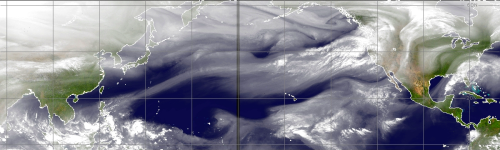
CIMSS
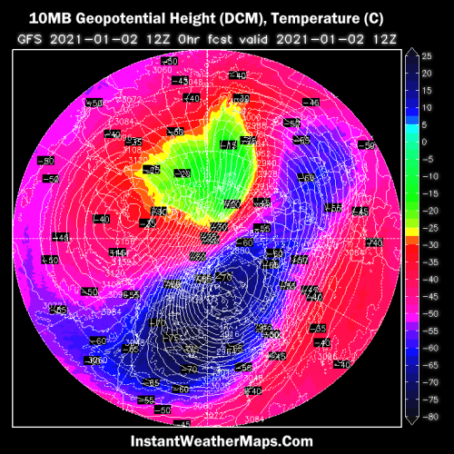
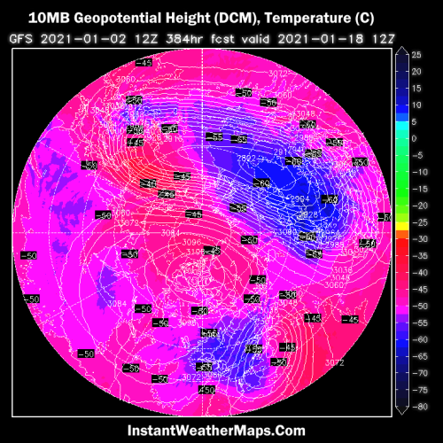
InstantWeatherMaps.Com (2)
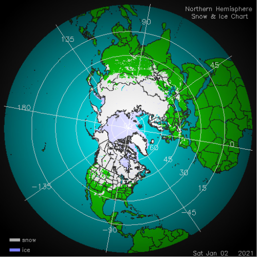
NOAA/IMS (2)
TropicalTidbits.Com (Levi Cowan) (3)
NOAA/PMEL
NOAA/CPC
HPRCC/University Of Nebraska (2)
Environment Canada
TropicalTidbits.Com (Levi Cowan) (5)
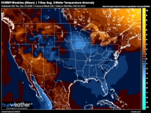
TrueWx.Com (3)
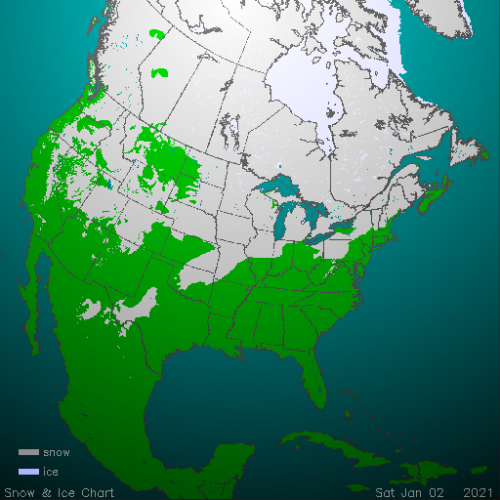
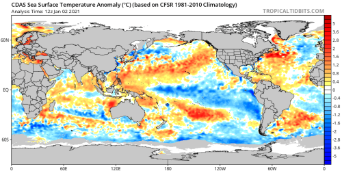
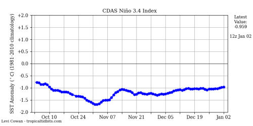
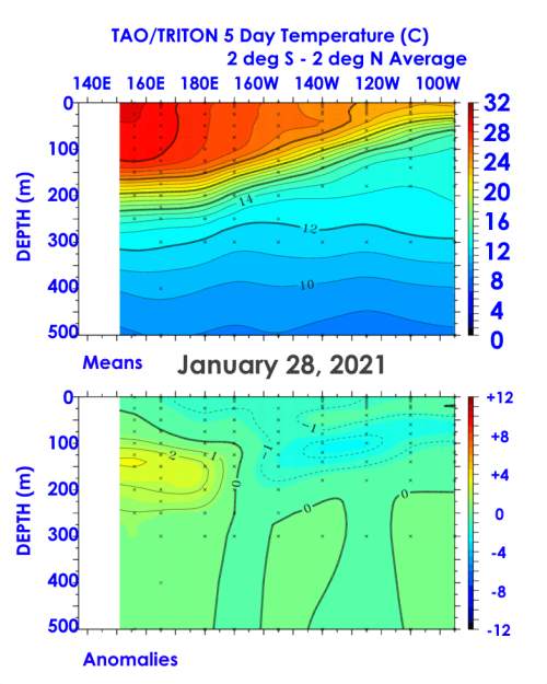
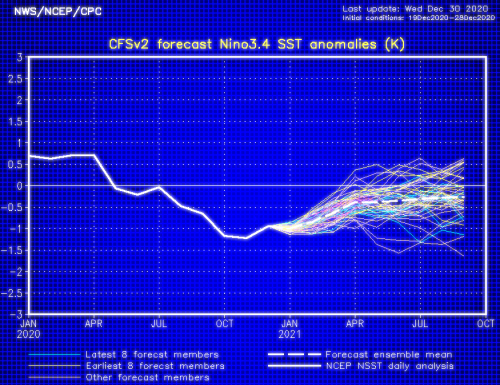
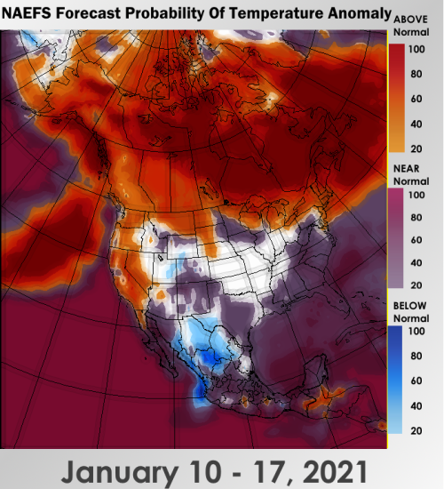
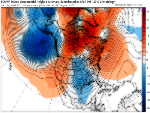
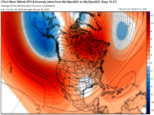
So far, many of the key features forecasted by analog guidance have come true. We have had important southern branch disturbances, temperatures overall have been less than the record warmth predicted by model guidance, and the La Nina episode is showing signs of weakening. The circumpolar vortex is becoming displaced and stretched, snow cover is expanding southward, and the first signs of high-latitude blocking are evident along the Arctic Circle in and about North America. So my confidence is growing that we will transition from a normal/mild alignment in the lower 48 states to colder profiles along and south of the Canadian border in the last half of the month.
All of that to consider, I caution that we will likely not see a "vast and fast" push of Arctic air toward the southern latitudes of the U.S. until past the middle of this month. The analogs show the colder air moving down only in pulses, with tendencies for mild/moist air along the East Coast and mild/dry values in the Pacific shoreline communities. If the -ENSO episode do readingses climb toward negative/neutral as most of the modeling suggests, then the credibility for a more impressive dose of cold readings will be increasing.
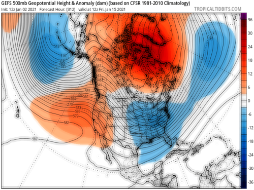
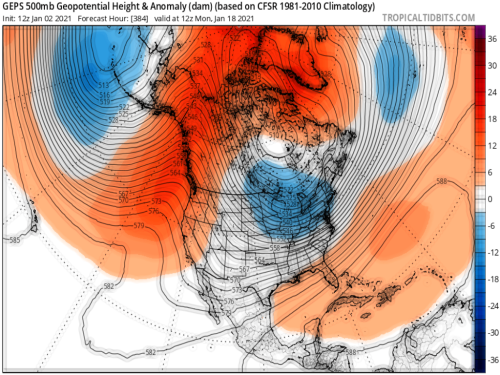
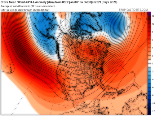
I will raise the issue of the warming of the stratosphere once again, since all of the computer models have virtually the same idea with respect to the episode, and its likely effects at lower levels of the atmosphere. One possible feedback of the moderation and splitting of the circumpolar vortex will be a broad, high-velocity southern branch jet stream at 500MB by the last week of January. If you follow the accepted "working down to the boundary layer' progression, you can make a very real case for a major winter storm along the Eastern Seaboard in the first week of February. I know that is a long way away, but the various schemes have handled the upper and middle atmospheric alignment well (though not the 2m temperature outlines, which have been laughable), and the tendency to collect cAk air in the Great Lakes and middle Appalachia against a warm, open watershed could produce spectacular vertical motion and snow/ice production. Especially if a Miller A type storm gets entrained by the vortex remnant. This is why I am urging everyone to keep close track of the 10MB forecasts, and project core height centers two to three weeks in lower altitudes. It looks very interesting to say the least.
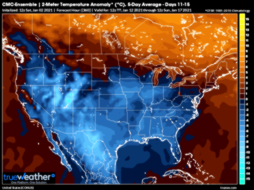
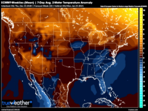
For middle January, we keep a basic cool/mild Canada vs. cold U.S., with the likelihood of a strong/significant storm from Texas into the Mid-Atlantic in the 11 - 15 and 16 - 20 day periods.
Prepared by Meteorologist LARRY COSGROVE on
Saturday, January 2, 2020 at 9:35 P.M. CT
Disclaimer:
The previous statements are my opinions only, and should not be construed as definitive fact. Links provided on this newsletter are not affiliated with WEATHERAmerica and the publisher is not responsible for content posted or associated with those sites.
Copyright 2020 by Larry Cosgrove
All rights reserved.
This publication may not be reproduced or redistributed in whole or in part without the expressed written consent of the author.
This publication may not be reproduced or redistributed in whole or in part without the expressed written consent of the author.
Reply all
Reply to author
Forward
0 new messages