WEATHERAmerica Newsletter, Saturday, October 16, 2021 at 10:20 P.M. CT; Longer Term Forecast
108 views
Skip to first unread message

Larry Cosgrove
Oct 16, 2021, 11:23:25 PM10/16/21
Reply to author
Sign in to reply to author
Forward
Sign in to forward
Delete
You do not have permission to delete messages in this group
Copy link
Report message
Show original message
Either email addresses are anonymous for this group or you need the view member email addresses permission to view the original message
to weather...@googlegroups.com
EXTENDED PERIOD FORECAST
(Between Day 11 And Day 15)
Friendly Advice About La Nina And The Arctic Vortices (Gulf Of Alaska Low And Grand Banks Gyre)
CIMSS (2)

WMO/GRAPES


Tropical Tidbits.Com (Levi Cowan) (4)
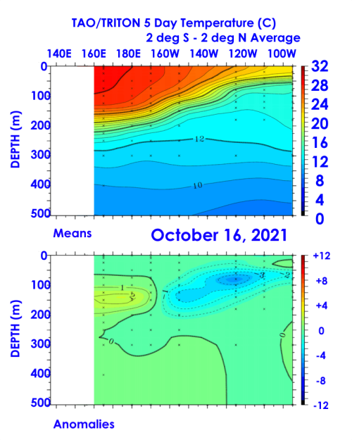
NOAA/PMEL

NOAA/CPC

HPRCC/University Of Nebraska (2)
Environment Canada


TropicalTidbits.Com (Levi Cowan) (5)
TrueWx.Com (3)
First came the panic commentary about the "coming bitter cold winter". Then, almost like magic, some firms and agencies dedicated to forecasting, proclaimed "no winter expected". Now you and I have been through this routine in previous autumns. As always, when presented with two extremes, the proper course is somewhere in the middle. The upcoming NDJFM period will prove to be no different. I think we should look at the most important players in the low sun period arena.
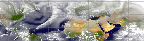
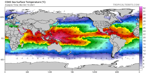
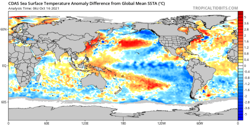
We can start with the La Nina episode. The ENSO signature is very real, destined like last winter to reach a moderate-to-strong rating (I will say -1.5 deg C differential in sector 3.4). The cooling is not making it to the westernmost area of the Pacific Ocean, which means that tropical cyclone production may remain in play to the right of the Orient during much of November. With percolations of the Madden-Julian Oscillation to the left of the International Dateline, there will be chances for ridge formation in Alaska and northwestern Canada. But mostly in a transient manner.
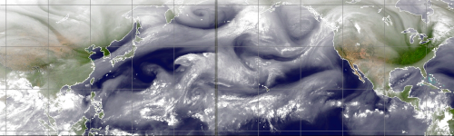
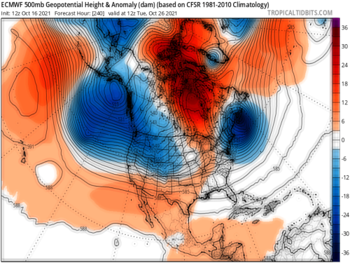
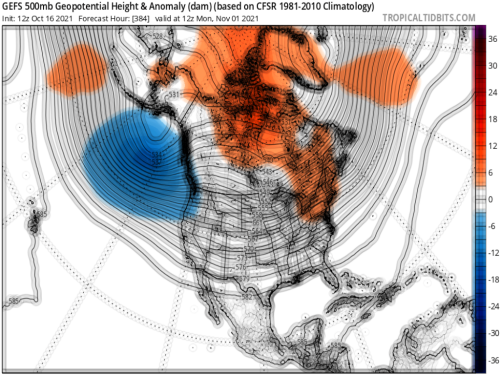
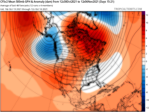
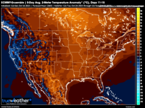
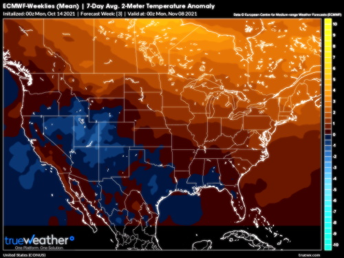
We again see impressive subtropical jet stream formation, often depressed to very low latitudes into northwestern Mexico, Texas and Florida. That was evident last year, and the equatorial Pacific Ocean is similar to 2020 and can be used as an analog. Repeated reformation of both the Gulf Of Alaska Low, in ever-deeper intensities and cold pooling, and teh recent emergence of mA vortices over the Grand Banks/Flemish Cap are also a cold teleconnection for the eastren two-thirds of the continent. In a La Nina, the pools of cold air and vorticity come across the Pacific Northwest into the Prairie Provinces or Upper Midwest and Great Lakes into the St. Lawrence Valley. So a good deal of the U.S., above Interstate 70 and to the left of the Appalachian Mountains, should be turning colder this November.
The x-factor here: will we see a late October storm that draws moisture from the Gulf of Mexico and Caribbean Sea, and targets the Eastern Seaboard? It could happen, even if that is not apparent on any of the computer schemes. Since another vortex is likely to form over Newfoundland, energy from the polar westerlies might link or phase with a tropical or subtropical impulse. If that happens, a somewhat more meaningful cold intrusion into the eastern U.S. may occur by the second week of November.
Prepared by Meteorologist LARRY COSGROVE on
Saturday, October 16, 2021 at 10:20 P.M. CT
Disclaimer:
The previous statements are my opinions only, and should not be construed as definitive fact. Links provided on this newsletter are not affiliated with WEATHERAmerica and the publisher is not responsible for content posted or associated with those sites.
Copyright 2021 by Larry Cosgrove
All rights reserved.
This publication may not be reproduced or redistributed in whole or in part without the expressed written consent of the author.
This publication may not be reproduced or redistributed in whole or in part without the expressed written consent of the author.
 | ReplyForward |
Reply all
Reply to author
Forward
0 new messages