WEATHERAmerica Newsletter, Saturday, January 8, 2022 at 10:40 P.M. CT; Longer Term Forecast
142 views
Skip to first unread message

Larry Cosgrove
Jan 8, 2022, 11:41:23 PM1/8/22
to weather...@googlegroups.com
EXTENDED PERIOD FORECAST
(Between Day 11 And Day 15)
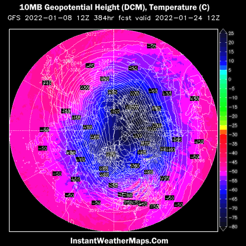
The "January Thaw" Gives Way To An Alaskan Blocking Ridge And A James Bay Arctic Vortex
CIMSS
NOAA/IMS (2)
InstantWeatherMaps.Com (2)
TropicalTidbits.Com (Dr. Levi Cowan) (3)
NOAA/PMEL
NOAA/CPC
ECMWF
HPRCC/University Of Nebraska (2)
Environment Canada
TrueWx.Com (3)
TropicalTidbits.Com (Dr. Levi Cowan) (5)
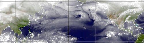
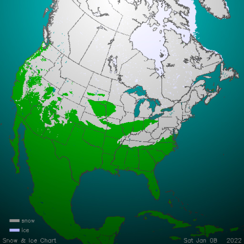
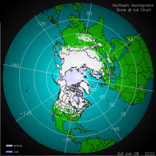
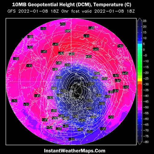
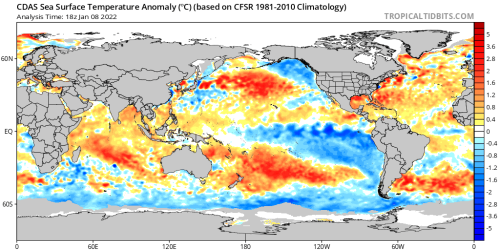
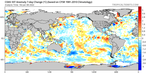
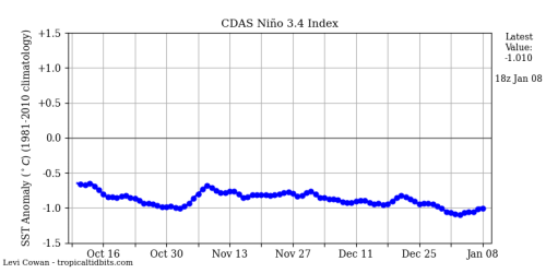
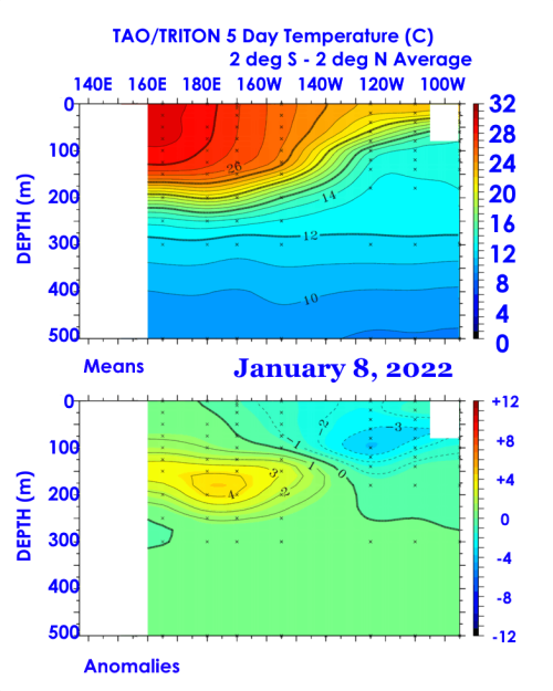
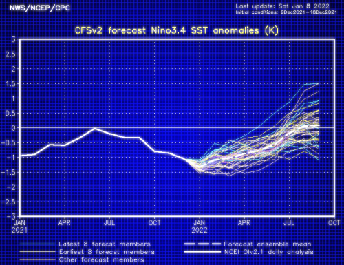
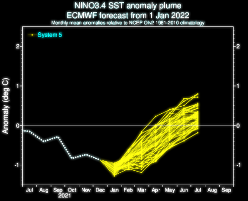
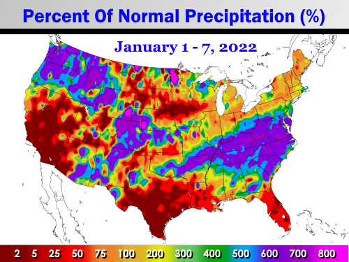
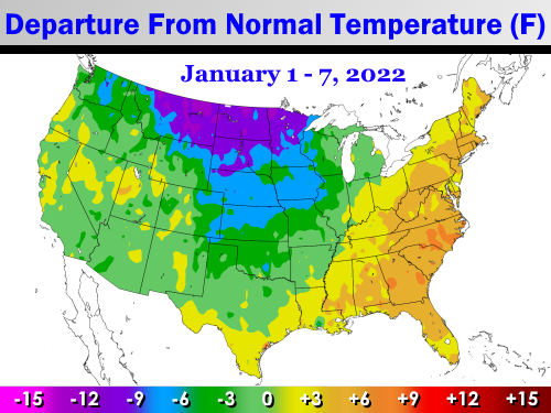
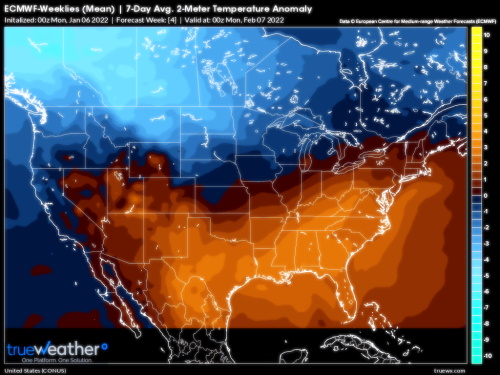
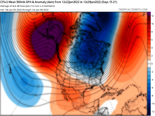
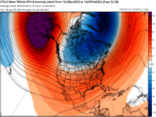
The end phase of the current La Nina episode is beginning, the circumpolar vortex continues to show a "rubber band" elasticity, and the subtropical jet stream appears to be energizing. These events, and the recent expansion of the snow field in Russia and North America are solid indicators of a colder, and likely stormier, turn in weather over the lower 48 states. I will caution you that a more wintry period probably will not last all that long (3 to 4 weeks), since all model guidance for February in the lower 48 states is warmer (retreat of Arctic air into Canada).
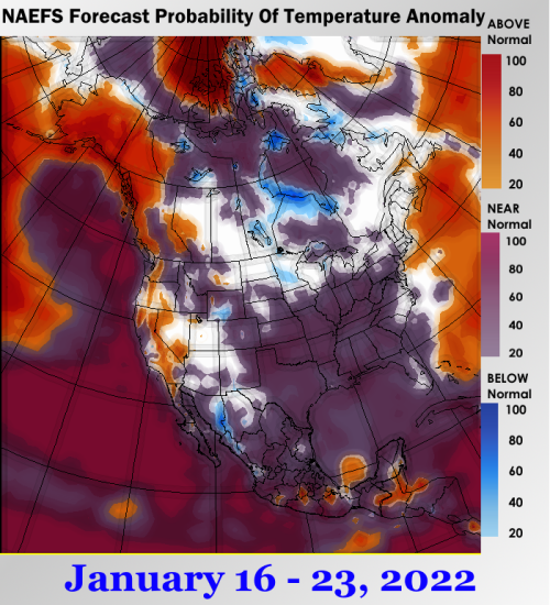
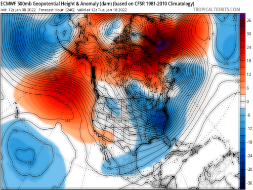
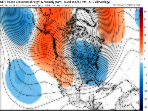
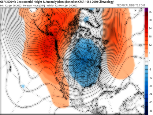
A key feature is the possibility of a "triple phase" weather event affecting the eastern third of the continent in the 11-15 day time frame. With blocking signatures in the -EPO (Alaska), -AO (Northwest Territories and Nunavut AR), and -NAO (Greenland) positions, energy coming across the Pacific Northwest should be forced into the south central U.S., coming into contact with the aforementioned southern branch nearing Baja California. A cAk vortex nearing James Bay may be pushed into Ontario and Michigan, leaving open the possibility of contact with any disturbance moving along the Gulf Coast and then up and just off of the Atlantic shoreline. The ensemble platforms have hinted at this possibility for about ten days now (that is a long time in terms of numerical model profiling), so I have decent confidence that something akin to a major winter storm will occur in the longer term. The chief area of interest would be from the Great Lakes region into the Mid-South, Appalachia and the Interstate 95 corridor above Fayetteville NC. Now if you think this areal coverage is too much and too far south, just take a look at the past two episodes involving heavy snowfall.
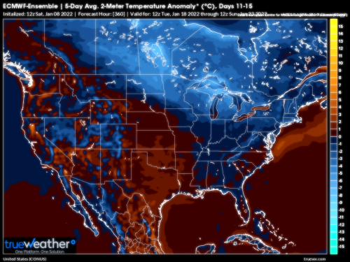
Typically in this type of set-up, the coldest air is found along and to the right of the Rocky Mountains. As long as ridging holds across the western U.S., the greatest chill will occur along and east of a line from Edmonton AB to Laredo TX. A subsidence inversion may develop through the Intermountain Region, in association with +PNA ridging, creating seemingly endless bouts of Tule fog and low-level chilly temperatures.
Now admit it....you thought winter was over, right? Guess again.
Prepared by Meteorologist LARRY COSGROVE on
Saturday, January 8, 2022 at 10:40 P.M. CT
Disclaimer:
The previous statements are my opinions only, and should not be construed as definitive fact. Links provided on this newsletter are not affiliated with WEATHERAmerica and the publisher is not responsible for content posted or associated with those sites.
Copyright 2022 by Larry Cosgrove
All rights reserved.
This publication may not be reproduced or redistributed in whole or in part without the expressed written consent of the author.
This publication may not be reproduced or redistributed in whole or in part without the expressed written consent of the author.
Reply all
Reply to author
Forward
0 new messages