More info on Memphremagog
32 views
Skip to first unread message

Matt Steinberg
Apr 10, 2023, 9:19:32 PM4/10/23
to NHNordicSkating, VTNordicskating
Hello Everyone,
Here on April 10 I bet at least some of you were hoping the posts were done
for the next 7 months but I received a request to further explain what
characteristics on the lake made me decide to turn around instead of
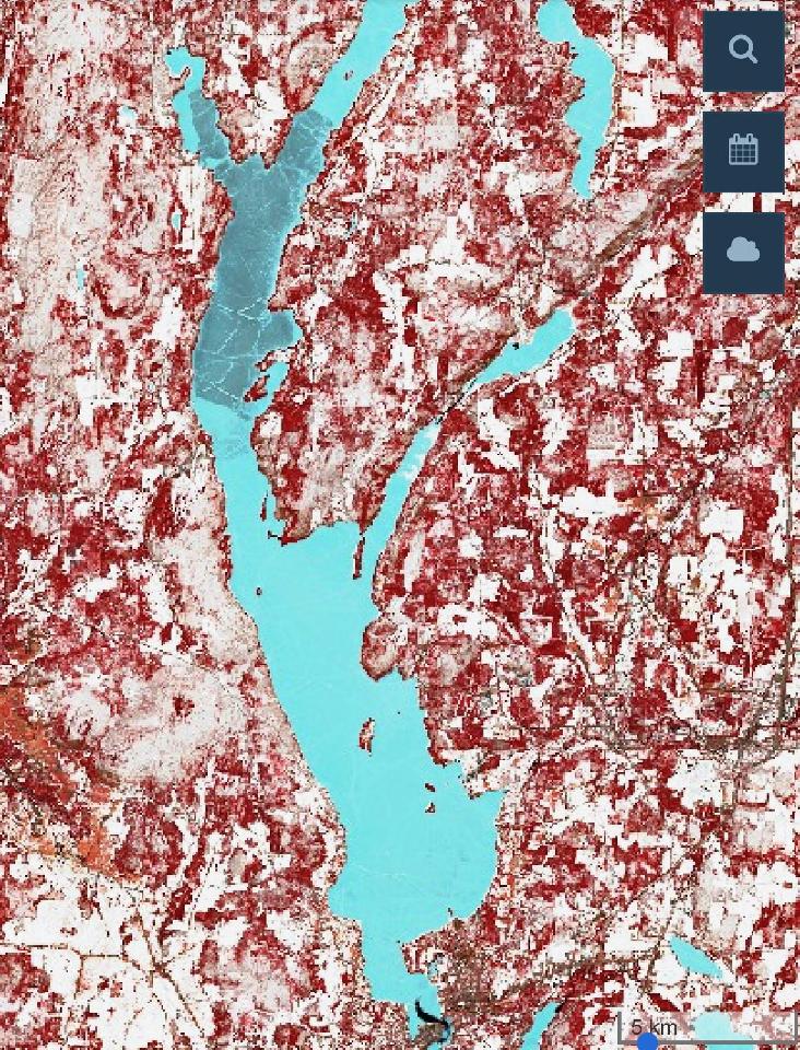
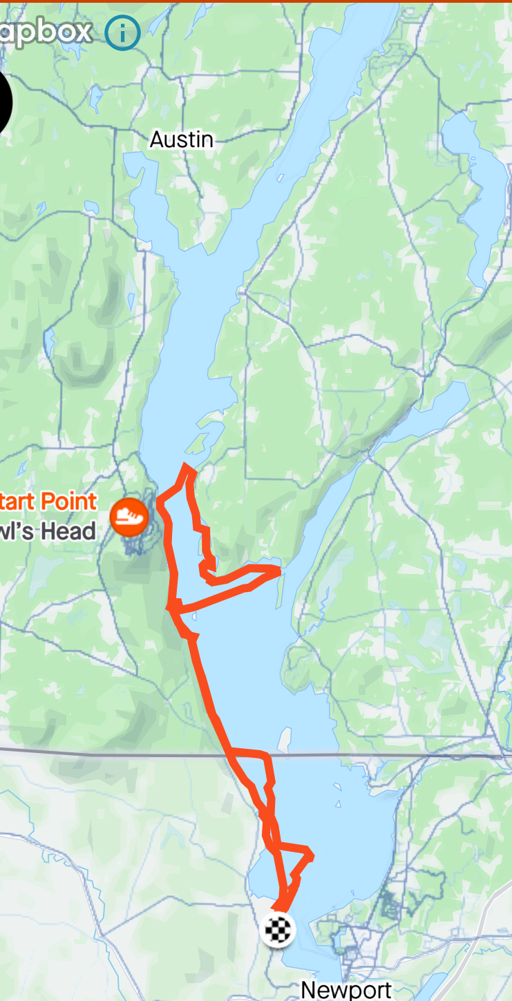
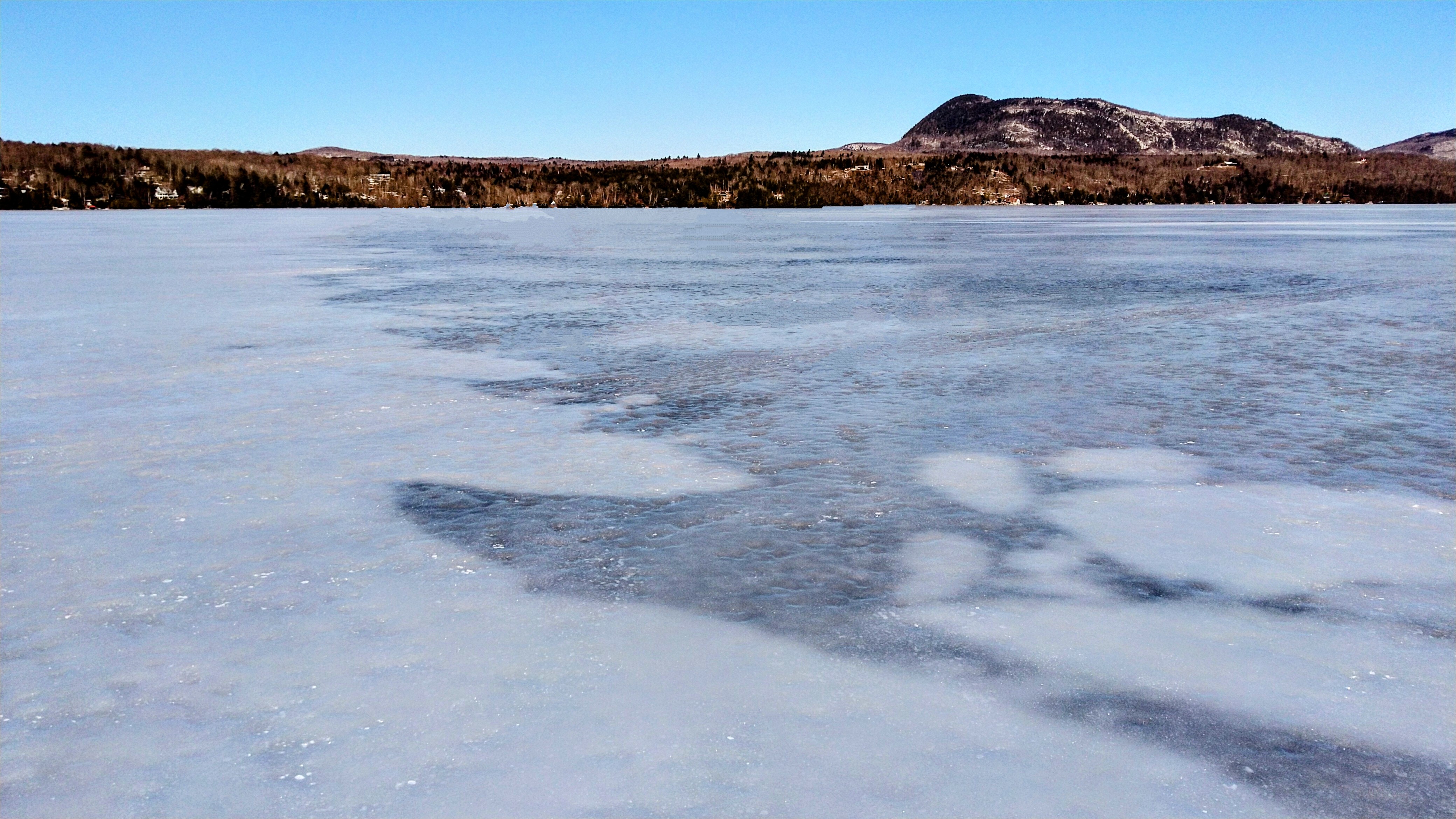
pressing forward to my goal. You have all seen the various discussions we have had in the past few months on the satellite images. Now I typically am not a big tech person and I still need to figure out how to make them work on my phone, but Jamie has been kind enough to provide them to me over the past few months and we have found them to be very accurate and helpful. He provided me the latest clear image for Memphramagog that was taken 6 days before my planned trip and I had the opportunity to review it, so I had some expectations of where the thin ice was the prior weekend and I am pleased to say that the satellite images corresponded EXACTLY with what I found. I have attached my track as well as the satellite image. The satellite shows that the whole lake was clear of snow but you can see that the southern wider half is bright blue representing the thicker ice and there is a very defined line at the narrows that shows a much darker color. As you can see in my track, this is the exact point where I stopped due to thinner ice. I have also attached a picture from this location where this border was very evident visually, extending all the way across the lake and as far north as I could see, just like in the images. This ice was 4 poke at the boundary and I ventured on it up to the island and it quickly got thinner, more hollow, sounding, and started cracking, causing me to turnaround and head back. I hope this helps. I am now a big believer in how these images can give us an additional tool to work with so we can maximize our time, pleasure, and safety on the ice. The major limitation I see is that these particular images only come out every 5 days and living where we do, they are often obscured by clouds which means we can go weeks without data. I am sure there may be other, more frequent images out there that we just not have found yet.
Here on April 10 I bet at least some of you were hoping the posts were done
for the next 7 months but I received a request to further explain what
characteristics on the lake made me decide to turn around instead of
pressing forward to my goal. You have all seen the various discussions we have had in the past few months on the satellite images. Now I typically am not a big tech person and I still need to figure out how to make them work on my phone, but Jamie has been kind enough to provide them to me over the past few months and we have found them to be very accurate and helpful. He provided me the latest clear image for Memphramagog that was taken 6 days before my planned trip and I had the opportunity to review it, so I had some expectations of where the thin ice was the prior weekend and I am pleased to say that the satellite images corresponded EXACTLY with what I found. I have attached my track as well as the satellite image. The satellite shows that the whole lake was clear of snow but you can see that the southern wider half is bright blue representing the thicker ice and there is a very defined line at the narrows that shows a much darker color. As you can see in my track, this is the exact point where I stopped due to thinner ice. I have also attached a picture from this location where this border was very evident visually, extending all the way across the lake and as far north as I could see, just like in the images. This ice was 4 poke at the boundary and I ventured on it up to the island and it quickly got thinner, more hollow, sounding, and started cracking, causing me to turnaround and head back. I hope this helps. I am now a big believer in how these images can give us an additional tool to work with so we can maximize our time, pleasure, and safety on the ice. The major limitation I see is that these particular images only come out every 5 days and living where we do, they are often obscured by clouds which means we can go weeks without data. I am sure there may be other, more frequent images out there that we just not have found yet.
Reply all
Reply to author
Forward
0 new messages