setting eye elevation in Google Earth?
6,315 views
Skip to first unread message

William Premerlani
Jun 13, 2015, 7:05:14 AM6/13/15
to uavdevboard-dev
Team,
I have been testing the helical controls branch with my EasyStar2. Performance is better than I had even hoped.
Now I want to take some screen shots, but I cannot seem to get the ones I want because I have not yet figured out how to control eye elevation in Google Earth. I have tried several things, have done a Google search, but the technique for setting it still eludes me. Do any of you have a sure fire way to zoom in on a flight track?
I would suspect that Peter knows, but I think he is on vacation.
Best regards,
Bill

Tom Pittenger
Jun 13, 2015, 8:04:48 AM6/13/15
to uavdevb...@googlegroups.com
Have you tried right-mouse click and drag and also center scroll wheel press and drag?
--
You received this message because you are subscribed to the Google Groups "uavdevboard-dev" group.
To unsubscribe from this group and stop receiving emails from it, send an email to uavdevboard-d...@googlegroups.com.
For more options, visit https://groups.google.com/d/optout.

Mark Whitehorn
Jun 13, 2015, 9:36:44 AM6/13/15
to uavdevboard-dev
--
William Premerlani
Jun 13, 2015, 10:48:31 AM6/13/15
to uavdevboard-dev
Hi Mark and Tom,
Thanks for your replies.
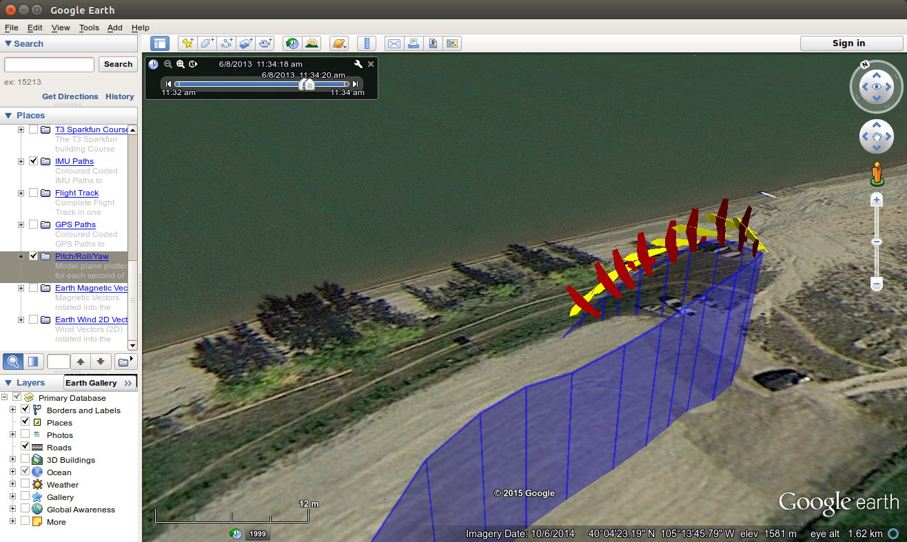
I have tried all of those techniques, they will indeed change the "eye alt", as long as I am not trying to view directly from the side of the flight path. What I am trying to do is to view the plane icon from the side, in the same horizontal plane as the track, where the performance of the controls during a 180 degree roll is evident.
Here is what happens in Google Earth:
I adjust the tilt of the view so that I am looking parallel to the earth surface. At that point I would like to "climb up" to the flight track to look at it, but no matter what I do, as long as the earth surface is horizontal, the eye altitude is locked to the earth surface.
I can change the eye altitude through a combination of mouse operations, but only if I change the tilt first. But then when I change the tilt back to get a look from the side of the track in the same horizontal plane, the eye altitude changes in a way that I cannot predict, and I wind up being either too high or too low to get a close up view of the track.
With everything that I have tried I either cannot get very close to the track, or I cannot get in the same horizontal plane, I have to look either up or down.
So, here is what I would like to do:
1. Set the tilt so that I am looking parallel to the earth surface.
2. Adjust the eye altitude until it is equal to the altitude of the track.
I looked on line, this apparently is a common question with multiple replies on how to do it, none of which work for me. Most of them are hacks of one sort or another.
Best regards,
Bill
William Premerlani
Jun 13, 2015, 11:05:30 AM6/13/15
to uavdevboard-dev
Mark and Tom,
After looking online at the suggestions for setting eye elevation, I think I figured out the basics of how to do it.
I think you have to create a placemark with the desired altitude, and then make it the center of the view.
The rest of the details of the procedure were not clear, but I think eventually I will figure it out.
Best regards,
Bill
Mark Whitehorn
Jun 13, 2015, 11:44:26 AM6/13/15
to uavdevboard-dev
More like this? I'm just using the mouse to adjust the viewpoint.

Mark Whitehorn
Jun 13, 2015, 11:45:45 AM6/13/15
to uavdevboard-dev
But I agree, it seems impossible to get the camera axis parallel to the ground.
--
William Premerlani
Jun 13, 2015, 12:59:28 PM6/13/15
to uavdevboard-dev
Mark,
Yes, that is exactly what I am trying to do, except I cannot get as close as I would like using the mouse. I wind up with an eye elevation much higher or lower than I want it to be. I would be satisfied getting as close as you got in your last email, but it seems that I am not as skilled with the mouse as you are.
Best regards,
Bill
Mark Whitehorn
Jul 19, 2015, 11:36:13 AM7/19/15
to uavdevb...@googlegroups.com
Bill,
I just found that "Shift + left mouse button + drag down" lets me get closer to the horizontal: https://support.google.com/earth/answer/148115?hl=en

William Premerlani
Jul 19, 2015, 12:16:58 PM7/19/15
to uavdevboard-dev
Mark,
Thank you so much for tracking this down, I appreciate it.
Best regards,
Bill
Reply all
Reply to author
Forward
0 new messages