2013 Sierra Ski-O Tour: Northstar-at-Tahoe Checkin, Registration, Gondola, Cross Country Center instructions
7 views
Skip to first unread message

Tony Pinkham
Jan 29, 2013, 12:20:51 AM1/29/13
to Bay O-Net, sierra-ski-...@googlegroups.com, Sierra Ski-O Tour
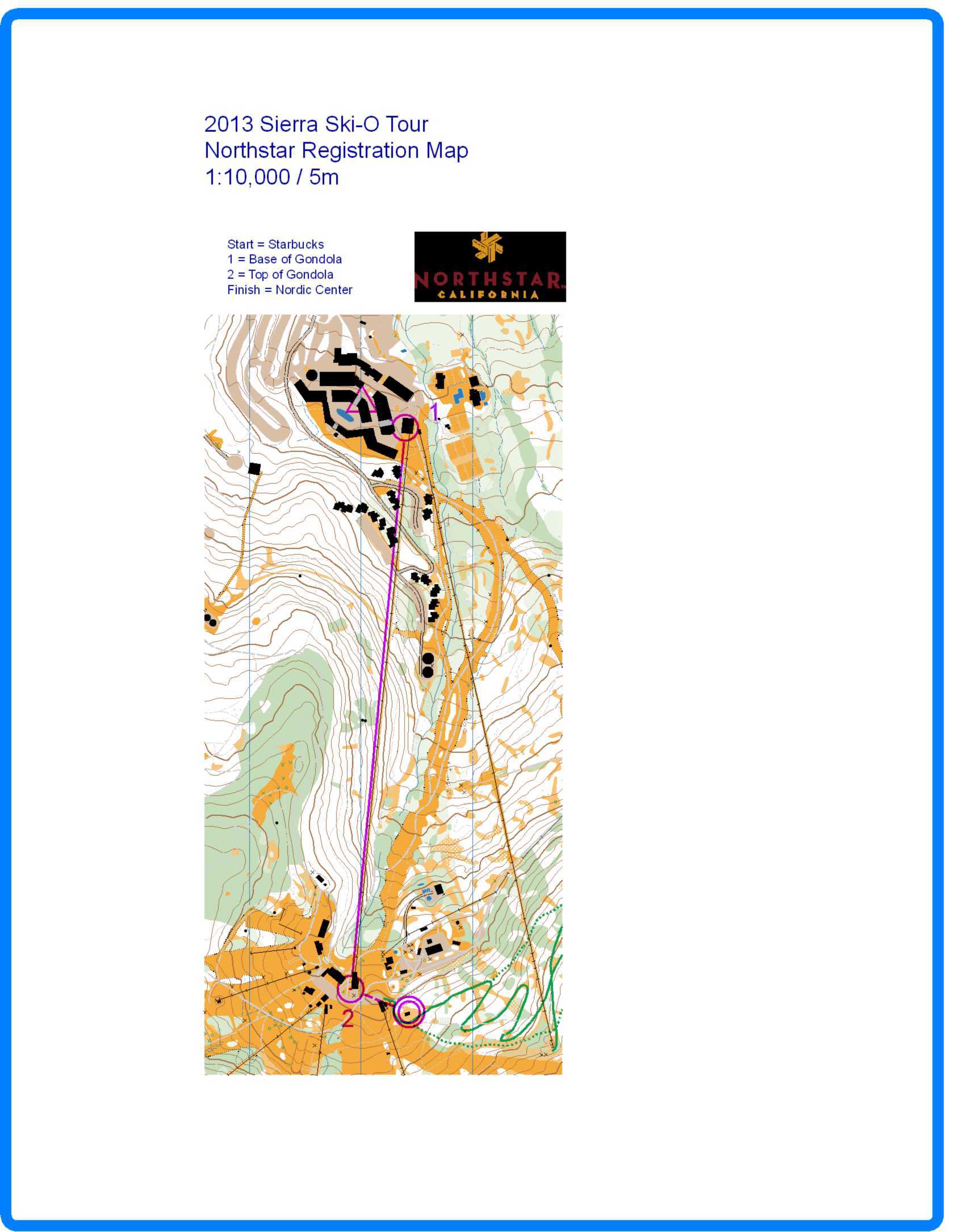
If you are attending the Northstar Ski-O event on Tuesday 29-January-2013, here is a map showing where you need to go to register or check in, then go to the gondola and the cross country center. Everybody needs to either register or check in to get their gondola pass. The attached map shows the parking area with a start triangle, the registration/checkin area (Starbucks cafe) as control 1, the gondola loading area as control 2, the gondola exit as control 3, and the cross country center as the finish. At the cross country center, you can drop off your non valuables that you don't want to carry while racing. After you drop off your stuff, you go about one mile up the hill to the start area near Saw Mill Flats. Near the starting area, you will cross two downhill tracks--PLEASE BE CAREFUL WHEN CROSSING THE DOWNHILL TRACKS!!!
The course setter and director for this event are Brenda Giese and Jonathan Owens. Check the Registration/Check In station at Starbucks to see if they have any special information other than the following stats:
White 2.5 km 75 m
Orange 5.5 km 150 m
Green 6 km 150 m
Red 8.5 km 250 m
Blue 10 km 300 m
Tony
Tony Pinkham
Jan 29, 2013, 12:25:41 AM1/29/13
to Bay O-Net, sierra-ski-...@googlegroups.com, Sierra Ski-O Tour, Ann Wiselogle, Mike Poulsen, Scott Drumm, liz muckerman, Jonis, Anna Voegele
More info on Northstar from the course setter and event director:
Snow shoe trails are mapped as the permanent network of Northstar’s snow shoe trails. Not all of them may have been walked by people in snow shoes lately, so some may be indistinct or absent entirely. In most locations snow-shoe-trail signs on trees are spaced about 100 to 200 feet apart.
Not all trails have been mapped with GPS; some trail locations are therefore approximate and not exact.
On Mon, Jan 28, 2013 at 9:20 PM, Tony Pinkham <runner...@gmail.com> wrote:
[Attachment(s) from Tony Pinkham included below]
__._,_.___Attachment(s) from Tony Pinkham
1 of 1 Photo(s)
Reply via web post Reply to sender Reply to group Start a New Topic Messages in this topic (1) To unsubscribe, send an email to: baoc-uns...@yahoogroups.com
![Yahoo! Groups]() .
.![]()
__,_._,___
Reply all
Reply to author
Forward
0 new messages