Trombetta Open Space

Teresa Gallagher
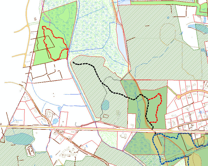
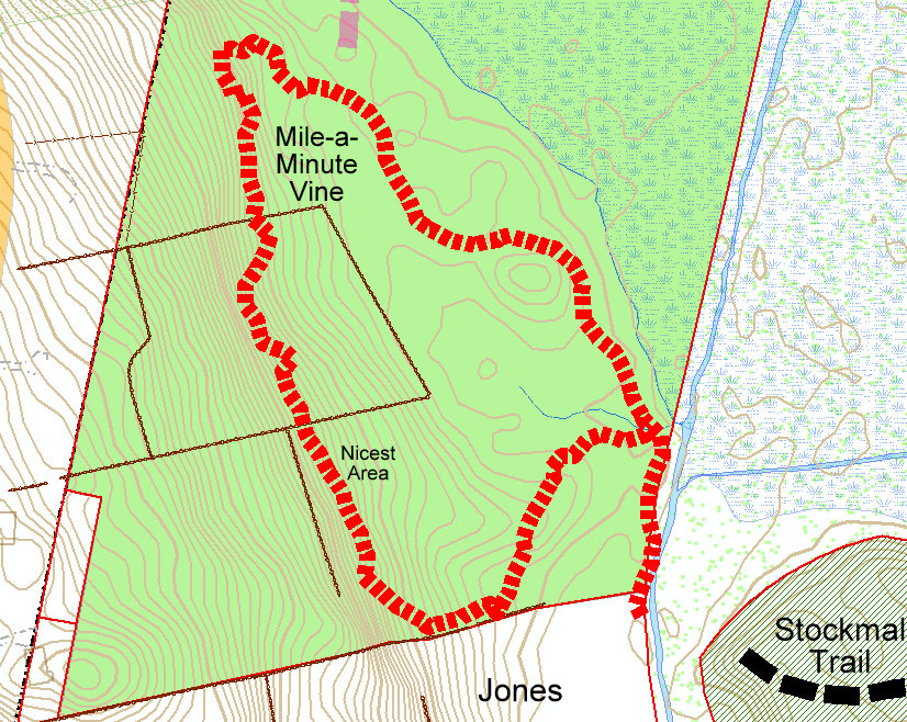
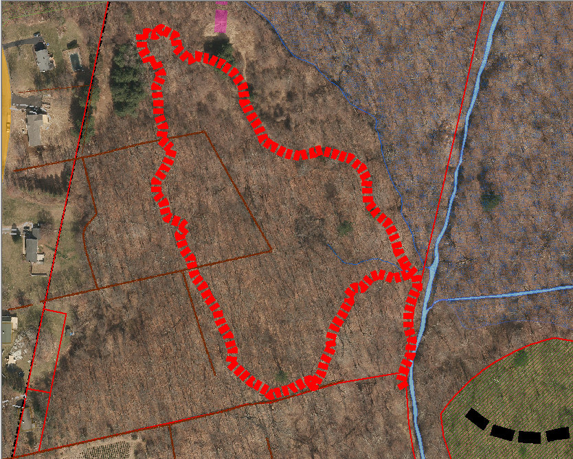
Update on the 32-acre Trombetta open space where I discovered the Mile-a-Minute vine growing in September:
It was too late in the season to bother pulling up the Mile-a-Minute Vine because it dies with the frost, but the location was extremely difficult to reach, so I worked on making it accessible for next year. There are many seeds in the ground that will be sprouting for years to come. There’s now a loop trail about 0.5 mile long on the property (hikeable but still needs a bit more work). See maps.
To get across Means Brook, I was originally able to just walk across it with high-topped waterproof hiking boots, but after the Nor’easter the water has been about a foot deep and I’ve had to use tall rubber boots. With Terry’s help, I now have a 12-foot 2x10” board across the brook tied to a tree for when it floods. Works great so far. Most of the time Means Brook is just a tiny brook, but when it floods the water really goes up high.
The new loop trail is not connected to Stockmal Trail (yet) because we need to get permission from Aquarion and the committee that manages Centennial Watershed State Forest to cross about 150’ of their land. I’m working with Joe Welsh on that (the state bought recreation rights over this and other water company properties across the state known as Centennial State Forest). When we applied for the Stockmal Open Space grant, we stated that we wanted to preserve the Stockmal property and acquire pedestrian access over it in order to reach the Trombetta property, which is otherwise inaccessible. So public access to the Trombetta property has been a documented goal for many years. Currently, Stockmal Trail just stops quite abruptly and then hikers just have to turn around and go back. Being able to cross Means Brook and hike a half mile loop before returning would be a much nicer outing, even if the Trombetta property isn’t always accessible due to high water.
Teresa Gallagher
Natural Resources Manager
City of Shelton
54 Hill Street, Shelton, CT 06484

McCreery, Edward P.
One of my dreams has been to have a proper trail bridge built across the Means Brook to connect the two parcels of open space along with the trail through Stockmal Woods. But to be able to withstand the spring time flooding would be a challenge and more importantly to be doing more than a board – we need to open a line of discussion with the water company as I recall they still own the stream bank sides and that strip separates the two city-owned parcels. So could – should we put on the next agenda the beginning of a discussing a more formal bridge near that trail crossing. Nothing bit like near the dam – but rather more like wooden bridges which cross the East Sprayne of the Means Brook through Nicholdale …albeit…probably have to be longer. But single file is recommended to prevent ATVs from using.
Edward P. McCreery, III, Esq.
Pullman & Comley LLC
T 203 330 2216 • emcc...@pullcom.com
THIS MESSAGE AND ANY OF ITS ATTACHMENTS ARE INTENDED ONLY FOR THE USE OF THE DESIGNATED RECIPIENT, OR THE RECIPIENT’S DESIGNEE, AND MAY CONTAIN INFORMATION THAT IS CONFIDENTIAL
OR PRIVILEGED. IF YOU ARE NOT THE INTENDED RECIPIENT, PLEASE (1) IMMEDIATELY NOTIFY PULLMAN & COMLEY ABOUT THE RECEIPT BY TELEPHONING (203) 330-2000; (2) DELETE ALL COPIES OF THE MESSAGE AND ANY ATTACHMENTS; AND (3) DO NOT DISSEMINATE OR MAKE ANY USE OF ANY
OF THEIR CONTENTS.
--
You received this message because you are subscribed to the Google Groups "Shelton Conservation Commission" group.
To unsubscribe from this group and stop receiving emails from it, send an email to
sheltoncc+...@googlegroups.com.
To view this discussion on the web visit
https://groups.google.com/d/msgid/sheltoncc/cb39ae99bfbb48aaa111137aa7ae9f4a%40mail.ex2013.local.
Teresa Gallagher
I recommend just getting permission to put the trail across first. Then worry about a permanent bridge later. We’ve been looking at this crossing for a few years and it’s deceptively challenging and complicated. The river gets really high and wide with a strong flow. Aquarion might have stipulations about bridge building if/when they grant permission for the trail to cross the brook. The simple plank provides surprisingly good hiker access for now, it’s just that hikers will need to throw it back across the river after every significant rainfall, and there will be times where the water may be too high to do so for a week or so. That’s the way it is with some trails and that’s OK. I think local hikers will be willing to put the plank back after the water recedes.
From: shel...@googlegroups.com <shel...@googlegroups.com>
On Behalf Of McCreery, Edward P.
Sent: Wednesday, November 10, 2021 10:50 AM
To: shel...@googlegroups.com
Subject: SheltonCC RE: Trombetta Open Space
|
CAUTION: This email originated from outside your organization. Exercise caution when opening attachments or on clicking links from unknown senders. |
To view this discussion on the web visit https://groups.google.com/d/msgid/sheltoncc/acd156ccc4854fedb2768623f68c3005%40pullcom.com.

thomas harbinson
To view this discussion on the web visit https://groups.google.com/d/msgid/sheltoncc/a038a012e39849888ea3fbab7f0f8215%40mail.ex2013.local.