Safecast QGIS3 plugin
49 views
Skip to first unread message

Jan Helebrant
Mar 3, 2020, 6:23:42 AM3/3/20
to Safecast Discussion Group
Hi Safecasters,
some of you might know the QGIS plugin for viewing and processing the Safecast bGeigie LOG data. There is an old version in QGIS repository but there is also an active development for QGIS3. Due to some delay in development the QGIS3 plugin is still not available through the official plugin repository.
So we are offering you a way to try the development version from Github this way:
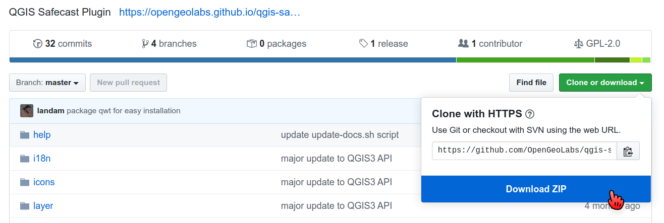
1) visit plugin Github page here:
and download the ZIP file (click "Clone or download" and then "download ZIP"):
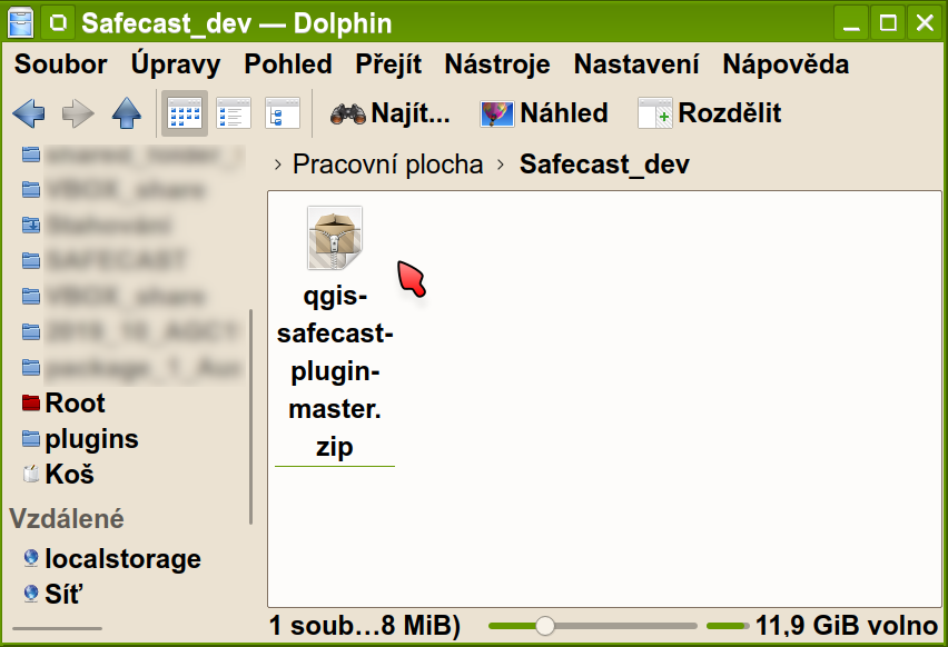
so you should have something like this on your PC drive:
2) install QGIS - the plugin was tested in QGIS 3.8.-3.12. in Windows (7 and 10) and linux (various ubuntu flavors)
to make it easier I am adding direct links to 64bit Windows installers:
current version QGIS 3.12.0 'București'
long-term version - QGIS 3.10.3 'A Coruña'
more here:
I am using the 3.12 version now.
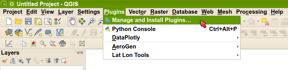
3) run QGIS and choose "Manage and Install Plugins" in main menu:
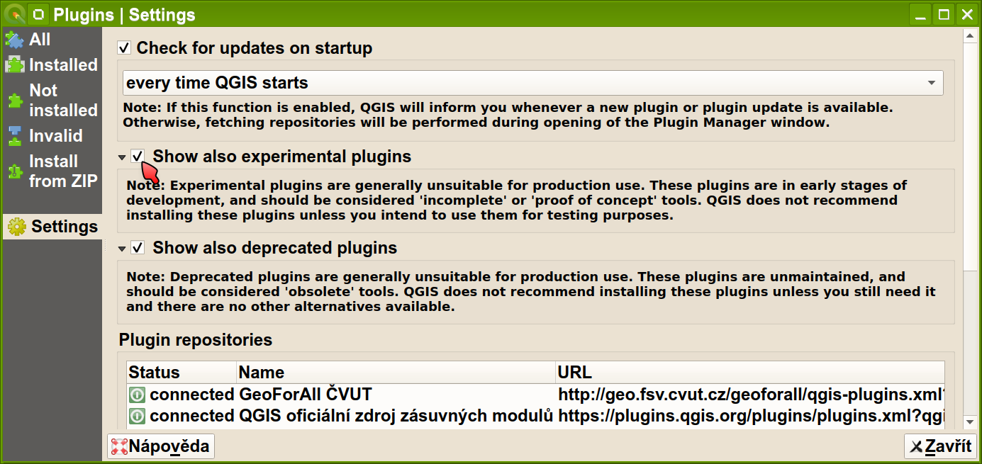
4) just to be sure, check the "Show also experimental plugins" option in Settings:
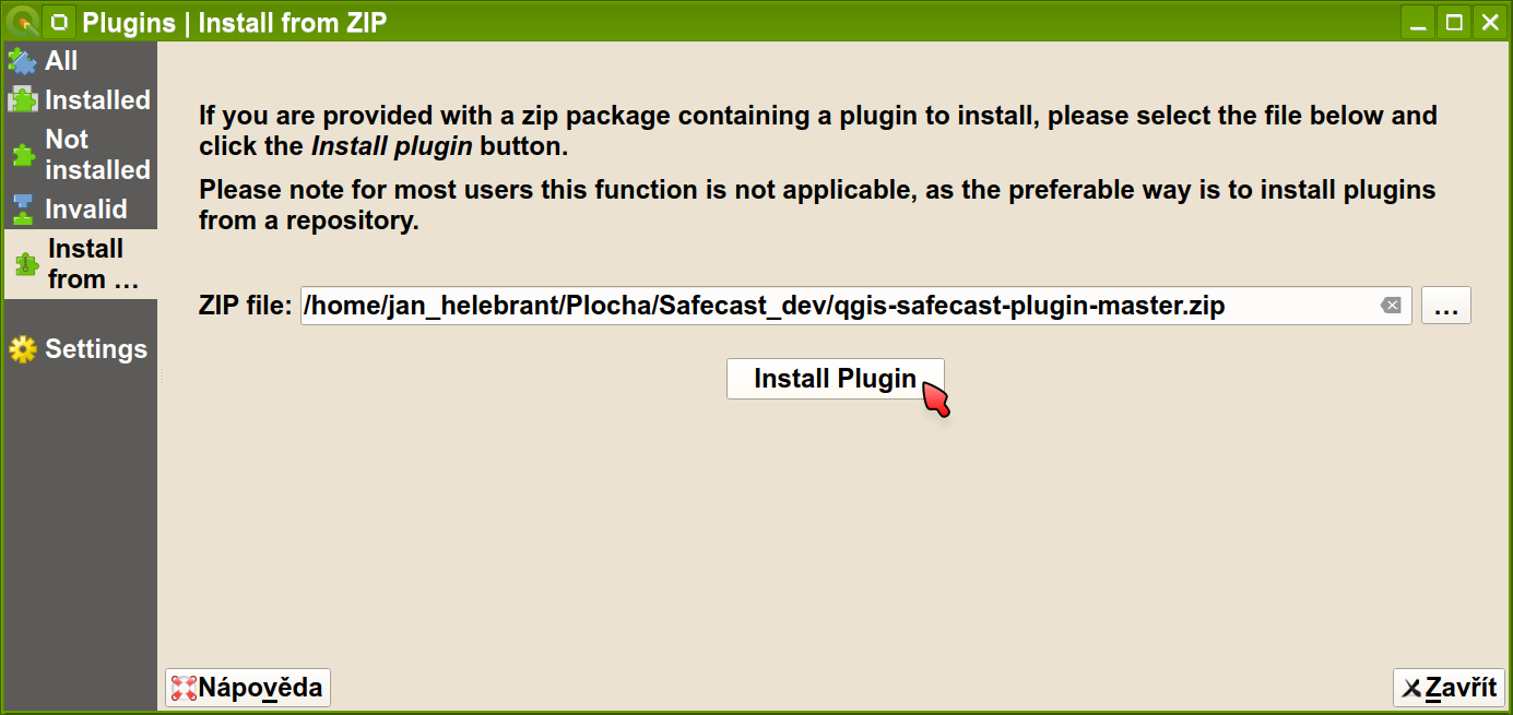
5) go to "Install from ZIP" section, browse for the downloaded ZIP file and click the "Install Plugin" button:
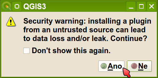
6) QGIS will show this warning but no need to worry in this case:
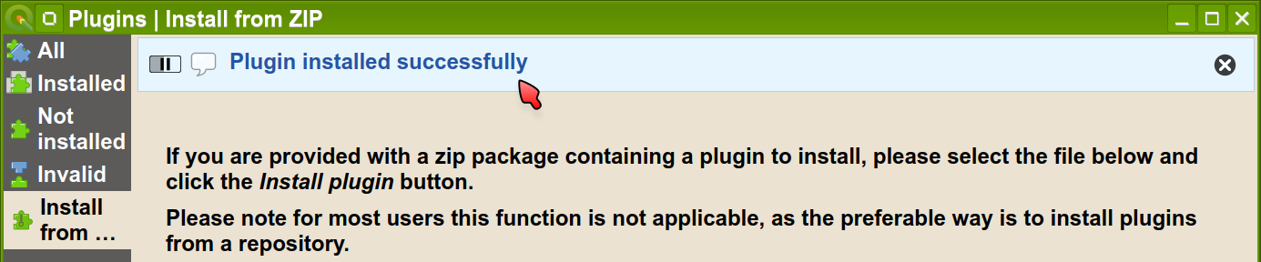
7) after few seconds QGIS informs you about successfull plugin installation:
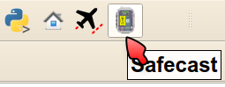
8) and tiny bGeigie Nano icon appears in the QGIS toolbar:
9) and clicking the icon activates the Safecast plugin panel (which is looking almost the same as the QGIS2 version, but now we also support other languages):
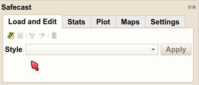
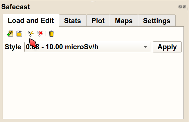
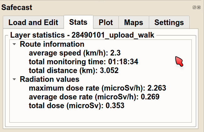
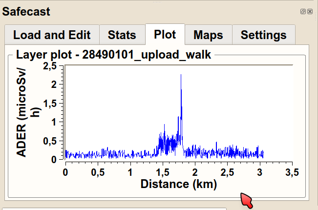
10) after loading some LOG data you can also check the additional features:
including Statistics panel:
plot panel:
etc.
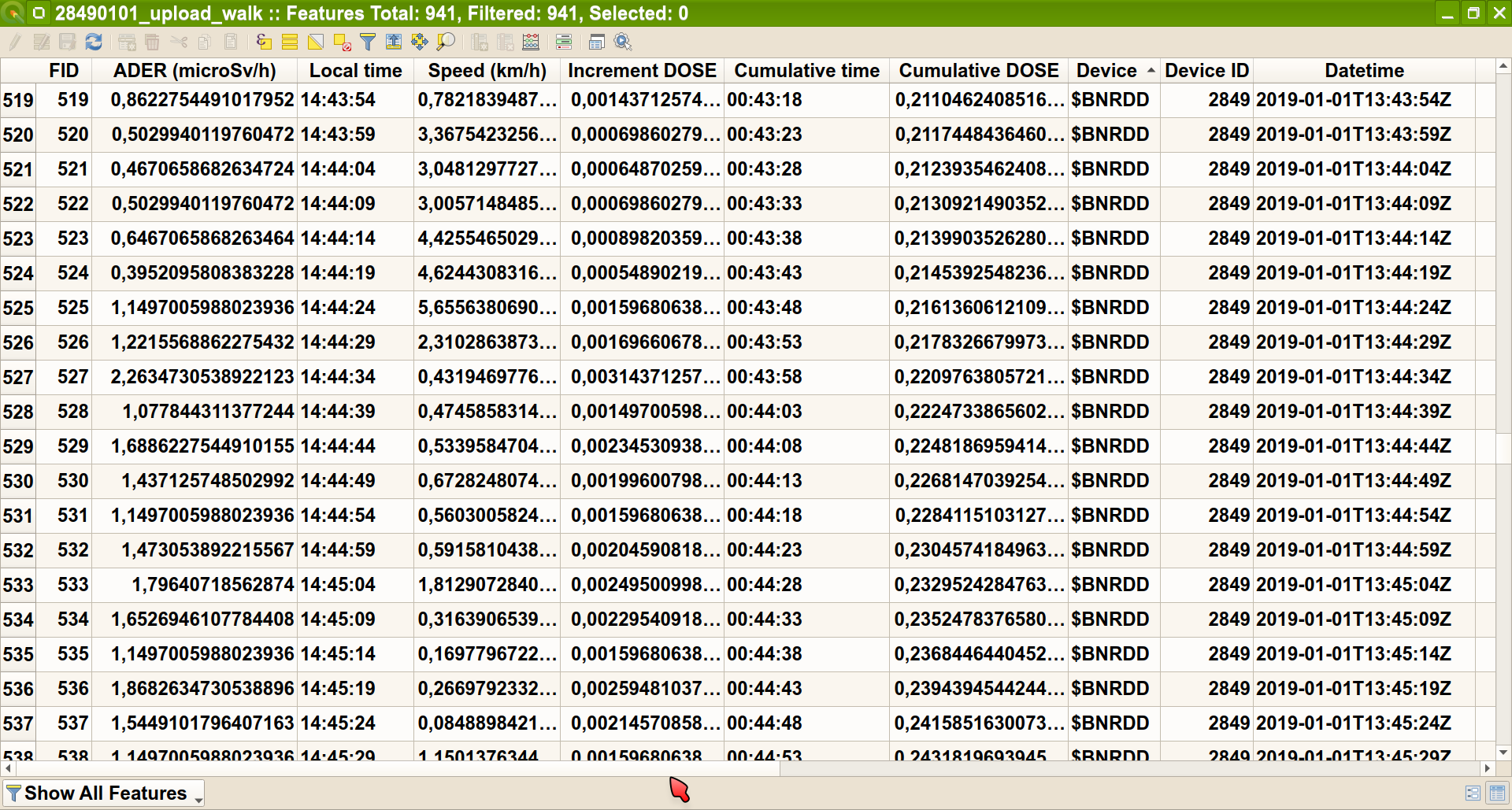
the layer attribute table includes some additional parameters calculated by the plugin:
The plugin makes it possible to remove some parts of the LOG file (same as the QGIS2 version) - e.g. remove some points but not to change the measured values. Output is standard LOG file compatible with the Safecast API.
I am already using this version to process our LOG data - mostly for:
1) checking the LOG files from our bGeigie users
2) removing "bad" data - outlier points (suddenly few points in another country etc.), points with huge GPS errors (HDOP about 500 and more), (lunch) break in a building (bunch of scattered points with big GPS error around the building) etc.
3) splitting measurements - one LOG file with carborne and walking data in different height and facing is split in two LOGs - one for car, second for walk. Also better for later scientific analyses.
If you have an previously prepared offline map (can help you with this) then all this data processing can be performed without need to have Internet connection.
enjoy
Jan
PS1: Known bugs (information might be obsolete as the ZIP file from Github always includes the fresh dev version):
- plot panel not properly working in Windows
- bad sorting of items in attribute table (annoying, needs user to refresh sorting) - it is qgis bug, not ours: https://github.com/qgis/QGIS/issues/23229
PS2: I was not sure which of the Google groups to use but this one looked more more generally focused than the Device support one.

Mat Schaffer
Mar 3, 2020, 7:35:52 AM3/3/20
to safecas...@googlegroups.com
Love the little bgeigie icon. You've inspired me to install QGIS again. Will let you know how it goes :)
--
--
** This is a public discussion mailing list, opinions expressed on this list belong to the individual only, and are not to be taken as official statements from Safecast.
http://groups.google.com/group/safecast-japan
http://safecast.org
---
You received this message because you are subscribed to the Google Groups "Safecast Discussion Group" group.
To unsubscribe from this group and stop receiving emails from it, send an email to safecast-japa...@googlegroups.com.
To view this discussion on the web visit https://groups.google.com/d/msgid/safecast-japan/dbcef8af-b2e7-48b7-925e-99e565833fb2%40googlegroups.com.
Mat Schaffer
Mar 3, 2020, 8:22:41 AM3/3/20
to safecas...@googlegroups.com
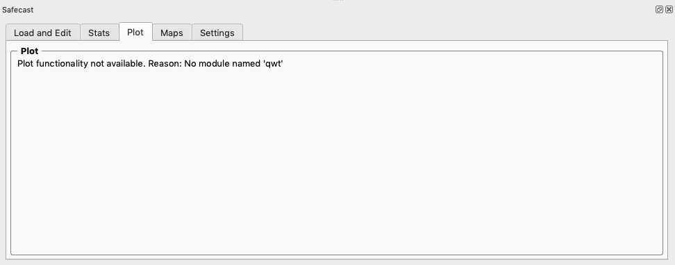
Maybe not a big deal, but on macos with qgis 3.12.0 and your plugin freshly installed, the plot tab shows this. Know of any quick fixes?
Jan Helebrant
Mar 3, 2020, 8:52:29 AM3/3/20
to Safecast Discussion Group
Yeah,
and the second answer here:
and
but it is rather an experimental approach :-P
Dne úterý 3. března 2020 14:22:41 UTC+1 Mat Schaffer napsal(a):
we had this problem in Windows too. The dev guys are working on a solution to include the library in the plugin package to make the plot work out of the box.
Regarding a temporary solution... I have absolutely no experience with MacOS, but for linux the recommendation was to run:
sudo pip3 install PythonQwt
and the second answer here:
says you can also install "pip3" in Mac so (based on that answer) I would try
pip3 install sip
pip3 install PythonQwt
but it is rather an experimental approach :-P
Jan
Dne úterý 3. března 2020 14:22:41 UTC+1 Mat Schaffer napsal(a):
To unsubscribe from this group and stop receiving emails from it, send an email to safecas...@googlegroups.com.
Mat Schaffer
Mar 3, 2020, 8:59:00 AM3/3/20
to safecas...@googlegroups.com
Thanks! Do you know if there's a good way to check which python qgis might be trying to use? I have a bunch installed (venvs, homebrew, os-installed, etc)
To unsubscribe from this group and stop receiving emails from it, send an email to safecast-japa...@googlegroups.com.
To view this discussion on the web visit https://groups.google.com/d/msgid/safecast-japan/3ad283e6-27ca-4835-bafe-caf8655c6bb2%40googlegroups.com.
Jan Helebrant
Mar 3, 2020, 9:25:06 AM3/3/20
to Safecast Discussion Group
Hi,
and then
for my laptop I got:
regards
this worked for me - in QGIS go to Plugins / Python console and use:
import sys
and then
sys.version
for my laptop I got:
'3.7.5 (default, Nov 20 2019, 09:21:52) \n[GCC 9.2.1 20191008]'
Jan
source: https://gis.stackexchange.com/questions/222075/how-can-i-discover-the-python-version-in-qgis/222076
Dne úterý 3. března 2020 14:59:00 UTC+1 Mat Schaffer napsal(a):
Dne úterý 3. března 2020 14:59:00 UTC+1 Mat Schaffer napsal(a):
Thanks! Do you know if there's a good way to check which python qgis might be trying to use? I have a bunch installed (venvs, homebrew, os-installed, etc)
Mat Schaffer
Mar 5, 2020, 1:58:06 AM3/5/20
to safecas...@googlegroups.com
Thanks, Jan!
Seems like the macos version uses a bundled python at /Applications/QGIS3.12.app/Contents/Frameworks/Python.framework/Versions/3.7 but it doesn't seem to contain a pip or easy_install.
I've emailed https://lists.osgeo.org/pipermail/qgis-user/ to see if they have any recommendations for my platform.
--
--
** This is a public discussion mailing list, opinions expressed on this list belong to the individual only, and are not to be taken as official statements from Safecast.
http://groups.google.com/group/safecast-japan
http://safecast.org
---
You received this message because you are subscribed to the Google Groups "Safecast Discussion Group" group.
To unsubscribe from this group and stop receiving emails from it, send an email to safecast-japa...@googlegroups.com.
To view this discussion on the web visit https://groups.google.com/d/msgid/safecast-japan/779e789a-6351-45ba-ba36-97dbfc3839c8%40googlegroups.com.

David Wood
Mar 30, 2020, 4:32:40 PM3/30/20
to Safecast Discussion Group
Howdy all!
I am running on an old Mac Pro with Mojave (10.14.6). I had considerable struggles with the official MacOS release of QGIS 3.1,2 and the 2.1DEV version of the Safecast plugin. I got warnings along the lines of
Plot functionality not available: no qwt.
I am a user of the MacPorts package management system, so tried installing qwt-61 using MacPorts--no luck. I then discovered that QGIS 3.1.2 is available from MacPorts, so installed it THAT way. Upon loading the plugin, I kept receiving the warnings
Couldn't load plugin 'qgis-safecast-plugin-master' due to an error when calling its classFactory() method
ModuleNotFoundError: No module named 'future'.
After plenty of Googling and multiple successful installations of versions of the future module (which did NOT fix the problem), I returned finally to https://qgis.org/en/site/forusers/download.html
which points to:
I chose to download the installation disk image QGIS 3.4.12 LTR. This installs (if you work through the packages in order, according to the READ ME) a clean Python 3.6.8 installation, the GDAL components, then QGIS 3 LTR.
The new Safecast plugin now loads without error and RUNS! The installation notes from the KyngChaos site (endless thanks to William Kyngesburye) made clear how fussy QGIS is about Python versions--my mixing of modules much earlier on may have been at fault.
So: I urge MacOS users to go directly to https://www.kyngchaos.com/software/qgis/.
The plugin is wonderful--in a long bGeigie Nano drive from last summer I could see average speeds, total elapsed time, total distance and radiation values easily. (I had not finished with my previous analysis because I knew I'd have to convert a time series into a distance series, not so easy when the vehicle speed is very variable in heavy traffic.)
Hope this helps some Mac users!
Mat Schaffer
Apr 2, 2020, 10:16:25 PM4/2/20
to safecas...@googlegroups.com
Nice find, David. Thanks!
--
--
** This is a public discussion mailing list, opinions expressed on this list belong to the individual only, and are not to be taken as official statements from Safecast.
http://groups.google.com/group/safecast-japan
http://safecast.org
---
You received this message because you are subscribed to the Google Groups "Safecast Discussion Group" group.
To unsubscribe from this group and stop receiving emails from it, send an email to safecast-japa...@googlegroups.com.
To view this discussion on the web visit https://groups.google.com/d/msgid/safecast-japan/0fee504b-9391-4021-9d71-3ffbbb39c237%40googlegroups.com.
Reply all
Reply to author
Forward
0 new messages