FW: Maps at JSS
1 view
Skip to first unread message

Daniel Pepper
Jan 17, 2012, 11:09:29 AM1/17/12
to raxa-jss-emr...@googlegroups.com, raxa-jss...@googlegroups.com, raxa-jss-em...@googlegroups.com
Dear contributors,
I sent this email yesterday to a subset of people on the project, but now want to open it up to see if anyone on the larger Contributors list (or anyone you know – feel free to pass along) might be able to help us with this unique challenge.
Just one addendum: There is no cell phone reception in much of the area where these villages are based. On top of that, there’s no budget at the moment for purchasing new equipment for the survey. So, based on existing material, which includes a limited number of simple cell phones, hand-drawn maps, lots of smart people, and Google maps, what can we come up with?
Ideas???
Cheers,
Daniel
------ Forwarded Message
From: Daniel Pepper <daniel...@gmail.com>
Date: Mon, 16 Jan 2012 16:32:36 +0530
To: "raxa-jss...@googlegroups.com" <raxa-jss...@googlegroups.com>, "raxa-jss-em...@googlegroups.com" <raxa-jss-em...@googlegroups.com>
Cc: <bi...@googlegroups.com>, Shivaram Kalyanakrishnan <shiv...@cs.utexas.edu>, Aditya Rawal <adi...@cs.utexas.edu>, Bryan Silverthorn <bsil...@cs.utexas.edu>
Conversation: Maps at JSS
Subject: Maps at JSS
Dear all:
Every couple of years JSS undertakes a detailed survey of 53 target villages (this year expanded to 70) in remote parts of Bilaspur district in northern Chhattisgarh, where many of the hospital's most needy patients work and live.
A long-standing request from the public health physicians at JSS has been to create a mapping interface for survey results - one that can be integrated with the rest of the future EMR system.
This afternoon I sat down with one of the senior Community Health Workers and looked up a sample of the 53 villages on Google maps. Some we were able to find using simple search, others we had to locate by scrolling around the region until we came upon the village. Oftentimes spelling was a problem. As a reference, I used the census of India list of villages (panchayats / ga’ons) listed here:
http://www.censusindia.gov.in/Census_Data_2001/PLCN/DIR-22R.pdf
All of the villages in the JSS village program’s survey are located in Lormi and Kota districts, which are on pages 129-138 (out of 402!) in the census data.
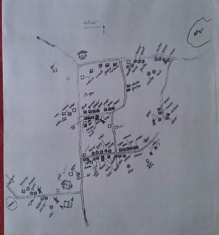
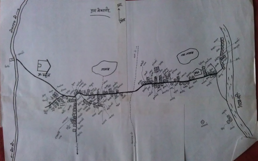
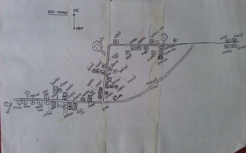
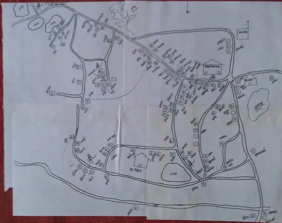
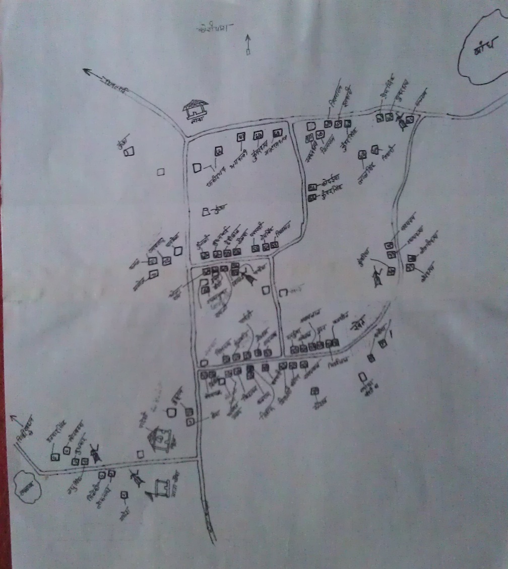
At the same time, JSS Community Health Workers have, over the past few years, created very detailed maps of each of their 53 target villages, which include information such as: location of main road, location of schools, location of handpumps, each house, name of head of each household. Photos of some of these maps are attached.
I’d like to put a general question out to the group: how can we use Google maps, the existing maps and other information available online to create an application whereby a CHW can open Google maps, click on a village and then drill down to the level of household to reveal survey information (demographic, economic, nutritional and other health information)?
Thoughts?
Best,
Daniel
------ End of Forwarded Message
I sent this email yesterday to a subset of people on the project, but now want to open it up to see if anyone on the larger Contributors list (or anyone you know – feel free to pass along) might be able to help us with this unique challenge.
Just one addendum: There is no cell phone reception in much of the area where these villages are based. On top of that, there’s no budget at the moment for purchasing new equipment for the survey. So, based on existing material, which includes a limited number of simple cell phones, hand-drawn maps, lots of smart people, and Google maps, what can we come up with?
Ideas???
Cheers,
Daniel
------ Forwarded Message
From: Daniel Pepper <daniel...@gmail.com>
Date: Mon, 16 Jan 2012 16:32:36 +0530
To: "raxa-jss...@googlegroups.com" <raxa-jss...@googlegroups.com>, "raxa-jss-em...@googlegroups.com" <raxa-jss-em...@googlegroups.com>
Cc: <bi...@googlegroups.com>, Shivaram Kalyanakrishnan <shiv...@cs.utexas.edu>, Aditya Rawal <adi...@cs.utexas.edu>, Bryan Silverthorn <bsil...@cs.utexas.edu>
Conversation: Maps at JSS
Subject: Maps at JSS
Dear all:
Every couple of years JSS undertakes a detailed survey of 53 target villages (this year expanded to 70) in remote parts of Bilaspur district in northern Chhattisgarh, where many of the hospital's most needy patients work and live.
A long-standing request from the public health physicians at JSS has been to create a mapping interface for survey results - one that can be integrated with the rest of the future EMR system.
This afternoon I sat down with one of the senior Community Health Workers and looked up a sample of the 53 villages on Google maps. Some we were able to find using simple search, others we had to locate by scrolling around the region until we came upon the village. Oftentimes spelling was a problem. As a reference, I used the census of India list of villages (panchayats / ga’ons) listed here:
http://www.censusindia.gov.in/Census_Data_2001/PLCN/DIR-22R.pdf
All of the villages in the JSS village program’s survey are located in Lormi and Kota districts, which are on pages 129-138 (out of 402!) in the census data.
At the same time, JSS Community Health Workers have, over the past few years, created very detailed maps of each of their 53 target villages, which include information such as: location of main road, location of schools, location of handpumps, each house, name of head of each household. Photos of some of these maps are attached.
I’d like to put a general question out to the group: how can we use Google maps, the existing maps and other information available online to create an application whereby a CHW can open Google maps, click on a village and then drill down to the level of household to reveal survey information (demographic, economic, nutritional and other health information)?
Thoughts?
Best,
Daniel
------ End of Forwarded Message
Reply all
Reply to author
Forward
0 new messages