hsaf_grib reader projection offset
35 views
Skip to first unread message

José Daniel Gómez de Segura
Mar 3, 2022, 7:24:00 AM3/3/22
to pytroll
Hi all,


I'm trying to read HSAF grib products from their FTP site into a scene.
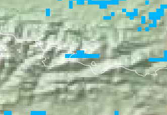
Apparently, the data is placed a few km to the North in the Northern hemisphere as compared to what we could agree as 'ground truth', i.e. the same data presented in EumetView.
Being playing around with QGIS, grib to netcdf translators (ecCodes and wgrib2) and the result is always the same. These are some images related to the issue:
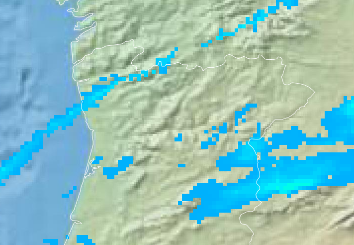
From Eumetsat (Andorra, instantaneous_rainrate_03b, 20220225T07:30 UTC)
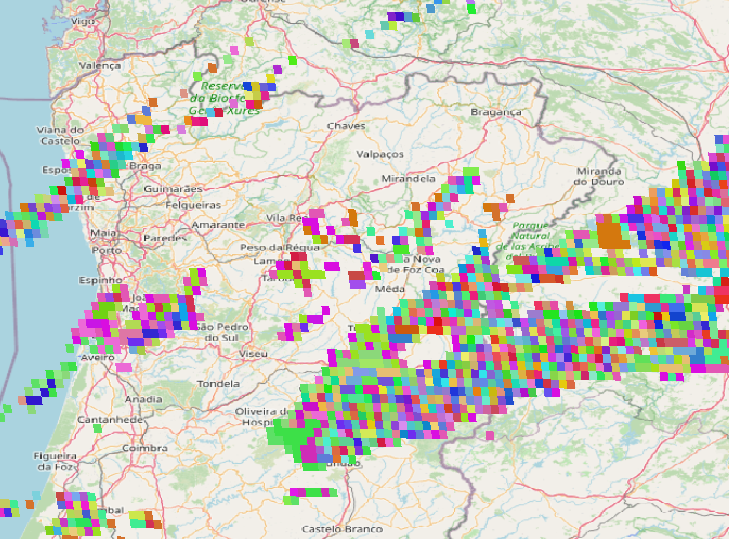
Reading the grib into QGIS
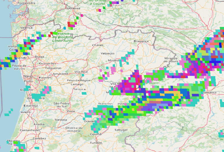
From satpy into QGIS
Same sequence over Portugal
Steps to reproduce:
1. Download grib from HSAF (ftphsaf.meteoam.it) In the example, /h03B/h03B_cur_mon_data/h03B_20220225_0730_fdk.grb.gz
2. Decompress it
3. Read with satpy and save a geotiff
from satpy.scene import Scene
filename=''H03b/h03B_20220225_0730_fdk.grb'
scn=Scene(reader='hsaf_grib', filenames=[filename])
scn.load(['instantaneous_rainrate_3b'])
scn.save_datasets(filename='/tmp/out.tiff')
4. Open both the grb and tiff files with QGIS
I don't discard my own errors, but all my trials with different approaches in Python lead to the same problem.
Do you think this could be a bug? I wouldn't want to have to translate the files into netcdf...
Thanks a lot,
José
Tecnalia
Reply all
Reply to author
Forward
0 new messages