load DTM in pulseview
56 views
Skip to first unread message

Mauro Assis
Oct 20, 2017, 5:46:13 PM10/20/17
to PulseWaves - no pulse left behind
Hi,
How can I proceed to load a DTM image in pulseview?
Tks in advance,
Mauro

Martin Isenburg
Oct 21, 2017, 12:09:35 AM10/21/17
to PulseWaves - no pulse left behind
Hello,
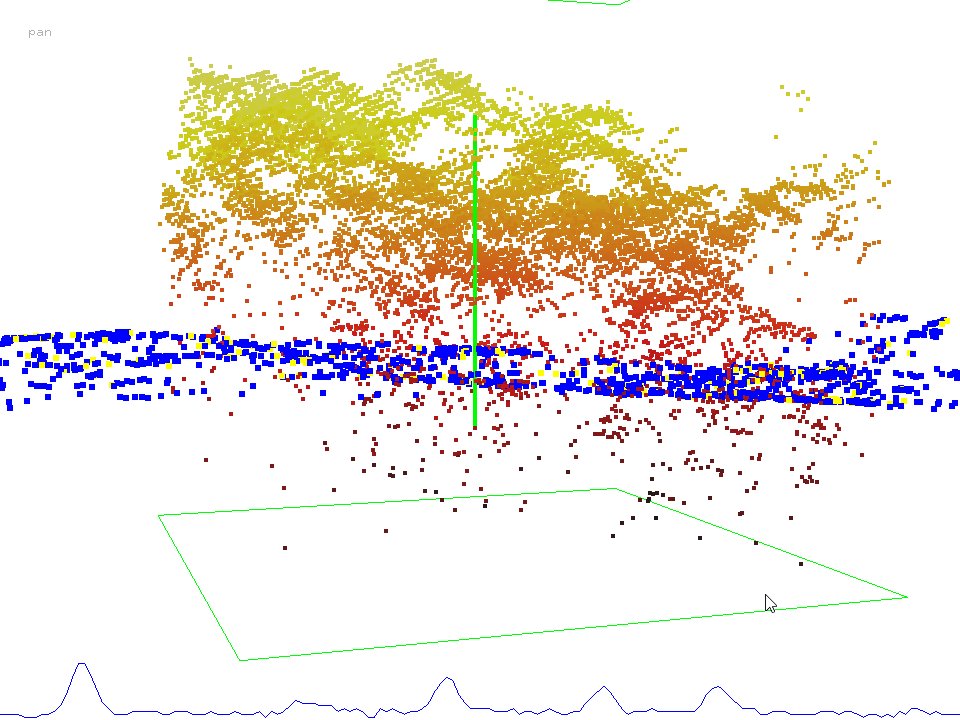
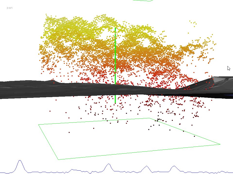
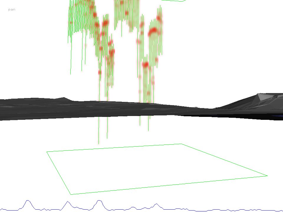
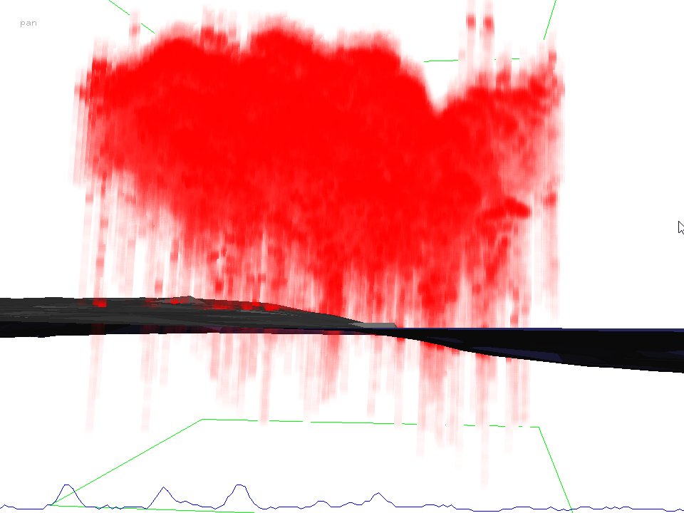
looks like another undocumented feature. (-: Create a LAZ file with classified ground points (or only ground points) and use the option '-r discrete.laz' to add discrete LiDAR or otherwise extracted ground points that must be in the same geo-referencing
pulseview -i wameba\NP_T-356_FWF_809450_9717400_50.plz ^
-r wameba\NP_T-356_FWF_809400_9717350_150_g.laz
then press <g> to only show those discrete returns classified as ground and press <t> to triangulate them..
Press <=> a couple of times to render the returns and the end-of-recording sample fatter. Hover over an end-of recording sample and press <i> to visualize a different pulse. Use the menu to show more than one pulse. Press <SHIFT>+<o> to suppress the rendering of the end-of recording samples (or the start-of-recording samples). Press <e> a few times to iterate through the rendering modes for the waveforms. Use the menu to also render the green pulses (connecting start-of-recording and end-of-recording samples) with green lines.
Some visuals are attached.
Regards.
Martin @rapidlasso
--
--
Post to "PulseWaves" by email to pulse...@googlegroups.com
Unsubscribe by email to pulsewaves+unsubscribe@googlegroups.com
Visit this group's message archives at http://pulsewaves.org
---
You received this message because you are subscribed to the Google Groups "PulseWaves - no pulse left behind" group.
To unsubscribe from this group and stop receiving emails from it, send an email to pulsewaves+unsubscribe@googlegroups.com.
For more options, visit https://groups.google.com/d/optout.
Reply all
Reply to author
Forward
0 new messages