[PublicLab] Rhode Island Timelapse (#25310)
do-not...@publiclab.org
Read and respond to the post here: https://publiclab.org/notes/kgradow1/12-22-2020/rhode-island-timelapse-aerial-maps

Overview
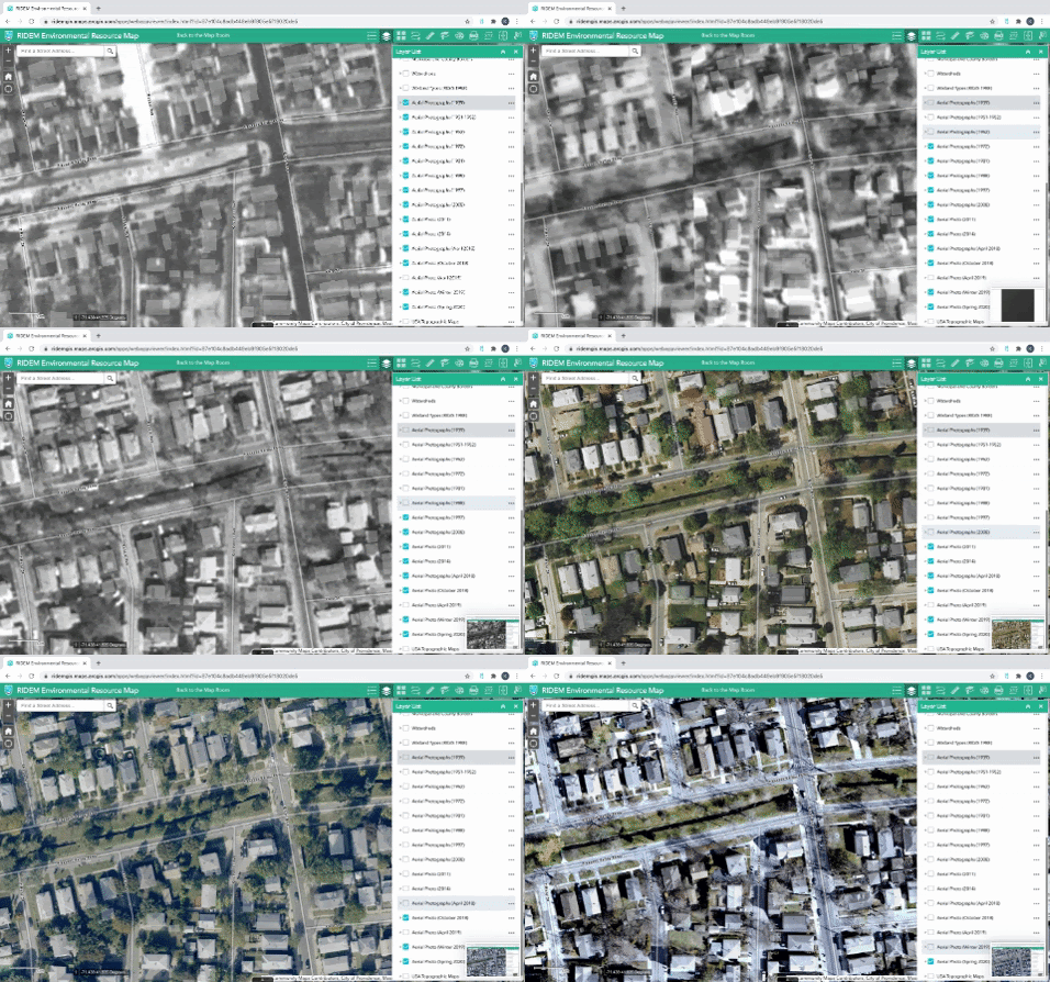
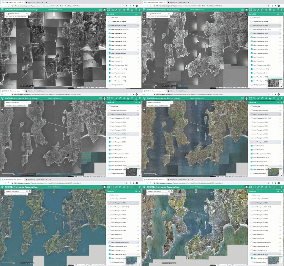
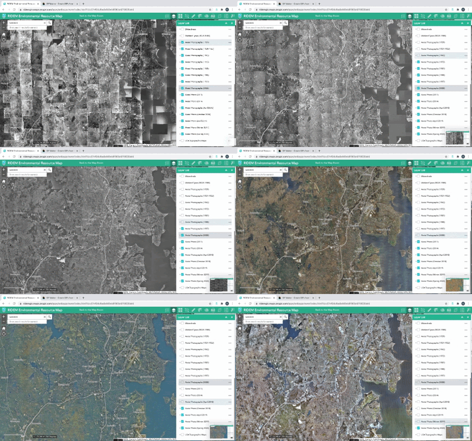
Rhode Island Department of Environmental Management has done flyovers of the state for close to 100 years. I went through their database and took screenshots of my neighborhood (Elmhurst / Providence), Jamestown / Newport, and Warwick to see how the methodology and the landscape changed over time.
Source: RIDEM Environmental Resource Map
Dates: 1939 - 2020. Initially, one image every ten years. Then in 2008, it looks like they transitioned to taking them every three years, and then twice a year after 2018.
Elmhurst / Providence
Pleasant Valley Parkway. This canal is just around the corner from where I live. This entire neighborhood has been built out for over a century, looks like not much has changed but the image quality. I mean, obviously a lot has changed, but not the land use maps. You can see the ghost property lines from 2020 overlay.
Jamestown / Newport
This series is zoomed out a bit. You can really see the stitching.
Warwick
Same level of zoom. Same stitching effect.
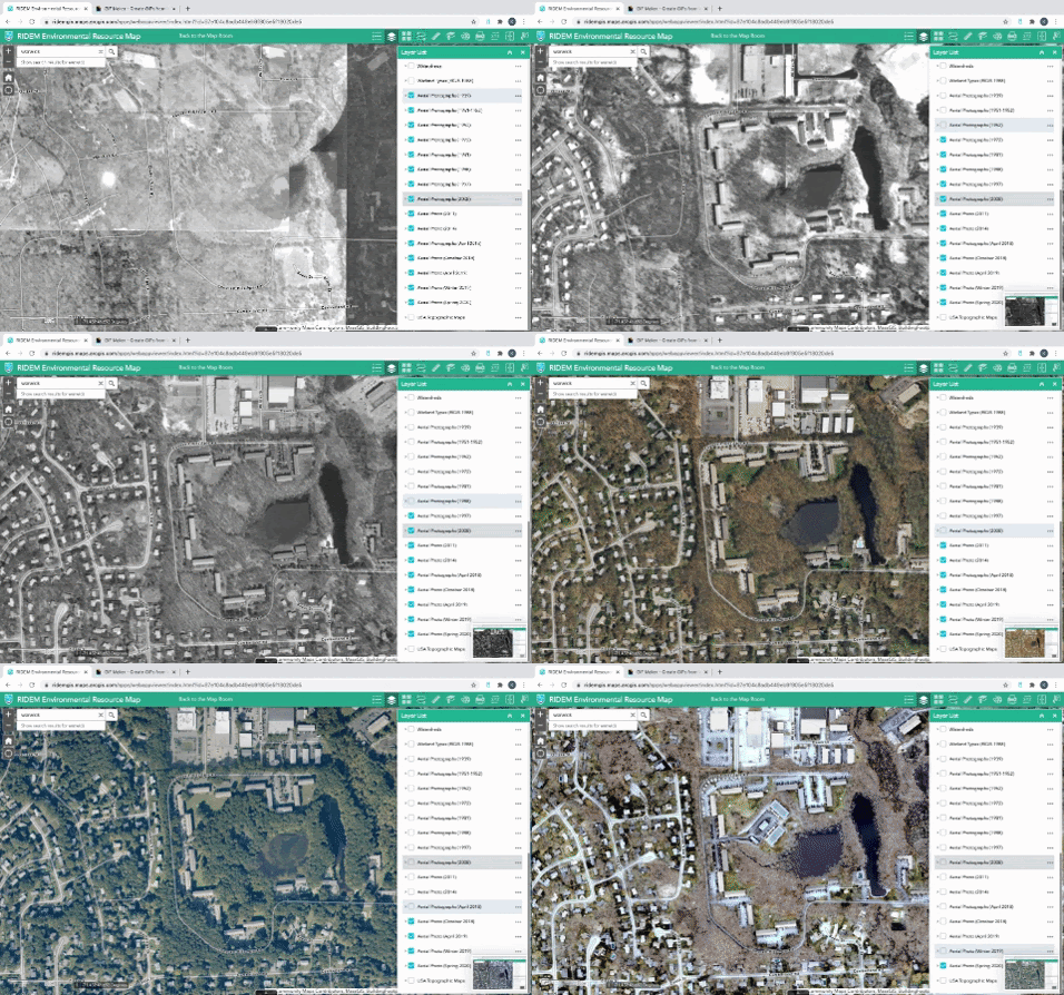
Warwick / Cowesett Hillls
But this was an interesting find! This is Cowesett Hills Apartments, which is a 3-story apartment complex with 456 units. Google says this was built in 1973. Assuming this is the same place, you can see how the whole area is built up over time.
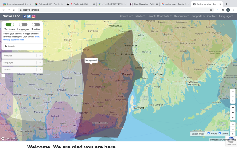
Narragansett / Wampanoag
The whole area is originally Narragansett and Wampanoag land, which I think is also where the name of the apartment complex comes from (Wikipedia says it comes from the Narragansett expression kówaw 'pine tree' + -es 'small' + -sett 'place', meaning 'Small Pine Place). Credit and llink to Native-Land.ca to explore the area more broadly.
Respond to the post here: https://publiclab.org/notes/kgradow1/12-22-2020/rhode-island-timelapse-aerial-maps
This post was tagged with #providence by liz
You received this email because it was tagged with: providence.
Subscribe to all the tags for this post by visiting https://publiclab.org/subscribe/multiple/tag/providence,balloon-mapping,aerial-photography,timelapse,development,rhode-island,northeast,lon:-71,lat:42,zoom:6.
To change your preferences, please visit https://publiclab.org/subscriptions.
Report spam and abuse to: moder...@publiclab.org
Check out the blog at https://publiclab.org/blog | Love our work? Make a one-time or recurring donation at https://publiclab.org/donate If this email title has an ID in the format #0000, you can reply with the email you use at PublicLab.org and your response will be posted as a comment on the website.