CWQT Week 16--results

1 view
Skip to first unread message

Rob Buchanan

unread,
Sep 3, 2021, 6:52:37 PM9/3/21
to water-...@nycwatertrail.org
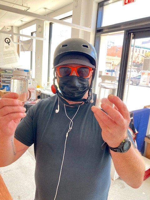
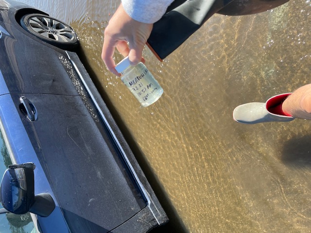
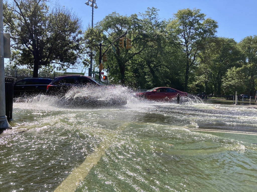
Not everyone sampled yesterday, even though it was beautiful--many groups canceled their collection runs due to 'hazardous conditions.' The samples that were taken seem to confirm that judgment. It was a red-number day at all but two sites, both of those on ocean-facing beaches on Staten Island. 

Click here to see our Thursday results from all over the harbor. For a map of our testing sites, click here


IMG_2506.jpg
IMG_2510.jpg
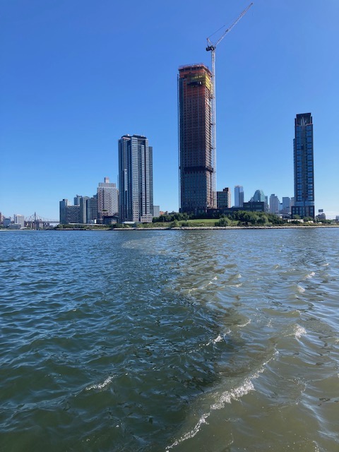
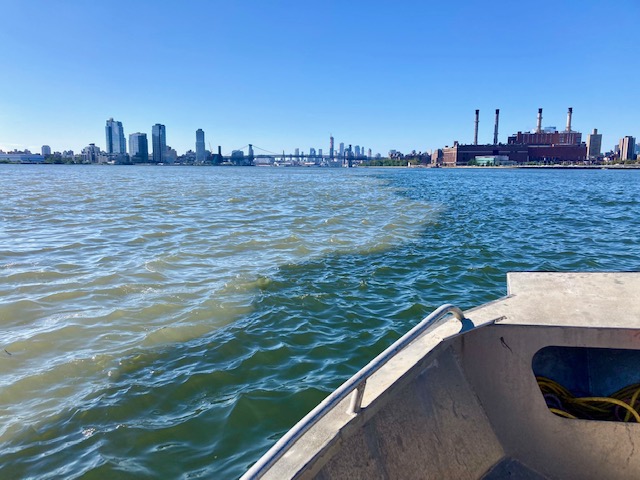
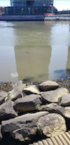
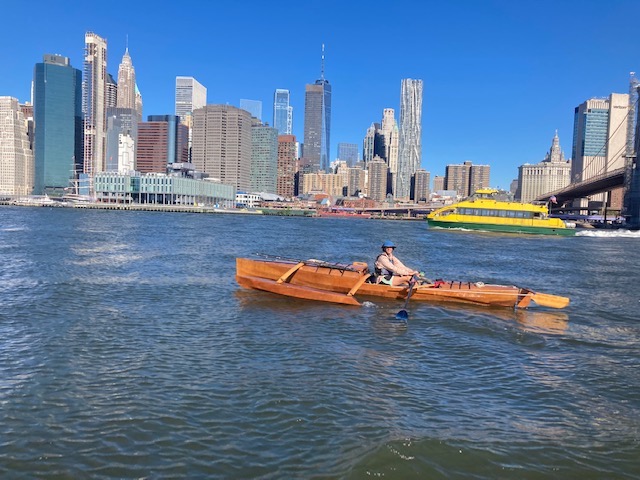
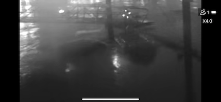
Grim tidelines: looking up and down on the East River yesterday morning, where a huge surge of stormwater and sewage from Newtown Creek pushed out into the harbor. 


WATERWAYS NEWS:

WEEKLY SLIDE SHOW:

IMG_2525.jpg
Extreme commitment: Sean Lynch with Gowanus Canal and Valentino Pier samples. 

IMG_2523.JPG
Steppin' out: Cody Hermann at an overflowing Meadow Lake.

2021_09_02_Prospect Park Lake Paerdegat Creek overflowing at Parkside and Coney Island Av_via Eymund CSI_1 lr.jpeg
The headwaters of Paerdegat Creek, aka Prospect Park Lake, also overflowed and ran down Parkside and Coney Island Aves (Eymund Diegel)

image.png
More 'oogy' water at the Second Street kayak launch in Long Island City (Sanjay Shirke)

IMG_2608.jpg
Nevertheless life goes on (Flushing Bay)

IMG_5280.jpeg
Shonel Rahim sampling at Gerritsen Creek near the Salt Marsh Nature Center (John Ribaudo)

IMG_2621.jpg
The long row: Tom Graves from Essex, New York passes under the Brooklyn Bridge, on his way from Lake Champlain to Philadelphia

IMG_2678.PNG
More on this story next week!


image0.png
Species ID quiz: on the right is a RIB (rigid inflatable boat) tied up at the floating dock on Pier 40. But what's that floating just to the left? (Ingo Gunther)

IMG_3350.jpg
Harbor Geography quiz: whose dock, on what waterway? 

Last week's quiz answers:
IMG_2069.jpg
Atlantic silversides, aka spearing (Menidia menidia)

66a19879-69b1-40c1-bd17-6acb62dce0a3.JPG
Harbor Geography: Triboro Bridge, Hell Gate Railroad Bridge, Astoria Generating Station


The Citizens Water Quality Testing Program (CWQT) is a collaboration between the New York City Water Trail Association, the Billion Oyster Project, and Hudson River Park's River Project, with support from Two Trees Management. 


Partner programs and labs sharing their data (or publishing ours) include: Bronx River Alliance, Gowanus Canal Conservancy, Interstate Environmental Commission, Lower Raritan Watershed Partnership, Hackensack Riverkeeper, Hudson Riverkeeper, Monsignor Farrell High School, Newtown Creek Alliance, St. Francis College, Sarah Lawrence Center for the Urban River, SUNY Maritime Marine Environmental Science Department, Queens College Biology Department. 


For more information, to volunteer, or to unsubscribe, email us at water-...@nycwatertrail.org


Screen Shot 2021-05-21 at 10.27.58 AM.png
Reply all
Reply to author
Forward
0 new messages