River John River Report

gu...@ns.sympatico.ca
Hello Paddle List,
I took a trip down the River John River and thought I post/share some info as I don’t recall ever hearing people talk too much about paddling it.
Put In: Minto Road Bridge
Take Out: Welsford Bridge
Distance: 19 km
Time: 7.0 hrs including lunch
I preferred the upper section between Minto Road Bridge and the confluence of the two branches of the River. Interestingly I found it more navigable than the lower part even though the lower part had the combined flow of two branches. The lower part of the river is very wide and shallow. Very windy day too, mostly head wind, which made picking your route on the lower wider river that more challenging and probably influenced how long it too me to complete the trip.
My lovely and kind wife shuttled me so I don’t know the true shuttle time but I would suspect it would be about an hour total.
Lots of birds, interestingly shore birds, eagles, lots of fish jumping and a very healthy fox bobbing along the shoreline. He went up a very steep and tall bank in a flash once he saw me. Alas too quick to get a good photo.
Put in at Minto Road
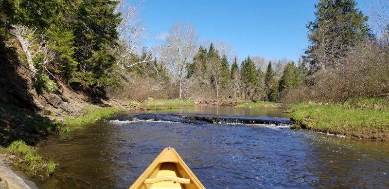
The river varied in width and every so often there would be a narrower s trun. Most of them were navagable even at this water level.

There were a few ledges that I had to step over.

Some complete with a beaver dam
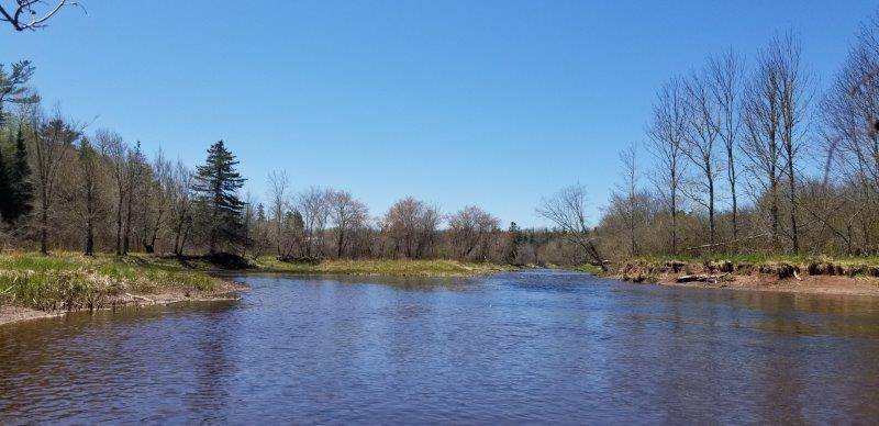
Looking upstream to the conflunce. West branch on the left and the East branch on the right

High banks downstream of the confluence. Lots of bank swallows!

Much to my disappointment the going got worse downstream of the confluence. The river was wide and shallow. I had to walk the canoe a couple times about 100 m to get through a rock/gravel section. Lots of river wide ledges too. It would be much better at a higher level. So this river may be strictly spring run when its been reasonably rainy.
Cool cliff near Welsford

More of the cliff
Cheers
Ian

David
Sent: May 24, 2020 10:49 PM
To: Nova Scotia Paddle List <paddleno...@googlegroups.com>
Subject: [PaddleNS] River John River Report
You received this message because you are subscribed to the Google Groups "paddle.novascotia" group.
To unsubscribe from this group and stop receiving emails from it, send an email to paddlenovascot...@googlegroups.com.
To view this discussion on the web visit https://groups.google.com/d/msgid/paddlenovascotia/000001d63236%24c9824970%245c86dc50%24%40ns.sympatico.ca.

Nisbet, John
On May 24, 2020, at 11:08 PM, David <dmc...@hotmail.com> wrote:
** EXTERNAL EMAIL / COURRIEL EXTERNE **
Exercise caution when opening attachments or clicking on links / Faites preuve de prudence si vous ouvrez une pi�ce jointe ou cliquez sur un lien
Looks like a great trip! Thanks for sharing, Ian!
- David
From: paddleno...@googlegroups.com <paddleno...@googlegroups.com> on behalf of gu...@ns.sympatico.ca <gu...@ns.sympatico.ca>
Sent: May 24, 2020 10:49 PM
To: Nova Scotia Paddle List <paddleno...@googlegroups.com>
Subject: [PaddleNS] River John River Report
Hello Paddle List,
I took a trip down the River John River and thought I post/share some info as I don’t recall ever hearing people talk too much about paddling it.
Put In: Minto Road Bridge
Take Out: Welsford Bridge
Distance: 19 km
Time: 7.0 hrs including lunch
I preferred the upper section between Minto Road Bridge and the confluence of the two branches of the River. Interestingly I found it more navigable than the lower part even though the lower part had the combined flow of two branches. The lower part of the river is very wide and shallow. Very windy day too, mostly head wind, which made picking your route on the lower wider river that more challenging and probably influenced how long it too me to complete the trip.
My lovely and kind wife shuttled me so I don’t know the true shuttle time but I would suspect it would be about an hour total.
Lots of birds, interestingly shore birds, eagles, lots of fish jumping and a very healthy fox bobbing along the shoreline. He went up a very steep and tall bank in a flash once he saw me. Alas too quick to get a good photo.
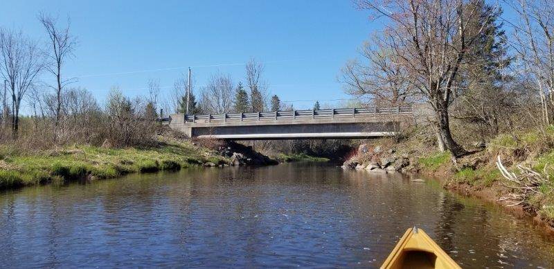
Put in at Minto Road
<image011.jpg>
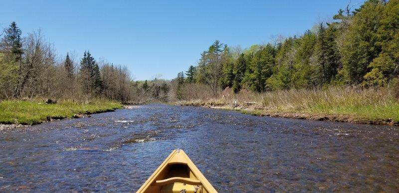
The river varied in width and every so often there would be a narrower s trun. Most of them were navagable even at this water level.
<image012.jpg>
There were a few ledges that I had to step over.
<image013.jpg>
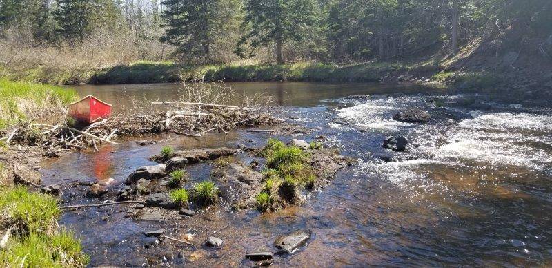
Some complete with a beaver dam
<image014.jpg>
Looking upstream to the conflunce. West branch on the left and the East branch on the right
<image015.jpg>
High banks downstream of the confluence. Lots of bank swallows!
<image017.jpg>
Much to my disappointment the going got worse downstream of the confluence. The river was wide and shallow. I had to walk the canoe a couple times about 100 m to get through a rock/gravel section. Lots of river wide ledges too. It would be much better at a higher level. So this river may be strictly spring run when its been reasonably rainy.
<image019.jpg>
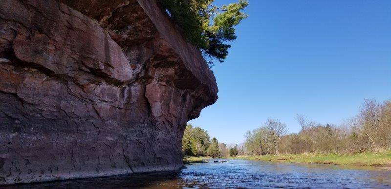
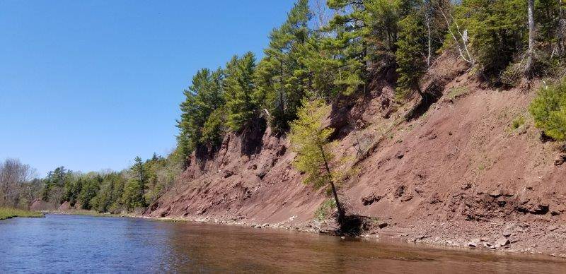
Cool cliff near Welsford
<image021.jpg>
More of the cliff
<image023.jpg>
Cheers
Ian
--
You received this message because you are subscribed to the Google Groups "paddle.novascotia" group.
To unsubscribe from this group and stop receiving emails from it, send an email to paddlenovascot...@googlegroups.com.
To view this discussion on the web visit https://groups.google.com/d/msgid/paddlenovascotia/000001d63236%24c9824970%245c86dc50%24%40ns.sympatico.ca.
--
You received this message because you are subscribed to the Google Groups "paddle.novascotia" group.
To unsubscribe from this group and stop receiving emails from it, send an email to paddlenovascot...@googlegroups.com.
To view this discussion on the web visit https://groups.google.com/d/msgid/paddlenovascotia/YQXPR0101MB092008869C3421C03CFFC21394B30%40YQXPR0101MB0920.CANPRD01.PROD.OUTLOOK.COM.

Dusan Soudek
Hello Paddle List,