Southern Asia QC Project

655 views
Skip to first unread message

Courtney Williamson

unread,
Dec 6, 2021, 11:31:25 AM12/6/21
to Openstreetmap Slovakia

Hello everyone,


I'm Courtney from TomTom. Would you prefer that I translate this message to Slovak? I would welcome a recommendation for a reliable online translator if so.

We used public instances of OSM QC tools such as Atlas and Osmose in addition to internal validation to detect potential map data issues in Southern Europe, including Slovakia.

The quality checks in the challenges for this project are mainly focused on potential issues that would impact the road network and tags that affect automotive navigation applications. Note that additional information is available in each challenge description. Furthermore, some challenges will occasionally show only a few or no tasks. We will update these challenges as new data becomes available.

We will begin working on these tasks in a few weeks.

Here is the project (for multiple countries in Southern Europe including Slovakia):

https://maproulette.org/browse/projects/46945

Let me know if you have any questions or suggestions. We are also interested to learn if there is any other topic we can support you with.

Courtney

Filip C

unread,
Dec 6, 2021, 3:45:49 PM12/6/21
to Openstreetmap Slovakia
Hello,

I completed almost every available task located in Slovakia (some are completed but system has not delete them [around 18 tasks], some needs visit [around 3 tasks]). When some new ones will appear I will try my best to implement them.

If you have some subscription link, where I can subscribe, if you will add new tasks I will appreciate it.

Filip009

Dátum: pondelok 6. decembra 2021, čas: 17:31:25 UTC+1, odosielateľ: ttom...@gmail.com

miro.j...@gmail.com

unread,
Dec 8, 2021, 3:22:09 AM12/8/21
to Openstreetmap Slovakia
@Courtney: Hi Courtney, I have translated your message to Slovak with google translate which does a good job in English->Slovak:

Prikladám preklad správy od Courtney, pre tých čo nehovoria po anglicky:
-----------------------
Ahojte všetci,

Som Courtney z TomTom. Boli by ste radšej, keby som túto správu preložil do slovenčiny? Ak áno, uvítam odporúčanie spoľahlivého online prekladača.

Okrem internej validácie sme použili verejné inštancie nástrojov OSM QC, ako sú Atlas a Osmose, aby sme odhalili potenciálne problémy s mapovými údajmi v južnej Európe vrátane Slovenska.

Kontroly kvality vo výzvach pre tento projekt sa zameriavajú najmä na potenciálne problémy, ktoré by mohli ovplyvniť cestnú sieť a značky, ktoré ovplyvňujú automobilové navigačné aplikácie. Všimnite si, že v popise každej výzvy sú k dispozícii ďalšie informácie. Okrem toho niektoré výzvy občas ukážu len niekoľko alebo žiadne úlohy. Tieto výzvy budeme aktualizovať, keď budú k dispozícii nové údaje.

Na týchto úlohách začneme pracovať o niekoľko týždňov.

Tu je projekt (pre viaceré krajiny južnej Európy vrátane Slovenska):

https://maproulette.org/browse/projects/46945

Ak máte nejaké otázky alebo návrhy, dajte nám vedieť. Máme tiež záujem dozvedieť sa, či existuje nejaká iná téma, s ktorou vás môžeme podporiť.

Courtney
--------
Dátum: pondelok 6. decembra 2021, čas: 21:45:49 UTC+1, odosielateľ: filipk...@gmail.com

miro.j...@gmail.com

unread,
Dec 8, 2021, 3:26:25 AM12/8/21
to Openstreetmap Slovakia
Hi

I have looked on one local task https://maproulette.org/challenge/23712/task/121084426 and it was confusing. It says: "This check identifies a way connected between two other ways whose name tag is the same."

I saw that mentioned way has a name, and it was between ways with different names, so it does not match the description. Ways were not modified in last months.

I saw that this way did not have "lanes" marked and it was between ways with marked "lanes". Maybe your task description was incorrect? I have added the lanes and marked task as closed.

  with regards, Miro


Dátum: pondelok 6. decembra 2021, čas: 17:31:25 UTC+1, odosielateľ: ttom...@gmail.com

Hello everyone,

A.In.The.K A.In.The.K

unread,
Dec 8, 2021, 11:26:03 AM12/8/21
to osm...@googlegroups.com
Btw: i would like Slovakia to be in Sourhern Europe :-)))

Sent from my iPhone

On 8 Dec 2021, at 09:26, miro.j...@gmail.com <miro.j...@gmail.com> wrote:


--
Túto správu ste dostali, pretože v Skupinách Google ste odberateľom skupiny "Openstreetmap Slovakia".
V prípade, že chcete zrušiť odber tejto skupiny a prestať od nej prijímať e-maily, zašlite e-mail na adresu osm_sk+un...@googlegroups.com.
Ak chcete zobraziť túto diskusiu na webe, prejdite na adresu https://groups.google.com/d/msgid/osm_sk/faaf2a68-4705-4a6a-9573-9999e22b7952n%40googlegroups.com.

Filip C

unread,
Dec 9, 2021, 4:50:30 AM12/9/21
to Openstreetmap Slovakia
For Not connected highway challenge I reccomend to not check:
highway=construction;
highway=proposed;
removed:highway=*;

Filip009
Dátum: streda 8. decembra 2021, čas: 17:26:03 UTC+1, odosielateľ: a.in....@gmail.com

Courtney Williamson

unread,
Dec 14, 2021, 8:34:37 AM12/14/21
to Openstreetmap Slovakia
Thanks everyone for your input!

@Filip009: Thank you so much for contributing to the challenge! I'm not sure if it's possible to subscribe to a MapRoulette challenge. I will check with my team. If we have any new projects, we will definitely post them in this group.
Thank you as well for your recommendations regarding the Not connected highway challenge. I will also take this up with the team.

@Miro: Thanks for the translation and for your feedback on the task description. I understand your confusion. The full description is in the challenge description:
"Identify way connected between two ways whose name tag is the same. Flag the way if the way has a name tag different from the name tag of the ways connected to it or if there is no name tag."
Does this answer your question?
To avoid confusion in the future, we will look into extending the task descriptions.

Courtney

Filip C

unread,
Dec 14, 2021, 8:56:58 AM12/14/21
to Openstreetmap Slovakia
And in challenge Road name gap try to implement this scheme from wiki. Because there were a lot of not an issue tasks.

osm_junction.jpg
Dátum: utorok 14. decembra 2021, čas: 14:34:37 UTC+1, odosielateľ: ttom...@gmail.com

miro.j...@gmail.com

unread,
Dec 15, 2021, 2:59:29 PM12/15/21
to Openstreetmap Slovakia
Hi Courtney

it does not answer my question at all; as I mentioned - the way in the task was "between ways with different names" so it does not match the description - connected ways did not have the same name.

   with regards, Miro

Dátum: utorok 14. decembra 2021, čas: 14:34:37 UTC+1, odosielateľ: ttom...@gmail.com
Thanks everyone for your input!

Filip C

unread,
Dec 16, 2021, 11:54:14 AM12/16/21
to Openstreetmap Slovakia
Polygon is not closed
Why this challenge is scanning amenity=bench, that are mapped as a ways?
Please make them not scanned.
bench.jpg
Dátum: streda 15. decembra 2021, čas: 20:59:29 UTC+1, odosielateľ: miro.j...@gmail.com

Courtney Williamson

unread,
Dec 17, 2021, 9:20:50 AM12/17/21
to Openstreetmap Slovakia

@Filip009 and Miro

Thanks for your additional input about the 'Road Name Gap' challenge. We investigated this case, and indeed it looks like there are some issues causing false positives. We have now hidden these specific challenges to prevent users from contributing to them.

@Filip009

Secondly, we took a look at the 'Polygon is not closed' issue with the benches. Thank you for pointing this out as well–these cases should not be logged in the challenge. We have taken this up with our engineers and hope to have this fixed soon.

In the meantime, our team was also able to take a look at your comments about the 'Not Connected Highway' challenge. Indeed, highway=construction and highway=proposed should not be checked, thank you for this suggestion! The QA rule will be improved accordingly, and we will let you know when the challenge is updated. Removed:highway=* was never a part of this QA rule, so no violations should be logged for this case.

I also checked if there's a way to subscribe to a MapRoulette challenge, but unfortunately there's no built-in functionality for that. A bit of code would need to be written against the MapRoulette API.

Courtney

Filip C

unread,
Jan 1, 2022, 1:30:24 PM1/1/22
to Openstreetmap Slovakia
Polygon is not closed
I think that it is not an issue when members of relations are not sorted properly. I have started some tasks and always multipolygon was closed, but members were not sorted properly.

Dátum: piatok 17. decembra 2021, čas: 15:20:50 UTC+1, odosielateľ: ttom...@gmail.com

Courtney Williamson

unread,
Jan 4, 2022, 2:04:14 PM1/4/22
to Openstreetmap Slovakia
Thanks for your additional comment, Filip. I also passed this along to my team.
They are working with your feedback, and I will come back with an update next week.

Thanks again for sharing these comments, we really appreciate it.

Courtney

Courtney Williamson

unread,
Jan 10, 2022, 8:49:40 AM1/10/22
to Openstreetmap Slovakia

Hi Filip009,

I just wanted to give you an update on our progress in implementing your comments.

The bench issue with the Polygon is not closed QA rule was actually resolved earlier last year. The tasks created in MapRoulette before that time will be carefully reviewed by our editors. The violations logged after that should not include benches.

Regarding your latest comment about Polygon is not closed issues in case the members of relations are not sorted properly: we actually do not check if members are sorted or not. If you encounter such a case again, could you please share the task ID with me? Then we will review it.

For the Not connected highway challenge: we are working on adapting the QA rule so highway=construction and highway=proposed are not logged.

Thank you again for all your valuable input!

Filip C

unread,
Jan 10, 2022, 3:37:14 PM1/10/22
to Openstreetmap Slovakia
Polygon is not closed
I do not see any issue with these multipolygons.
https://maproulette.org/challenge/23703/task/121397293

These multipolygons are closed. They have good tags. Each way is part of that relation. Maybe it has scanned it in the past? I thinked that it is caused by not properly sorted relation, but now I do not think that, because these were sorted properly and you have had still find some issue.

Dátum: pondelok 10. januára 2022, čas: 14:49:40 UTC+1, odosielateľ: ttom...@gmail.com

Filip C

unread,
Jan 12, 2022, 4:40:30 AM1/12/22
to Openstreetmap Slovakia
Polygon has self intersection
https://maproulette.org/challenge/23704/task/121397484
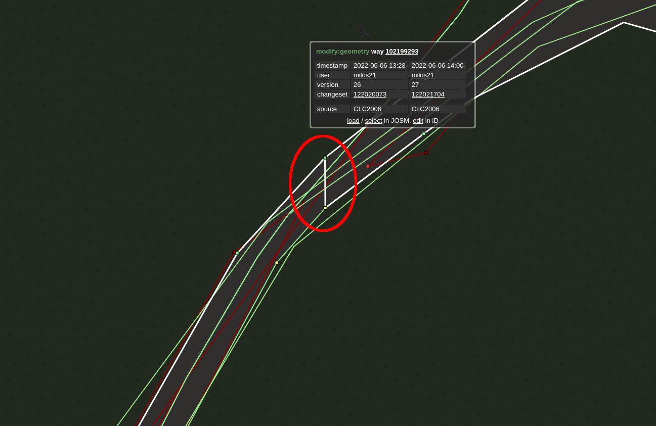
Please, if it is possible, just show me the way where is that intersection. In small multipolygons it's easy to find them, but in bigger ones like this one, I can not find it :(

Dátum: pondelok 10. januára 2022, čas: 21:37:14 UTC+1, odosielateľ: Filip C

TomTom

unread,
Jan 13, 2022, 4:34:29 AM1/13/22
to Openstreetmap Slovakia
Hi Filip009,

Thank you for these additional comments.
These are also false positives, which were caused by issues with the QA rules that we solved last year as well. Again, our editors will carefully review these tasks. Projects created in the future will not contain such cases.

Courtney

Filip C

unread,
Jan 23, 2022, 4:27:20 PM1/23/22
to Openstreetmap Slovakia
Hello, I have idea of new challenge: Overlapping highways ?

Dátum: štvrtok 13. januára 2022, čas: 10:34:29 UTC+1, odosielateľ: ttom...@gmail.com
Message has been deleted

TomTom

unread,
Jan 24, 2022, 5:59:07 AM1/24/22
to Openstreetmap Slovakia
Hi Filip, thank you for your latest suggestion! I've passed it along to my team.

Marjan (Courtney's co-worker)

Filip C

unread,
Jan 24, 2022, 3:45:13 PM1/24/22
to Openstreetmap Slovakia
Not connected highway

Please do not check highway=rest_area

And to my idea of overlapping highway challenge I mean 2 cases:
1) when 2 ways with highway=* (exept cases i have reported previously for Not connected highway challenge) are crossing each other but are not connected and
     1.a) are without layer
     1.b) layer on first highway equals layer on second highway
     #2.a) tag bridge=* is without layer
               tag layer>0 is without bridge=*
     #2.b) tag tunnel=* is without layer
               tag layer<0 is without tunnel=*
2) when there are 2 highways on each other

#this part maybe for next challenge?
Dátum: pondelok 24. januára 2022, čas: 11:59:07 UTC+1, odosielateľ: ttom...@gmail.com

Filip C

unread,
Jan 28, 2022, 5:50:30 PM1/28/22
to Openstreetmap Slovakia
Polygon is not closed
there are a lot of false positives (or just I'm not enough skilled to find them?)
Is it a problem, when leisure=track is not polygon?
On wikipedia is, that it could be just a simple way too https://wiki.openstreetmap.org/wiki/Tag:leisure=track

Dátum: pondelok 24. januára 2022, čas: 21:45:13 UTC+1, odosielateľ: Filip C

TomTom

unread,
Feb 1, 2022, 12:52:58 PM2/1/22
to Openstreetmap Slovakia
Hi Filip,

Thank you for your additional comments.

Regarding the 'leisure=track' cases in the 'Polygon is not closed' challenge--a violation is logged if the following conditions are met:
  • leisure=track AND area=yes, OR
  • leisure=track AND type=multipolygon.
Did you encounter any cases not meeting these criteria?

For the 'Not connected highway' challenge, our team will look into fixing the QA rule so highway=rest_area is not logged in future projects. Thanks for this advice.

In general, I can assure you that our expert editors carefully review each task so they can mark false positives as such.

Thank you also for the detailed input about your overlapping highway challenge idea. It is an interesting suggestion and we will keep it in mind.

Marjan

Filip C

unread,
Feb 1, 2022, 1:15:27 PM2/1/22
to Openstreetmap Slovakia
I did not checked each leisure=track, but I remember on these I opened were tags as area=no. And every track were just a siple way, not an area. Mostly there were 2 and more ways nearby each other.
Like these:

Dátum: utorok 1. februára 2022, čas: 18:52:58 UTC+1, odosielateľ: ttom...@gmail.com

Filip C

unread,
Feb 1, 2022, 4:44:45 PM2/1/22
to Openstreetmap Slovakia
Polygon is not closed
Can you please explain me, what's the problem with this multipolygon?
Because I think he is okay and this is brand new issue.

Dátum: utorok 1. februára 2022, čas: 19:15:27 UTC+1, odosielateľ: Filip C

A.In.The.K A.In.The.K

unread,
Feb 1, 2022, 7:24:54 PM2/1/22
to osm...@googlegroups.com
if anyone who understands pumptracks and other leisure=track which are not circular by nature will come up with consistent idea how to draw them, i will fix mine. untill then it is "i made it best i knew"

Sent from my iPhone
Ak chcete zobraziť túto diskusiu na webe, prejdite na adresu https://groups.google.com/d/msgid/osm_sk/7b62e691-e6b5-4b88-8854-f7f88a591e48n%40googlegroups.com.

TomTom

unread,
Feb 2, 2022, 7:31:22 AM2/2/22
to Openstreetmap Slovakia
I did not checked each leisure=track, but I remember on these I opened were tags as area=no. And every track were just a siple way, not an area. Mostly there were 2 and more ways nearby each other.
Like these:

>  These cases are old violations that were wrongly logged. In the meantime, we have fixed the QA rule, and false positives like these should not be logged in the future. Let me know if you encounter any new tasks like this.

Polygon is not closed
Can you please explain me, what's the problem with this multipolygon?
Because I think he is okay and this is brand new issue.

>  Thank you for pointing this out to me. Our team will look into this case.

Marjan

TomTom

unread,
Mar 7, 2022, 4:12:40 AM3/7/22
to Openstreetmap Slovakia

Hi Filip,

I'd like to thank you again for all the feedback that you gave us. In the meantime, we have made all the remaining improvements that you suggested in our QA rules for detecting not connected highways and non-closed polygons. Thanks to your help, our future challenges will be even better.

Have a great week!

Marjan

Filip C

unread,
Jun 7, 2022, 2:21:44 AM6/7/22
to Openstreetmap Slovakia
Hello,

again on this task https://maproulette.org/challenge/23704/task/130948899 I do not see any issue. If there is some please let me know.
1) role of the way is correct
2)I do not see a line crossing anywhere

Filip

Dátum: pondelok 7. marca 2022, čas: 10:12:40 UTC+1, odosielateľ: ttom...@gmail.com

Tibor Jamečný

unread,
Jun 7, 2022, 2:01:45 PM6/7/22
to osm...@googlegroups.com
Hi Filip,

I believe, that the issue is here:
obrázok.png

How to find it:
1) download the Way from the Task.
2) select the relation it belongs to and download it with all its members
3) select all downloaded data (shortcut CTRL+A) and choose Validate.

I leave the correction up to you :)

Br
Tibor.


ut 7. 6. 2022 o 8:21 Filip C <filipk...@gmail.com> napísal(a):
Ak chcete zobraziť túto diskusiu na webe, prejdite na adresu https://groups.google.com/d/msgid/osm_sk/e5c94bfa-bffc-41bd-8aa9-3da03c1f931en%40googlegroups.com.

Filip C

unread,
Jun 7, 2022, 4:00:23 PM6/7/22
to Openstreetmap Slovakia
So then I have question, why it does not selected this wrong way https://www.openstreetmap.org/way/102199293 ?

Dátum: utorok 7. júna 2022, čas: 20:01:45 UTC+2, odosielateľ: Tibor Jamečný

TomTom

unread,
Jun 10, 2022, 2:43:33 AM6/10/22
to Openstreetmap Slovakia

Hi Filip and Tibor,

Thanks for your input!

@Filip currently we only do a partial data check to detect potential issues, but we are working on implementing a full data check so we can identify additional issues like the one you mentioned.

Have a nice weekend!

Marjan

Filip C

unread,
Jun 15, 2022, 2:05:18 AM6/15/22
to Openstreetmap Slovakia
Tag area=yes on object without feature type
area=yes AND piste:difficulty  is not an issue. See https://wiki.openstreetmap.org/wiki/Key%3Apiste%3Atype#The_piste_as_area

Invalid Turn Restriction
there already is a challenge for invalid turn restriction, so maybe you can contact with author, if you have same QA rule.

PS: If you made new challenge please let me know, so I can give you feedback. :)
Dátum: piatok 10. júna 2022, čas: 8:43:33 UTC+2, odosielateľ: ttom...@gmail.com

TomTom

unread,
Jun 16, 2022, 2:41:57 AM6/16/22
to Openstreetmap Slovakia
Hi Filip,

Thanks again for sharing some valuable comments. I will take these up with my team.

We haven't added new challenges since I started this thread, but I will let you know if we do!

Kind regards,
Marjan

Filip C

unread,
Jun 17, 2022, 12:33:36 PM6/17/22
to Openstreetmap Slovakia
Dátum: štvrtok 16. júna 2022, čas: 8:41:57 UTC+2, odosielateľ: ttom...@gmail.com
Hi Filip,

Thanks again for sharing some valuable comments. I will take these up with my team.

We haven't added new challenges since I started this thread, but I will let you know if we do!
Then I'm sorry. Bur first time you have send project link I have just saw 4 challenges. Just randomly I looked into it, few days ago, and I saw 2 more challenges. So I thinked that you have made 2 new challenges. How many challenges are there currently in Slovakia? 6?

So I have just edited the link and with changing the id I have found a new challenges which I have never saw before :D. Maybe it's caused by somebody marking most of tasks as hard. They are 12 :O
Slovakia | Polygon is not closed (23703)
Slovakia | Polygon has self intersection (23704)
Slovakia | Not connected highway (23705)
Slovakia | Tag area=yes on object without feature type (23706)
Slovakia | Missing tag or role on feature (23707)
Slovakia | This multipolygon is a simple polygon (23708)
Slovakia | Impossible angle in a highway (23709)
Slovakia | Spiky buildings (23710)
Slovakia | Invalid Turn Restriction (23711)
Slovakia | Road Name Gap (23712)
Slovakia | Invalid Lane Tag (23713)
Slovakia | Invalid Mini Roundabout (23714)

TomTom

unread,
Jun 21, 2022, 4:39:16 AM6/21/22
to Openstreetmap Slovakia

Hi Filip,

Indeed, we released 12 challenges for Slovakia back in December. I could not find a reason why you would not have been able to see all of them–perhaps it was a glitch in MapRoulette.

Right now, if you go to the MapRoulette project link, you should only see two challenges for Slovakia (Spiky buildings and Polygon has self intersection). Is this the case for you? The others are not shown because 1) all tasks have been completed, and/or 2) the challenge was automatically archived by MapRoulette because the tasks were older than 6 months.

If you want to see the full list of challenges for Slovakia (regardless of whether they were completed/archived or not), you can take a look at the "Challenges" section of the Slovakia project page that we recently created in GitHub. Note that this list does not contain two of the challenges (Road Name Gap and Missing tag or role on a feature), because we decided to no longer release these challenges. All tasks in these two challenges were completed, and no new tasks will be added in the future.

I hope this gives you the information you were looking for. Don't hesitate to let me know if you have any more questions!

Marjan

Filip C

unread,
Jun 21, 2022, 8:40:49 AM6/21/22
to Openstreetmap Slovakia
Thanks for explanation. :)

Yes, I see only 2 challenges. 1) But Maproulette is also tagging challenges with tasks marked as "Too hard/Can't see" as completed, which is not good, I think. In my opinion there is a big difference between too hard and can't see. If is something too hard for somebody, somebody else can fix it. If it is not visible from available sources, then could challenge be marked as completed. But that's improvement for MapRoulette.

And please edit "Sources for editing" on github to:
We mostly map based on these sources. :)

Filip

Dátum: utorok 21. júna 2022, čas: 10:39:16 UTC+2, odosielateľ: ttom...@gmail.com

TomTom

unread,
Jun 23, 2022, 4:37:05 AM6/23/22
to Openstreetmap Slovakia

Hi Filip,

Your point about tasks marked as "Too hard"/"Can't see" is a valid one. We're aware of this issue in MapRoulette and are looking into how to deal with this.

And thank you for sharing those sources! I've added them to the GitHub page and I've alerted our editors about this.

Marjan

Filip C

unread,
Jul 1, 2022, 2:05:04 PM7/1/22
to Openstreetmap Slovakia
Hello, can you see who has marked task as "Too hard"? Because some tasks are not too Hard and I think somebody is just skipping them to earn points, or I do not know why. In challenge "Not connected highway".

In my own challengeI can't find this possibility, so I think you would not find it too.

Filip
Dátum: štvrtok 23. júna 2022, čas: 10:37:05 UTC+2, odosielateľ: ttom...@gmail.com

TomTom

unread,
Jul 4, 2022, 10:18:07 AM7/4/22
to Openstreetmap Slovakia

Hi Filip,

In admin view, we can see that some of our editors have marked tasks as "Too hard" in the "Not connected highway" challenge. We checked and the reason for this is that based on the imagery available, they were not able to make the edits with the appropriate level of confidence. They will only make changes that they can verify as correct based on the sources available. If you have an example of a task marked as "Too hard" that you believe should not have been marked as such, feel free to share.

Marjan

Filip C

unread,
Jul 5, 2022, 6:14:56 AM7/5/22
to Openstreetmap Slovakia
I'm marking tasks, which cannot be seen on Ortophotomosaic or DMR 5.0 as "Not an issue" because, they cannot be verified from the computer. They need to be resurveyed so they are not real issues, they just wait for somebody to check them in reality.

https://maproulette.org/challenge/23705/task/132572290 In this one you can see from Ortophotomosai, that on the north it is coonecting to nearby track.
https://maproulette.org/challenge/23705/task/132572291 This one is really hard, but I think there is road on the south or just mark this task as Not an issue an somebody sometime will resurvey it.
https://maproulette.org/challenge/23705/task/132572292 This one have on the southest point meadow with track pointing  to the forest, so maybe connect it to that point and run it accross meadow.
https://maproulette.org/challenge/23705/task/132574613 In this case some new mapper has made a mistake to tag way as highway=footway not highway=path in the forest. And from DMR is visible, that track need to be connected on west to the nearby track, where is now footway.

Filip

Dátum: pondelok 4. júla 2022, čas: 16:18:07 UTC+2, odosielateľ: ttom...@gmail.com

TomTom

unread,
Jul 7, 2022, 4:43:49 AM7/7/22
to Openstreetmap Slovakia

Hi Filip,

"Not an issue" is actually meant to be used for cases where you can reliably verify that the issue is not actually an issue (in other words, a false positive). Marking these cases as "Not an issue" makes it clear that there's no need to take another look at them in the future.
If it's not possible to verify a certain issue (for instance because the imagery sources available don't provide the necessary visual information), and therefore there's still a possibility that it's an actual issue, the task should be marked as "Too hard". This indicates that it's useful to revisit this case.

Thank you for your pointers for solving those particular tasks. I have passed this information along to our editors so they can check if they can fix certain tasks based on your suggestions.

Marjan

Filip C

unread,
Jul 7, 2022, 3:10:48 PM7/7/22
to Openstreetmap Slovakia
They really needs to split "Too hard" and "Can't see".

Dátum: štvrtok 7. júla 2022, čas: 10:43:49 UTC+2, odosielateľ: ttom...@gmail.com

Filip C

unread,
Jul 7, 2022, 3:21:22 PM7/7/22
to Openstreetmap Slovakia
I have crated an proposal for them https://github.com/osmlab/maproulette3/issues/1779
Please write a comment or something, that they will see I'm not the only one who want that. :)

Dátum: štvrtok 7. júla 2022, čas: 21:10:48 UTC+2, odosielateľ: Filip C

TomTom

unread,
Jul 8, 2022, 4:04:24 AM7/8/22
to Openstreetmap Slovakia
Thanks for sharing, Filip!

Filip C

unread,
Jul 15, 2022, 9:41:22 AM7/15/22
to Openstreetmap Slovakia
Not connected highway
please do not check highway=services

Dátum: piatok 8. júla 2022, čas: 10:04:24 UTC+2, odosielateľ: ttom...@gmail.com

Filip C

unread,
Jul 31, 2022, 4:07:23 PM7/31/22
to Openstreetmap Slovakia
Tag area=yes on a feature
Plese do not check railway=platform with area=yes
It is good based on wiki.

Filip

Dátum: piatok 15. júla 2022, čas: 15:41:22 UTC+2, odosielateľ: Filip C

Filip C

unread,
Jul 31, 2022, 4:25:31 PM7/31/22
to Openstreetmap Slovakia
Not connected highway
Can your team somehow figure out how to exempt track connected to cycleway with motor_vehicle allowed?

Filip :)

Dátum: nedeľa 31. júla 2022, čas: 22:07:23 UTC+2, odosielateľ: Filip C

TomTom

unread,
Aug 2, 2022, 3:59:30 AM8/2/22
to Openstreetmap Slovakia

Thanks for your thoughtful comments, Filip! I really appreciate you taking the time to dig into the challenges. We will keep your feedback in mind, but we currently aren't making any changes to the logic used to create the challenges. As always, our editors carefully review each task and mark false positives as such.

Have a nice day and thanks again!

Marjan

Marjan Van de Kauter

unread,
Apr 28, 2023, 8:00:42 AM4/28/23
to Openstreetmap Slovakia

Hi Filip,

It’s been a while since we talked, I hope you are doing well!

Thank you for all the tasks you’ve already solved in our TomTom challenges, we really appreciate your help!

I was looking at the "overlapping highway" challenge suggestion you shared last year:

And to my idea of overlapping highway challenge I mean 2 cases:
1) when 2 ways with highway=* (exept cases i have reported previously for Not connected highway challenge) are crossing each other but are not connected and
     1.a) are without layer
     1.b) layer on first highway equals layer on second highway
     #2.a) tag bridge=* is without layer
               tag layer>0 is without bridge=*
     #2.b) tag tunnel=* is without layer
               tag layer<0 is without tunnel=*

2) when there are 2 highways on each other

In the meantime we have actually created a process that identifies, among others, occurrences of scenarios 1a and 2. We ran it on Slovakia, but only found 5 issues. It’s probably not worth creating a whole challenge for these cases, but if you’re interested we could create map notes?

Related to scenarios 2a and 2b, we have a process that identifies issues in bridge and tunnel tagging. I will let my team run it on Slovakia to see what we find.

If you have any other suggestions or comments, I’m happy to hear them.

Have a great weekend!

Marjan 

Filip C

unread,
Apr 29, 2023, 5:48:17 AM4/29/23
to Openstreetmap Slovakia
Hello,

Dátum: piatok 28. apríla 2023, čas: 14:00:42 UTC+2, odosielateľ: vandekau...@gmail.com

Hi Filip,

It’s been a while since we talked, I hope you are doing well!

Thank you for all the tasks you’ve already solved in our TomTom challenges, we really appreciate your help!

I was looking at the "overlapping highway" challenge suggestion you shared last year:

And to my idea of overlapping highway challenge I mean 2 cases:
1) when 2 ways with highway=* (exept cases i have reported previously for Not connected highway challenge) are crossing each other but are not connected and
     1.a) are without layer
     1.b) layer on first highway equals layer on second highway
     #2.a) tag bridge=* is without layer
               tag layer>0 is without bridge=*
     #2.b) tag tunnel=* is without layer
               tag layer<0 is without tunnel=*

2) when there are 2 highways on each other

In the meantime we have actually created a process that identifies, among others, occurrences of scenarios 1a and 2. We ran it on Slovakia, but only found 5 issues. It’s probably not worth creating a whole challenge for these cases, but if you’re interested we could create map notes?

Yes, I will at least fix these 5 :)

Related to scenarios 2a and 2b, we have a process that identifies issues in bridge and tunnel tagging. I will let my team run it on Slovakia to see what we find.

That would be great. Can you please send me link then?

Thanks. :)

Marjan Van de Kauter

unread,
May 4, 2023, 6:35:04 AM5/4/23
to Openstreetmap Slovakia
Thanks Filip! I will share the links for any notes or challenge we create.

Marjan
Op zaterdag 29 april 2023 om 11:48:17 UTC+2 schreef Filip C:

Marjan Van de Kauter

unread,
May 23, 2023, 3:20:42 AM5/23/23
to Openstreetmap Slovakia
Hi everyone,

I just wanted to say that I started a new topic to talk about TomTom's activities in Slovakia: https://groups.google.com/g/osm_sk/c/FYZ7bTONH90

Have a nice day!

Marjan

Op donderdag 4 mei 2023 om 12:35:04 UTC+2 schreef Marjan Van de Kauter:
Reply all
Reply to author
Forward
0 new messages