Horizon file

miso k
In the file there should be one number per line, with each number representing the horizon height in degrees in a certain compass direction around the point of interest. The horizon height cannot be higher than 90 degrees, so if the file contains a value higher than that, it will be automatically replaced by 90.
The horizon heights in the file should be given in a clockwise direction starting at North; that is, from North, going to East South, West, and back to North. The values are assumed to represent equal angular distance around the horizon. For instance, if you have 36 values in the file, PVGIS assumes that the first point is due north, the next is 10 degrees east of north, and so on, until the last point, 10 degrees west of north.
priklad tuto:
https://re.jrc.ec.europa.eu/pvg_download/userhorizon.txt
Ak je to prilis narocna uloha, napiste, je to viacmenej pre moje hobby ucely.
Dakujem,
Miso

daniel abaffy
--
Túto správu ste dostali, pretože v Skupinách Google ste odberateľom skupiny "Openstreetmap Slovakia".
V prípade, že chcete zrušiť odber tejto skupiny a prestať od nej prijímať e-maily, zašlite e-mail na adresu osm_sk+un...@googlegroups.com.
Ak chcete zobraziť túto diskusiu na webe, prejdite na adresu https://groups.google.com/d/msgid/osm_sk/1958f25b-b4b3-49b9-bb1e-5c4962732421n%40googlegroups.com.
miso k

Michal Páleník
m
> Ahojte,
> chcel by som si lepsie vypocitat vynosnost svojej slnkovej elektrarne,
> vedel by mi niekto vygenerovat datovy subor pre program na pocitanie
> vynosnosti?
>
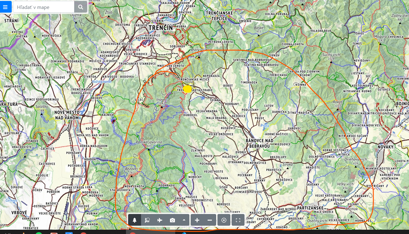
> Oblast asi takato:
> Okolo Trenc. Jastrabia po horizont inovca a horizont strazskych vrchov a
> smerom na juh.
> [image: oblast TJ.png]
> Original podrobnost je 90m, co sa mi zda prilis nepresne.
>
> popis:
> comma-separated values (.csv). The file name must have the extensions
>
>
> *In the file there should be one number per line, with each number
> around the point of interest. The horizon height cannot be higher than 90
> degrees, so if the file contains a value higher than that, it will be
>
>
> *The horizon heights in the file should be given in a clockwise direction
> to North. The values are assumed to represent equal angular distance around
> the horizon. For instance, if you have 36 values in the file, PVGIS assumes
> that the first point is due north, the next is 10 degrees east of north,
> priklad tuto:
>
> https://re.jrc.ec.europa.eu/pvg_download/userhorizon.txt
>
> Ak je to prilis narocna uloha, napiste, je to viacmenej pre moje hobby
> ucely.
>
> Dakujem,
>
> Miso
>
> Túto správu ste prijali, pretože ste prihlásení na odber správ skupiny „Openstreetmap Slovakia“ služby Skupiny Google.
>
> Ak chcete zrušiť odber tejto skupiny a prestať od nej prijímať e-maily, pošlite e-mail na adresu osm_sk+un...@googlegroups.com.
michal palenik
www.freemap.sk
www.oma.sk
miso
Túto správu ste prijali, pretože v službe Skupiny Google odberáte témy skupiny „Openstreetmap Slovakia“.
V prípade, že chcete zrušiť odber tejto témy, prejdite na adresu https://groups.google.com/d/topic/osm_sk/6W6zExA64Zs/unsubscribe.
Ak chcete zrušiť odber tejto skupiny a všetkých jej tém, pošlite e-mail na adresu osm_sk+un...@googlegroups.com.
Ak chcete zobraziť túto diskusiu na webe, prejdite na adresu https://groups.google.com/d/msgid/osm_sk/YC1u%2BPgdztuKq94I%40tanicka.iz.sk.