The case for isochrone support in OTP 2
138 views
Skip to first unread message

ma...@rideamigos.com
Sep 15, 2021, 3:58:55 PM9/15/21
to OpenTripPlanner Developers
I appreciate that OTP 2 has taken a more narrow focus towards transit.
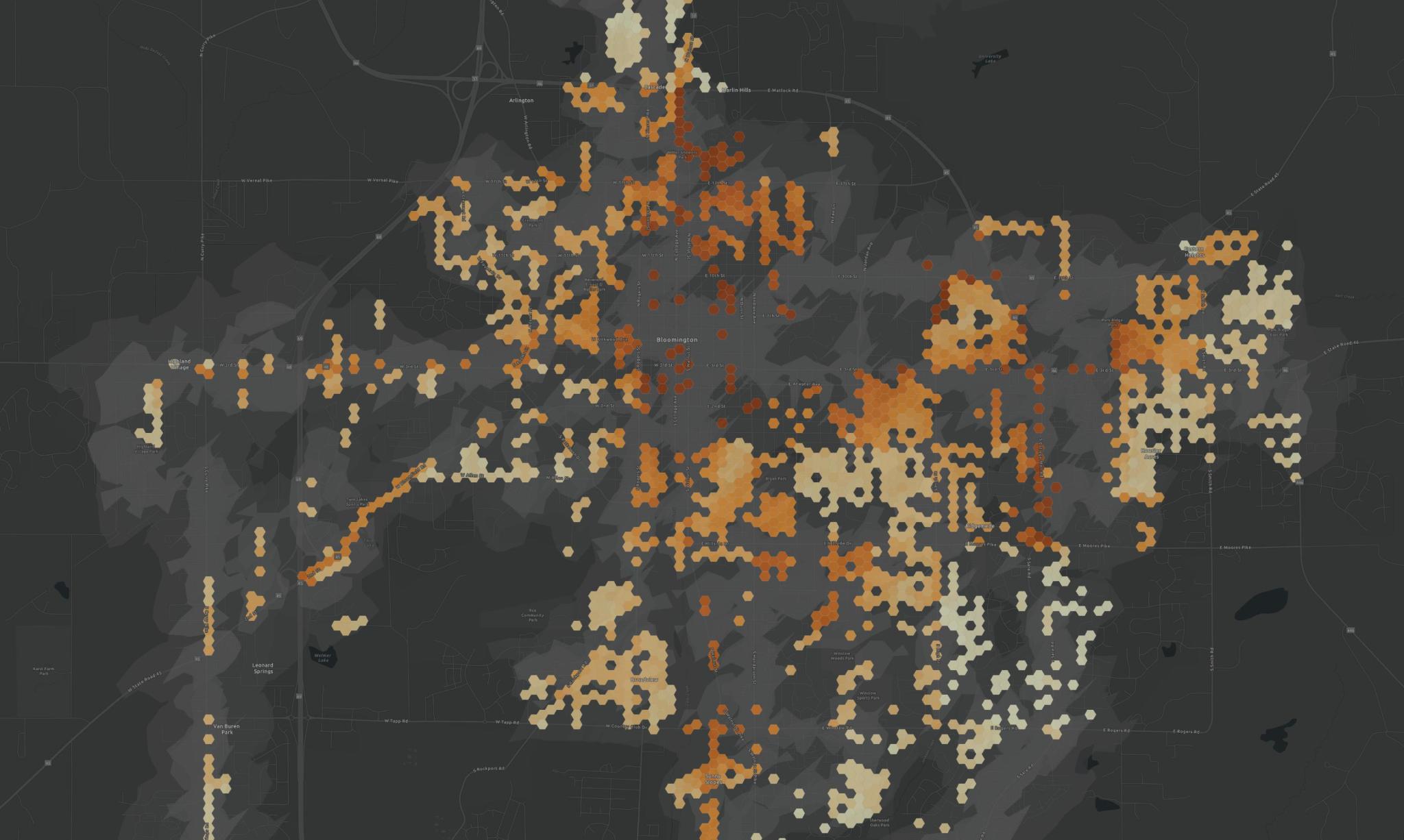
Here I want to share how I used the isochrone feature in 1.x to support transit in my town. The same approach may be useful to help improve transit in other areas. Here's a map I created which uses isochrones in two ways. I'll explain below.
This is a heatmap of the recommended priority of funding missing sidewalk locations in Bloomington, Indiana. You'll notice two shades of gray "cloud" between the hexagons. Those represent locations that are 5 or 10 minute walk from any transit stop in Bloomington. Those were calculated by starting with a map of every transit stop in town and then generating the 5-minute-walk and 10-minute-walk isochrones for every location and then combining all the 5-minute and 10-minute isochrones on their own layer.
With these, the City the can prioritize fixing missing sidewalks that are close to transit stops. Generating such maps should be something of interest to transit agencies to provide to their city planners to advocate for transit-oriented development-- better sidewalks near transit improves transit!
Isochrones are used in a second way in the map, which is generating the priority score itself. It's a an evolving formula, but one important metric is the "walk potential" of a given location. This is based on the "10 Minute Neighborhood" concept of having all necessary amenities close by. (More on that here: https://halifax.retales.ca/2018/08/10-minute-neighbourhoods/ ). To calculate Walk Potential, first Overpass Turbo was used to query about 20 different categories of amenities. For example, all day care locations. Then isochrones were calculated for every "amenity layer". So, we could find every location that was a 10 minute walk from a drug store. In sum, the approach allowed me to calculate locations that had high "walk potential". A location with a high walk potential that's close to transit is a good candidate to fix a missing sidewalk.
So, transit agencies could make an even stronger case to city planners by saying "look, not only are their missing sidewalks near transit stations, but some of the locations also generally have walk potential". Isochrone APIs help make this case for transit.
I'll also backup to share how the missing sidewalk locations were calculated. Some LIDAR-scanning firms like Transmap will generate a missing sidewalk map as a product. But in our town, we had a map of the road centerlines and map of the sidewalk network. Using those, I calculated the streets segments that didn't have an adjacent sidewalks.
Thanks,
Mark
Reply all
Reply to author
Forward
0 new messages