Walk Information Data with Distance
49 views
Skip to first unread message

Mr. Adi
Mar 10, 2022, 9:21:35 PM3/10/22
to openov
Hi Everyone,
I want to collect data between stop is possible reach with walk or not. But I don't see this data from any resource.
Is anybody know where I can get this data? Thank you.
Regards,
Adi

Stefan de Konink
Mar 11, 2022, 4:06:32 AM3/11/22
to ope...@googlegroups.com
On Friday, March 11, 2022 3:21:34 AM CET, Mr. Adi wrote:
> I want to collect data between stop is possible reach with walk or not. But
> I don't see this data from any resource.
>
> Is anybody know where I can get this data? Thank you.
CHB; http://data.ndovloket.nl/haltes/
> I want to collect data between stop is possible reach with walk or not. But
> I don't see this data from any resource.
>
> Is anybody know where I can get this data? Thank you.
OpenStreetMap; https://download.geofabrik.de/europe/netherlands.html
Filter the data for walkabality;
Apply Dijktra/A*/CH.
Apply 1:N with a max distance, I think 15min (900s =/ 900m) would be
sufficient.
Where you would query N stops around the source, this is your heuristic.
For each relationship, you would store the distance.
The advanced method would also take in account if the stop is along the
same route, hence if you would be able to take a bus to the next stop (but
not the previous), would you walk there? Some people like myself would, if
I would have the time to advance.
--
Stefan
Mr. Adi
Mar 14, 2022, 1:22:15 AM3/14/22
to openov
Hi Stefan,
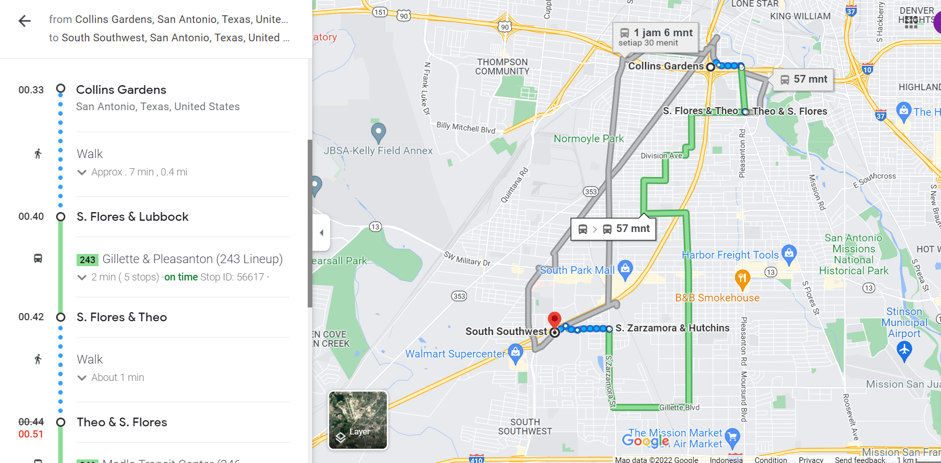
Thank you for your response. Good idea, my goal is like the picture below, I took this example from google maps, there it can be seen that people who travel can walk from Collins Gardens to S.Flores & Theo, then continue the journey with bus. Is it possible to make a journey like this using the method you provided? Or there is another way to design like this journey? Thank you.
Stefan de Konink
Mar 14, 2022, 4:59:13 AM3/14/22
to ope...@googlegroups.com
Hi Adi,
Because it is the first stop (or last one) in the journey it does not need
any especial treatment. That just boils down to reaching for the access to
the timetable planner. Give me all stops in the neighbourhood of my
departure, and for all these stops query the walking distance to them,
initialise the stops with that distance as time. For a RAPTOR based planner
that could instantly work. With one negative effect: if walking to the next
stop gives you an earlier bus, that would get a preference.
A far more interesting use case is arriving somewhere by train, and not
taking the bus stop near the train station, but some stop along the route,
because you would be able to walk the first bit instead of waiting 20
minutes due to alignment problems in the public transport network. For that
to work you need to have a precomputed transfer matrix, which may get huge
at stop level.
On Monday, March 14, 2022 6:22:15 AM CET, Mr. Adi wrote:
> Hi Stefan,
>
> Thank you for your response. Good idea, my goal is like the picture below,
> I took this example from google maps, there it can be seen that people who
> travel can walk from Collins Gardens to S.Flores & Theo, then continue the
> journey with bus. Is it possible to make a journey like this using the
> method you provided? Or there is another way to design like this journey?
> Thank you.
> [image: Screenshot_1.png]
>
> Pada Jumat, 11 Maret 2022 pukul 17.06.32 UTC+8 ste...@konink.de menulis:
>
>> On Friday, March 11, 2022 3:21:34 AM CET, Mr. Adi wrote: ...
>
--
Stefan
Because it is the first stop (or last one) in the journey it does not need
any especial treatment. That just boils down to reaching for the access to
the timetable planner. Give me all stops in the neighbourhood of my
departure, and for all these stops query the walking distance to them,
initialise the stops with that distance as time. For a RAPTOR based planner
that could instantly work. With one negative effect: if walking to the next
stop gives you an earlier bus, that would get a preference.
A far more interesting use case is arriving somewhere by train, and not
taking the bus stop near the train station, but some stop along the route,
because you would be able to walk the first bit instead of waiting 20
minutes due to alignment problems in the public transport network. For that
to work you need to have a precomputed transfer matrix, which may get huge
at stop level.
On Monday, March 14, 2022 6:22:15 AM CET, Mr. Adi wrote:
> Hi Stefan,
>
> Thank you for your response. Good idea, my goal is like the picture below,
> I took this example from google maps, there it can be seen that people who
> travel can walk from Collins Gardens to S.Flores & Theo, then continue the
> journey with bus. Is it possible to make a journey like this using the
> method you provided? Or there is another way to design like this journey?
> Thank you.
> [image: Screenshot_1.png]
>
> Pada Jumat, 11 Maret 2022 pukul 17.06.32 UTC+8 ste...@konink.de menulis:
>
>
--
Stefan
Adi
Mar 14, 2022, 5:24:21 AM3/14/22
to openov
Hi Stefan,
Regards,
Adi
Reply all
Reply to author
Forward
0 new messages