Google Summer of Code 2024:- DetourDetective

Andrew Cunningham
Hi all,
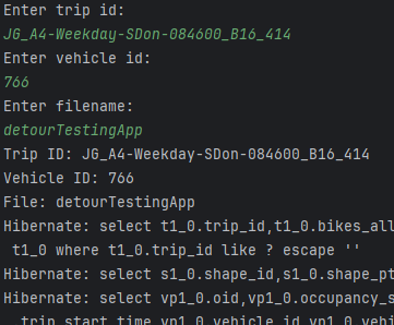
This week I developed my algorithm so that it will return all the off route points and will export these to an excel file. Which will allow us to easily plot the points on a map. Also developed my detour detour app to ask the user to enter trip id, vehicle id and a filename so they can run the detour detector. Below is an image of the app while running.
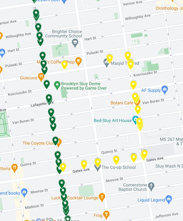
Below is an image of the results given from the app running. The yellow is the points of the vehicle going off route (that is what was returned in the excel file). The green points are the shape of the route.
Next week, we plan on :
Change export to csv instead of excel.
Developing our app that we can give it a route id so it will test multiple trips at once.
Test our algorithm with new data we have received from the MTA that has multiple detours in place.
Would like to thank William Wong from the MTA in New York for his continued support throughout this project. It is greatly appreciated.
Thanks,
Andrew