FW: 1400 MATTHEW TROPICAL UPDATE

Evans F. Mitchell
Evans F. Mitchell / KD4EFM
Field Service Tech.
Fisher Communications Group, Inc - Central Florida Division
C: 863-272-1713
O: 904-384-1270
________________________________________
Confidentiality Notice:
"The information contained in this e-mail and all attachments is confidential
and is intended only for the use of the person or entity to which it is addressed.
If you are not the intended recipient, be aware that any review, disclosure, copying,
distribution or use of this e-mail or any attachment is prohibited and may be unlawful.
If you have received this e-mail in error, please contact the sender by return e-mail
and delete the e-mail and all attachments from your system. Thank you."
From: Abernathy, William [mailto:billyab...@polk-county.net]
Sent: Thursday, October 6, 2016 2:23 PM
To: Abernathy, William <billyab...@polk-county.net>
Subject: 1400 MATTHEW TROPICAL UPDATE
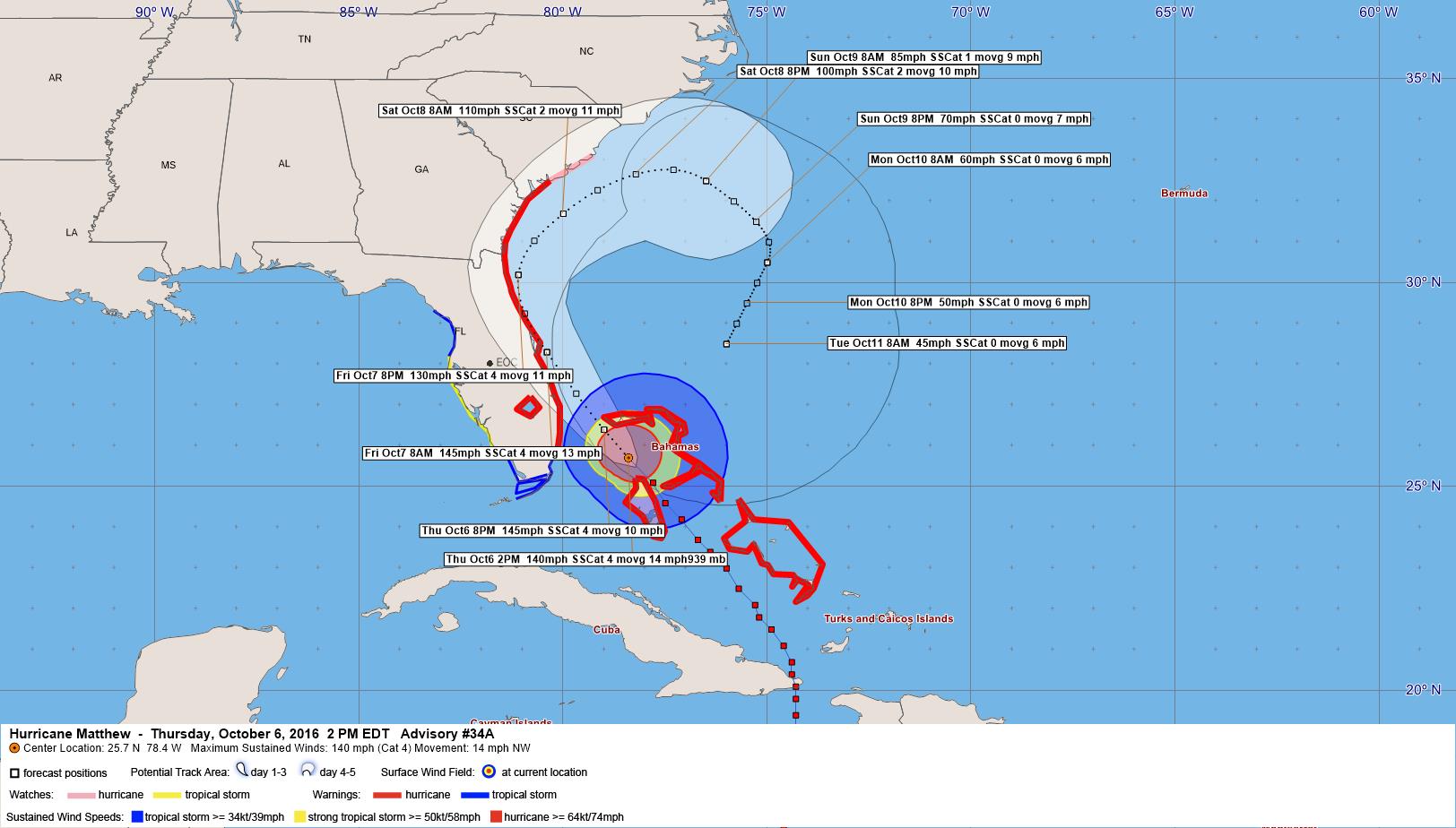
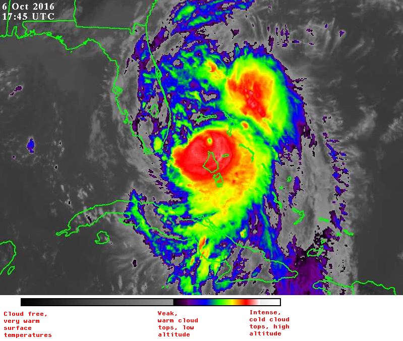
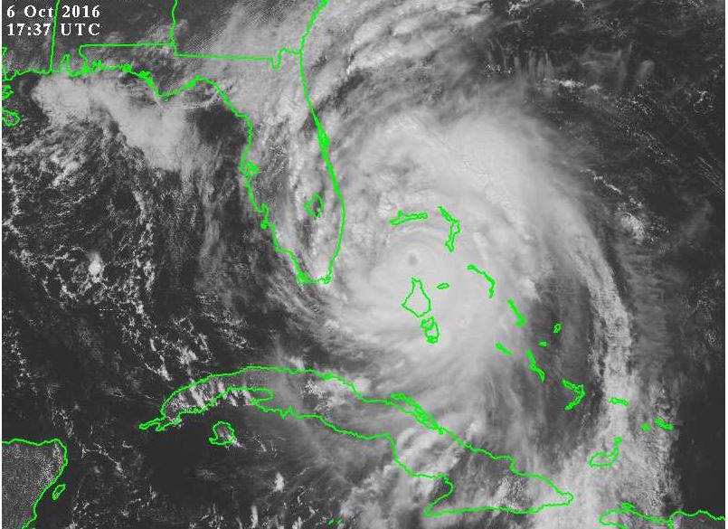
the eye of Hurricane Matthew was located near latitude 25.7 North, longitude 78.4 West. The hurricane is moving toward the northwest near 14 mph (22 km/h), and this general motion is expected to continue today with a turn toward the north-northwest tonight or early Friday. On the forecast track, the eye of Matthew should be near or over Freeport in the Bahamas in the next few hours, and move close to or over the east coast of the Florida peninsula through Friday night. Maximum sustained winds are near 140 mph (220 km/h) with higher gusts. Matthew is a category 4 hurricane on the Saffir-Simpson Hurricane Wind Scale. Some additional strengthening is possible, and Matthew should remain a Category 4 hurricane while it approaches the Florida coast. Hurricane-force winds extend outward up to 60 miles (95 km) from the center and tropical-storm-force winds extend outward up to 160 miles (260 km). Nassau in the Bahamas reported 97 mph (156 km/h) sustained winds earlier today when the northern eyewall moved over that island. The estimated minimum central pressure is 939 mb
Billy Abernathy FPEM
Polk County Emergency Management
Emergency Operation Center EM01
1890 Jim Keene Blvd. Winter Haven Fla. 33880
O. 863-298-7001 C. 863-860-8002

Proudly serving since 1983
Like Us - facebook.com/polkcountyem
Follow us on Twitter @PolkEmergency
The “Extra Mile” has no traffic jams.
*********************************************************************** Please Note: Florida has a very broad Public Records Law. Most written communications to or from State and Local Officials regarding State or Local business are public records available to the public and media upon request. Your email communications may therefore be subject to public disclosure. ***********************************************************************