FW: TROPICAL UPDATE

Evans F. Mitchell KD4EFM <GMail>
--
Evans F. Mitchell / KD4EFM
Field Service Tech.
Fisher Communications - Central Florida Division
C: 863-272-1713
O: 904-384-1270
Confidentiality Notice: "The information contained in this e-mail and all attachments is confidential and is intended only for the use of the person or entity to which it is addressed. If you are not the intended recipient, be aware that any review, disclosure, copying, distribution or use of this e-mail or any attachment is prohibited and may be unlawful. If you have received this e-mail in error, please contact the sender by return e-mail and delete the e-mail and all attachments from your system. Thank you."
From: William D. Abernathy [mailto:billyab...@polkfl.com]
Sent: Sunday, September 27, 2015 10:52 AM
To: William D. Abernathy <billyab...@polkfl.com>
Subject: TROPICAL UPDATE
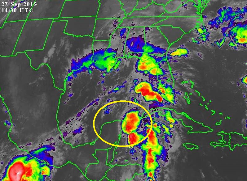
INV 99 -(INV 99 is identified in the attached imagery –NASA IR GULF- with a yellow circle) An area of low pressure over the northeastern Yucatan Peninsula and an upper-level low pressure system over the western Gulf of Mexico are producing a large area of disorganized cloudiness and showers extending from the northwestern Caribbean Sea northward over the eastern Gulf of Mexico. Upper-level winds are expected to be only marginally conducive for development while this system moves northward toward the northern Gulf Coast during the next couple of days. Regardless of tropical cyclone formation, this disturbance is likely to produce locally heavy rainfall over portions of the northern Gulf Coast and southeastern United States during the next several days. An Air Force Reserve reconnaissance aircraft is scheduled to investigate this system later today, if necessary.
- Formation chance through 48 hours, low, 30 percent
- Formation chance through 5 days, low30 percent,
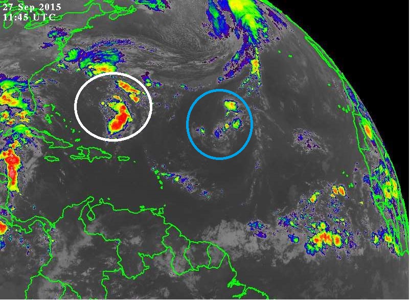
INV 98 -(INV 98 is identified in the attached imagery –NASA IR ATL- with a white circle) Showers and thunderstorms are showing signs of organization in association with an area of low pressure located about 425 miles south-southwest of Bermuda. Some additional development of this system is possible and this system could become a tropical depression during the next day or so while it moves toward the northwest at 5 to 10 mph. After that time, development is not expected due to unfavorable upper-level winds.
- Formation chance through 48 hours, medium, 50 percent
- Formation chance through 5 days, medium, 50 percent
5 DAY GRAPHIC
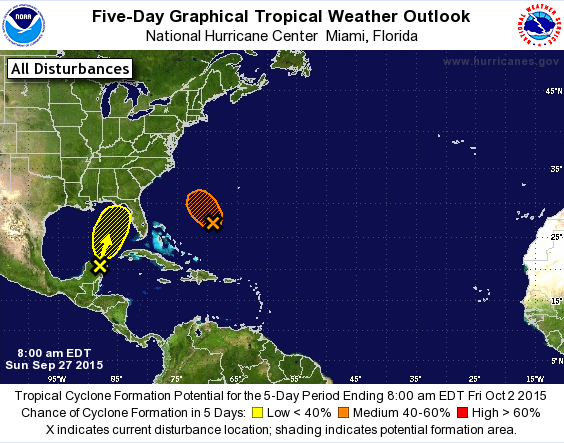
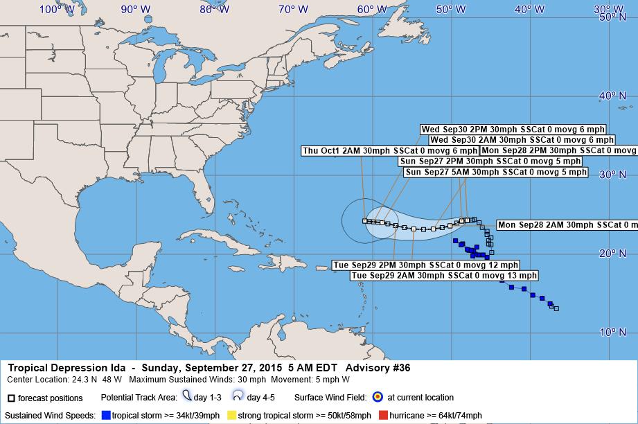
TD IDA -(TD Ida is identified in the attached imagery –NASA IR ATL- with a blue circle) the center of Tropical Depression Ida was located near latitude 24.3 North, longitude 48.0 West. The depression is moving toward the west near 5 mph. A turn toward the west-southwest and an increase in forward speed is expected later today. Maximum sustained winds are near 30 mph with higher gusts. Little change in strength is forecast during the next 48 hours. The estimated minimum central pressure is 1007 mb.
Polk County Emergency Management EOC will continually monitor the tropics and will advise of changes, if necessary.
Billy Abernathy FPEM
Polk County Emergency Management
Emergency Operation Center EM01
1890 Jim Keene Blvd. Winter Haven Fla. 33880
O. 863-298-7001 C. 863-860-8002

Proudly serving since 1983
Like Us - facebook.com/polkcountyem
Follow us on Twitter @PolkEmergency
The “Extra Mile” has no traffic jams.