Can anyone help in plotting a point (in NAD83) onto Google Maps

Nick

Mendum, Keith, Vodafone
Have you tried saving a copy of the table using the coordinate system used by Google Maps?
Alternatively, if you are producing a KMZ/KML file, is there a choice of CRS in the export dialogue? If not you may need to change your workspace defaults to the EPSG for NAD83 that is appropriate for your locality.
My business has a similar problem where the CRS for the Great Britain data (EPSG: 27700) does not project accurately in Northern Ireland when we use Google Maps.
Regards,
Keith
C2 General
From: mapi...@googlegroups.com <mapi...@googlegroups.com>
On Behalf Of Nick
Sent: 18 August 2021 16:13
To: MapInfo-L <mapi...@googlegroups.com>
Subject: [MI-L] Can anyone help in plotting a point (in NAD83) onto Google Maps
CYBER SECURITY WARNING: This email is from an external source - be careful of attachments and links. Please follow the Cyber Code and report suspicious emails.
I am working on plotting point data on a Google Map.
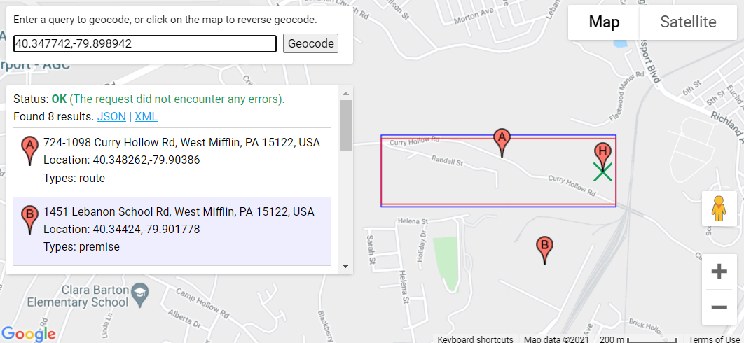
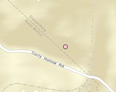
My source data points are in projection Latitude/Longitude NAD83. An example data point is: 40.347742,-79.898942 (shows up accurately in DRAVOSBURG in image below)

Google Maps was using Mercator projection (flat-base map) and then upgraded to displaying the Earth round and using a newer projection in recent years.
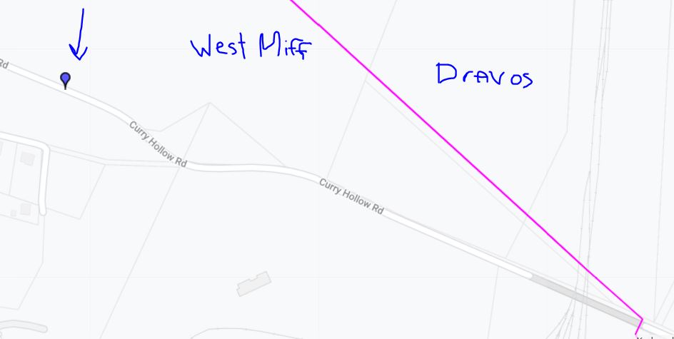
My question: Does anyone know of a way to get my point coordinates above to be accurately ported into the correct projection so that it is plotted on a Google Maps web control accurately? As you can see in the image below, the same coordinate values plotted on a Google Maps web page; however, the same coordinates show up in the adjacent borough West Mifflin.

If anyone has any insight, I would appreciate it.
--
--
You received this message because you are subscribed to the
Google Groups "MapInfo-L" group.To post a message to this group, send
email to mapi...@googlegroups.com
To unsubscribe from this group, go to:
http://groups.google.com/group/mapinfo-l/subscribe?hl=en
For more options, information and links to MapInfo resources (searching
archives, feature requests, to visit our Wiki, visit the Welcome page at
http://groups.google.com/group/mapinfo-l?hl=en
---
You received this message because you are subscribed to the Google Groups "MapInfo-L" group.
To unsubscribe from this group and stop receiving emails from it, send an email to
mapinfo-l+...@googlegroups.com.
To view this discussion on the web visit
https://groups.google.com/d/msgid/mapinfo-l/d1fe3267-8eda-4aed-a5d9-4752b1acb66en%40googlegroups.com.
Nick