Europe Boundary Data

Louise Kavanagh
Dear All,
Not specifically related to MapInfo but I’m wondering if anyone can help. I’m trying to source the country boundaries of Europe for a potential project. Does anyone know of a free data source? The only hits I am getting when searching online include lots of other data and administrative boundaries but I simply just need the country boundaries.
Thanks for your help.
Best wishes,
Louise
Louise Kavanagh
Managing Director
![]()
![]() | louise....@apogeedata.co.uk | +44 (0)7736 438822 | Subscribe
| louise....@apogeedata.co.uk | +44 (0)7736 438822 | Subscribe

Uffe Kousgaard
You can try the ADM0 level here:
https://www.geoboundaries.org/downloadCGAZ.html
Regards
Uffe Kousgaard
--
--
You received this message because you are subscribed to the
Google Groups "MapInfo-L" group.To post a message to this group, send
email to mapi...@googlegroups.com
To unsubscribe from this group, go to:
http://groups.google.com/group/mapinfo-l/subscribe?hl=en
For more options, information and links to MapInfo resources (searching
archives, feature requests, to visit our Wiki, visit the Welcome page at
http://groups.google.com/group/mapinfo-l?hl=en
---
You received this message because you are subscribed to the Google Groups "MapInfo-L" group.
To unsubscribe from this group and stop receiving emails from it, send an email to mapinfo-l+...@googlegroups.com.
To view this discussion on the web visit https://groups.google.com/d/msgid/mapinfo-l/007601d8d3e2%245e187380%241a495a80%24%40apogeedata.co.uk.

Seb
--
--
You received this message because you are subscribed to the
Google Groups "MapInfo-L" group.To post a message to this group, send
email to mapi...@googlegroups.com
To unsubscribe from this group, go to:
http://groups.google.com/group/mapinfo-l/subscribe?hl=en
For more options, information and links to MapInfo resources (searching
archives, feature requests, to visit our Wiki, visit the Welcome page at
http://groups.google.com/group/mapinfo-l?hl=en
---
You received this message because you are subscribed to the Google Groups "MapInfo-L" group.
To unsubscribe from this group and stop receiving emails from it, send an email to mapinfo-l+...@googlegroups.com.
To view this discussion on the web visit https://groups.google.com/d/msgid/mapinfo-l/007601d8d3e2%245e187380%241a495a80%24%40apogeedata.co.uk.
Seb
Uffe Kousgaard
That is EU + a bit more, but not all of Europe.
Regards
Uffe
To view this discussion on the web visit https://groups.google.com/d/msgid/mapinfo-l/CAP8fqbi05SqBNMHqecFByvFM8R8LDwOFtmARtgukd%3D2-LZWQRg%40mail.gmail.com.

Martin Hodder
Hi louise,
Just to join in with all the data sources.
I have used this one in the past for country boundaries:-
https://www.orrbodies.com/resource/world-250k-coastlinepolitical-map/
Just one to add to your list!
--
Seb
To view this discussion on the web visit https://groups.google.com/d/msgid/mapinfo-l/a0c81a1e-0b8b-b8d6-259d-d4e9a7876a38%40routeware.dk.
Louise Kavanagh
Thanks all for your help.
Louise Kavanagh
Managing Director
![]()
![]() | louise....@apogeedata.co.uk | +44 (0)7736 438822 | Subscribe
| louise....@apogeedata.co.uk | +44 (0)7736 438822 | Subscribe
From: mapi...@googlegroups.com <mapi...@googlegroups.com> On Behalf Of Seb
Sent: 29 September 2022 15:37
To: mapi...@googlegroups.com
Subject: Re: [MI-L] Europe Boundary Data
Uffe,
That's a very good point oops. :-)
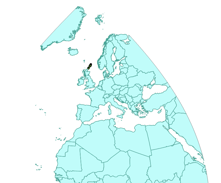
Eurostat also have a bunch of country boundary files here as well which cover countries outwith of the EU+ including North Africa and parts of Russia. See image below.
Cheers

To view this discussion on the web visit https://groups.google.com/d/msgid/mapinfo-l/CAP8fqbh0zY-wnfzgYoq9g4EB0NK37hY0mJv3LrQ-Zg9wf%3DOFgQ%40mail.gmail.com.