mbx error
25 views
Skip to first unread message

Ian Oldfield
Jan 19, 2022, 11:54:10 AM1/19/22
to MapInfo-L
Hi Mappers,
I hope someone may be able to advise on an error I am receiving when trying to run an mbx from a menu. The mbx is called spatialprofiler_b and was compiled back around 2012.
Now when I try to run the application, I get the following error:
(spatialprofiler_b:mb:115) Variable or Field
CAD_with_Loc_20191012_0038_Peo.obj not defined
CAD_with_Loc_20191012_0038_Peo.obj not defined
I have the file 'CAD_with_Loc_20191012_0038_Peo' in DAT, IND & TAB format and it displays the data in a browser, but obviously is not mapped.
However, it is not possible the CAD_with.. file was somehow built into the mbx so I don't understand why I am getting this error.
Any advice would be appreciated.
As discussed on this forum some time ago the mbx was built for me by Stuart Gill who sadly died prior to supplying the source code.
Ian Oldfield

Uffe Kousgaard
Jan 19, 2022, 6:05:44 PM1/19/22
to mapi...@googlegroups.com
Hi,
If your (lost) code refers to the obj column and your table doesn't have a .MAP file component, then you will get that error.
Nothing strange about that.
Regards
Uffe Kousgaard
If your (lost) code refers to the obj column and your table doesn't have a .MAP file component, then you will get that error.
Nothing strange about that.
Regards
Uffe Kousgaard
--
--
You received this message because you are subscribed to the
Google Groups "MapInfo-L" group.To post a message to this group, send
email to mapi...@googlegroups.com
To unsubscribe from this group, go to:
http://groups.google.com/group/mapinfo-l/subscribe?hl=en
For more options, information and links to MapInfo resources (searching
archives, feature requests, to visit our Wiki, visit the Welcome page at
http://groups.google.com/group/mapinfo-l?hl=en
---
You received this message because you are subscribed to the Google Groups "MapInfo-L" group.
To unsubscribe from this group and stop receiving emails from it, send an email to mapinfo-l+...@googlegroups.com.
To view this discussion on the web visit https://groups.google.com/d/msgid/mapinfo-l/308d3a8f-fb54-4399-8794-24248d725936n%40googlegroups.com.
Ian Oldfield
Jan 20, 2022, 5:15:59 AM1/20/22
to MapInfo-L
Uffe, thank you for your response. However, it is not possible the code referred to the specific file as the mbx was compiled several years earlier. It remains a mystery. However, back to basics - I ran a new session using 'new' tables - and the mbx ran like a dream! RIP to my talented friend Stuart Gill, who developed this with me but died suddenly several years ago.

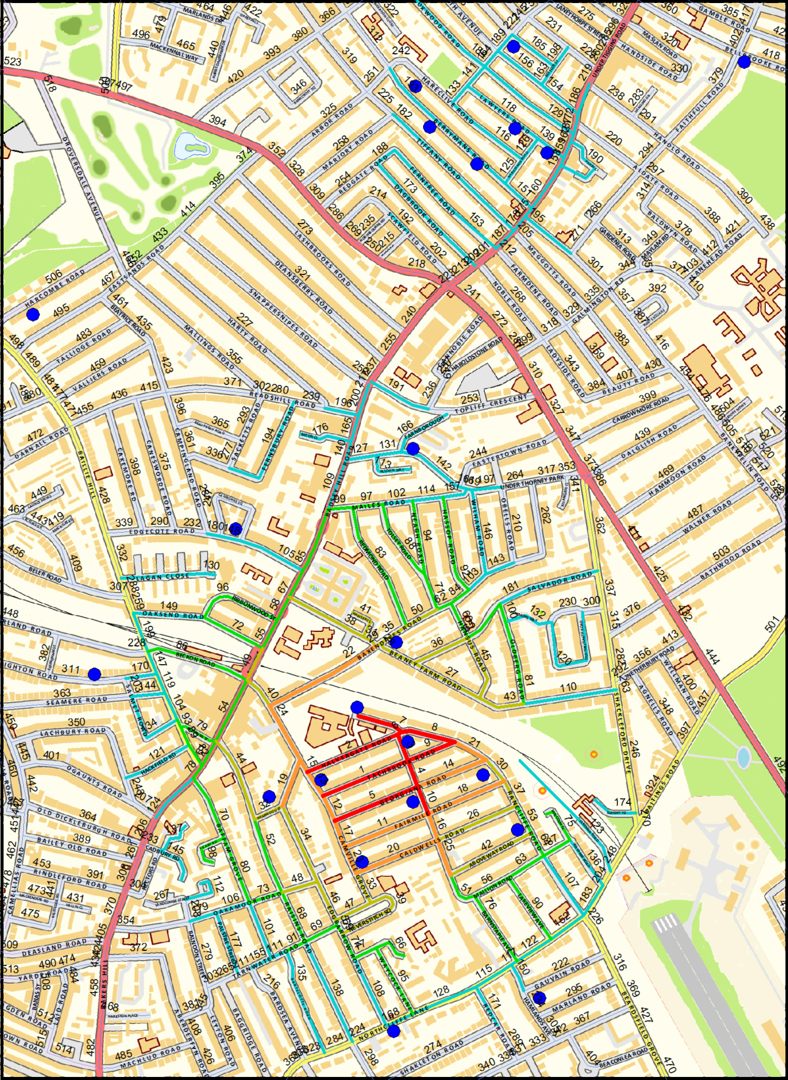
The image below is the output, the dots represent burglaries. The coloured lines are a Geographical Profile that identifies the likely Anchor Point (Home) of the offender. I haven't shown the legend but hopefuilly it is sufficiently intuitive to see that segment 1, then 2,3, etc. is the best starting point to find the suspect. For those concerned about confidentiality this is from my synthetic police data project that I am building, including people, maps, street names, crimes, incidents, vehicles, etc all are fictitious. In March I will be delivering a module on Geographical Profiling to a BSc Criminology cohort.
Kind regards
Ian Oldfield, MSc, CertEd.
Director
Synthetic Data Ltd
Mob: 07508 944826
Reply all
Reply to author
Forward
0 new messages