Ground classification once again
535 views
Skip to first unread message

jan.zachar
Aug 15, 2019, 11:16:02 AM8/15/19
to LAStools - efficient tools for LiDAR processing
I am returning to the ground classification issue once again (recently I posted similar issue on subterrain noise). I went through all of the posted and recommended tutorials on classification of noisy mostly photogrammetry data but none gave satisfactory result for me (maybe I do not understand the system of percentile of elevation enough, which may be a cucial part of the whole procedure) .
In most parts of the landscape I am ok with my workflow but there are significant parts where I fail.
My workflow is as follows:
1. Lastiling
2. Lasnoising /xy step 0.8, z step 0.2, isolated points 8/
3. Lasground /step 0.8, spike up 0.35, spike down 0.02, offset 0.02, bulge 0.02, hyperfine/
4. Statistical outlier removal /SOR/ (performed in CloudCompare) on ground points
Agressive lasnoise parametres are able to catch majority of undreground noise and eat some parts of the vegetation as well which I dont mind as I am interested purely on ground. However the are still underground noise points left.
Lasground with the given parameters works fine on approx 70 perc, of the landscape, but in some parts it misclassifies remained underground noise as ground and real ground above it as unclassed.
In most cases I was able to fix the problem with the final step - SOR performed on "grounds only" pointcloud, which helped me to ged rid off most of remained underground noise and remains of vegetation that lasground was not able to fix.
But currently I struggle with a lot of misclassified real ground which is omitted (misclassified as class 1) and only parts of the subterrain noise undrneath is left (misclassified as ground). In this case final SOR only produces holes as it gets off underground points (with lower density than the average) but exact ground points above are missing.
I would appreciate any comment
I would appreciate any comment
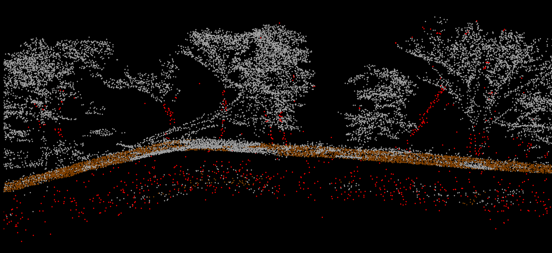
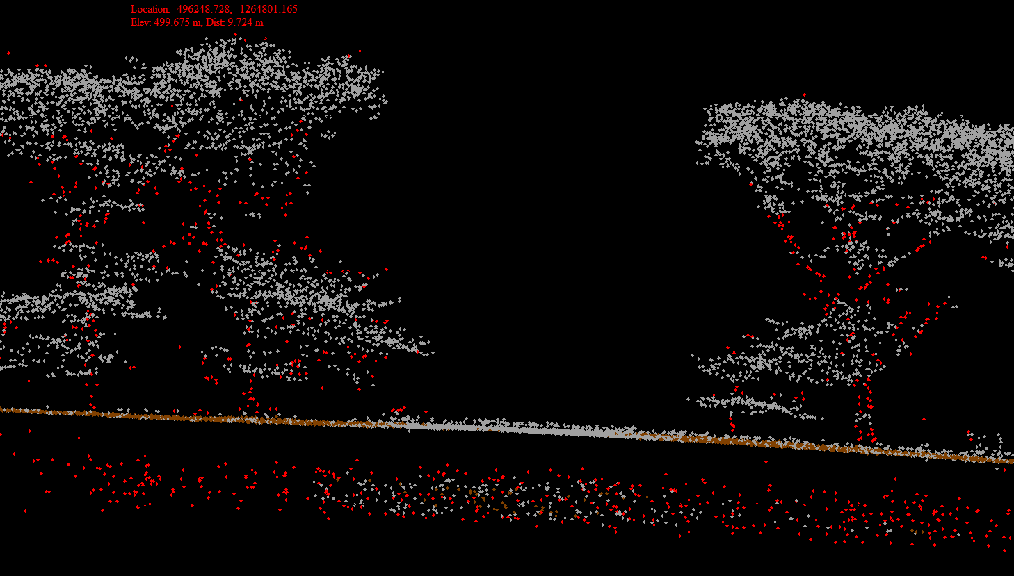
PS: explanation to pics: red -noise point
grey- unclassed
brown - ground
PS2: As far as I know the data was collected with a RIEGL "crossfire" LMS Q1560.

Martin Isenburg
Aug 15, 2019, 12:01:03 PM8/15/19
to LAStools - efficient command line tools for LIDAR processing
Hello,
can you share these a data set with these three representative scenes? I think I may be able to devise a LAStools workflow to clean this up.
Regards,
Martin
--
Download LAStools at
http://lastools.org
http://rapidlasso.com
Be social with LAStools at
http://facebook.com/LAStools
http://twitter.com/LAStools
http://linkedin.com/groups/LAStools-4408378
Manage your settings at
http://groups.google.com/group/lastools/subscribe
---
You received this message because you are subscribed to the Google Groups "LAStools - efficient tools for LiDAR processing" group.
To unsubscribe from this group and stop receiving emails from it, send an email to lastools+u...@googlegroups.com.
To view this discussion on the web visit https://groups.google.com/d/msgid/lastools/6190129f-1c77-413c-b11b-d3714a1dac96%40googlegroups.com.
Martin Isenburg
Aug 16, 2019, 11:24:57 AM8/16/19
to LAStools - efficient command line tools for LIDAR processing
Hello,
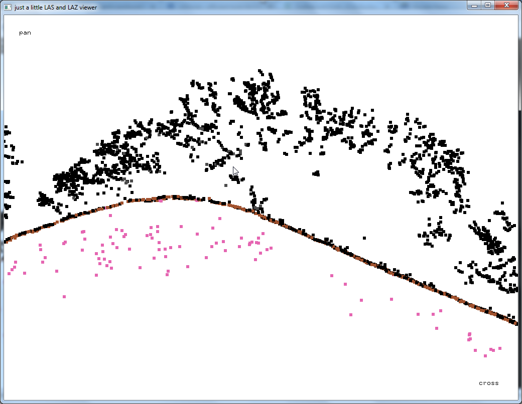
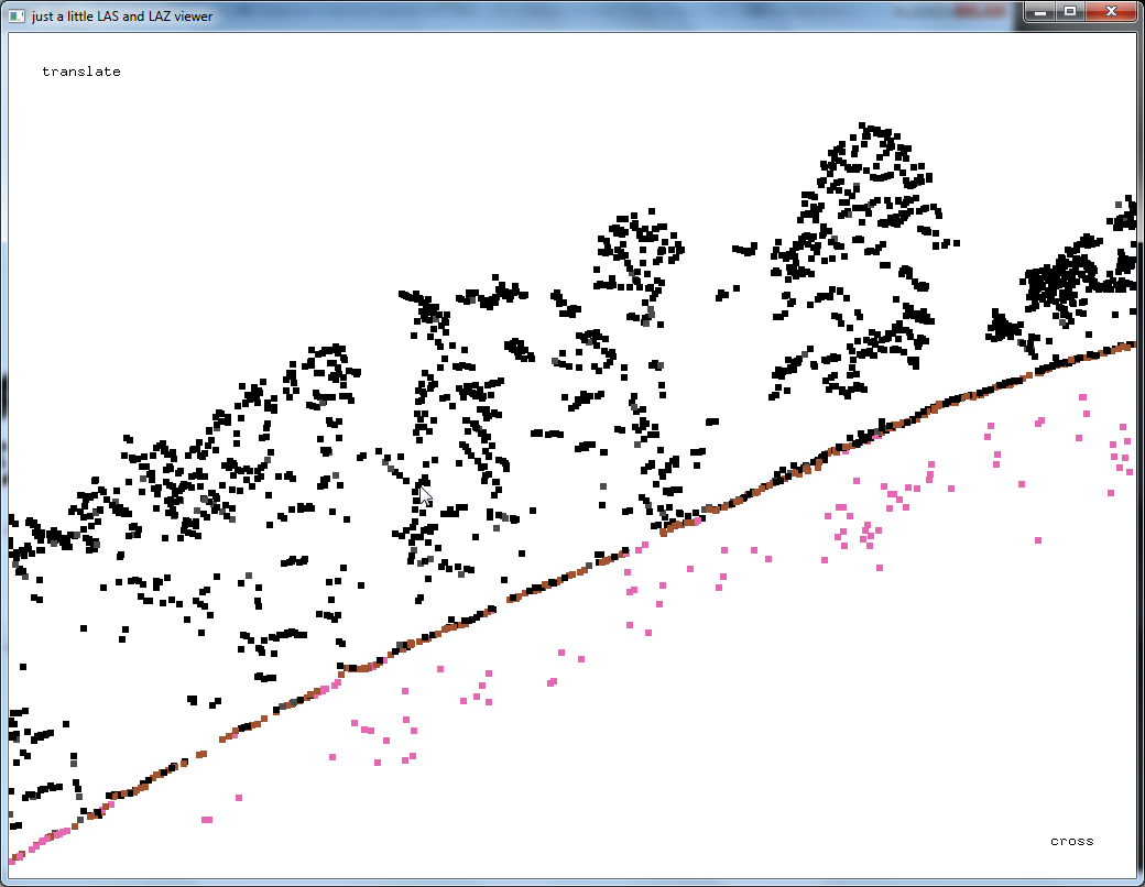
I received one tile from Jan and ran a pipeline of LAStools to remove the low now and ground classify the data. Here you see three 50 cm profile of one the resulting point classification as well as a 50 centimeter hill-shaded DTM, Does that look reasonable, Jan? Would it be possible to use this tile for a little blog article?
Martin
Martin Isenburg
Aug 18, 2019, 6:51:43 AM8/18/19
to LAStools - efficient command line tools for LIDAR processing
Hello,
I've used the one tile that I received from Jan and created a new blog article / tutorial on how to remove such noise with LAStools:
Because one of the options used in lasthin is not yet in the last release you will need to use this version of lasthin until the next version gets published:
Regards,
Martin @rapidlasso
Reply all
Reply to author
Forward
0 new messages