Google for Nonprofits Newsletter - August 2011
53 views
Skip to first unread message

Leslie Hernandez
Aug 31, 2011, 12:44:41 PM8/31/11
to googlefor...@googlegroups.com
|
| ||||||||||
|
Google for Nonprofits Newsletter - August 2011 | ||||||||||
| Your monthly round-up of the latest news and notes from Google for Nonprofits. | ||||||||||
| August 31, 2011 | ||||||||||
| ||||||||||
| ||||||||||
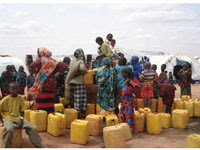
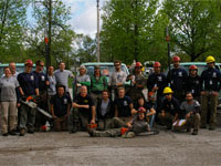
Greetings from the team at Google for Nonprofits! With everyone heading back to school, we’ve started to think about additional educational tools & resources that we can develop for you. Read on to take a quick 5-10 minute survey to give us feedback on your educational needs for Google for Nonprofits. Additionally, check out the latest product updates, insights from Phil Verney from Google Earth Outreach, and a success story from Americorps in response to the Joplin tornadoes. Wishing you a great September.
| ||||||||||
| ||||||||||
| ||||||||||
| ||||||||||
| ||||||||||
| ||||||||||
| ||||||||||
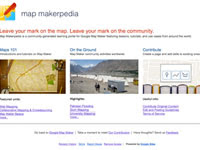
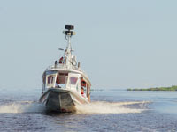
Q: Why is Google Earth Outreach important for nonprofits?
Google Earth, along with Google Maps, Sketchup and Fusion Tables are invaluable tools when it comes to communicating information through powerful visualization. Today, so much information has a geospatial component so we offer assistance to organizations that want to geographically organize their data. There are so many dedicated organizations out there doing truly amazing things. The information they gather in their work they do can enlighten many people. We offer resources, and where appropriate software grants to help them better achieve their aims. Q: What are some features in Google Earth Outreach that nonprofits should know about?
Although many groups will find that the free versions of our mapping products will likely meet all their needs, the Pro and Premier versions do provide more advanced features, such as the high resolution printing feature The HALO Trust uses to create wall-size maps for their de-mining operations. Google Earth Outreach offers eligible nonprofits the opportunity to apply for Pro and Premier software grants. What can nonprofits do with our mapping tools? Through our Showcase, we highlight organizations that have successfully used Google Earth & Google Maps in their efforts to send us their creations for others to see and get inspiration from. I’d definitely want to point out our tutorials too which offer all kinds of tips on how to go about how to organizing information geographically and actually creating maps like those you see in the Showcase. For example, the Appalachian Mountaintop Removal Tour describes their efforts against mountaintop removal coal mining and what tutorials they found the most useful to communicate their message. Q: Can you share any cool stories of organizations using Google Earth? One of my favorite examples is an indigenous tribe in Brazil, the Surui people, using Google Earth to raise awareness of (sometimes illegal) deforestation, particularly where it encroached upon their land. Their land is not just a part of their cultural heritage, but also serves as a key component in protecting the environment. Back in 2007, the tribe’s leader, Chief Almir made a powerful statement: “that the time had come to put down the bow and arrow, and pick up the laptop.” They’re true technological pioneers as they’ve adopted Google Earth, ODK (Open Data Kit) & Google Earth Engine. I highly encourage you to watch the video, Trading Bows and Arrows for Laptops. Q: Do you have any tips for an organization that's just getting started with Google Earth Outreach?
Absolutely! Show people what you’re doing with mapping technology & then share that information widely, whether that be through social media or more traditional routes such as newsletters. For specific information on how to get started, we have an extensive range of tutorials that you can use to learn more. We also wrote a blog post on how to quickly create your very first map. If you only have less than few minutes to spend, I would suggest customizing your nonprofit’s listing on Google Maps with Google Places. By following a few short and simple steps, you can correct basic information about your organization and enhance your Google Place Page by adding images and photos of your work. Q: Where can nonprofits go to find resources and support for Google Earth Outreach?
| ||||||||||
| ||||||||||
|
Share your story! Have you had a great experience with a Google product that you'd like to share? Tell us about it. |
||||||||||
| ||||||||||
| If someone sent you this email and you’d like to join our mailing list, click here. | ||||||||||
|
Reach more donors | Improve operations | Raise awareness Make a change: google.com/nonprofits | ||||||||||
| 2011 Google Inc. All Rights Reserved. Google and the Google logo are trademarks of Google Inc. www.google.com 1600 Amphitheatre Parkway, Mountain View, CA 94043 |
Reply all
Reply to author
Forward
0 new messages