New tile for Live map
330 views
Skip to first unread message

paolo....@gmail.com
Apr 10, 2021, 1:59:39 PM4/10/21
to golden-cheetah-users
Hi.
Could anybody indicate to me te correct url to use in the training live map.
The default one is not workign any more.
I currently have http://${a}.tile.openstreetmap.de/${z}/${x}/${y}.png but no map is showing.
Thanks.

Ale Martinez
Apr 10, 2021, 3:13:13 PM4/10/21
to golden-cheetah-users
Remove all $ from that url
paolo....@gmail.com
Apr 10, 2021, 3:22:01 PM4/10/21
to golden-cheetah-users
I modified the url to http://{a}.tile.openstreetmap.de/{z}/{x}/{y}.png
but still no map is showing.
but still no map is showing.
Do you have any other hint?
Thanks.
Paolo.
paolo....@gmail.com
Apr 10, 2021, 3:23:45 PM4/10/21
to golden-cheetah-users
Ale Martinez
Apr 10, 2021, 3:31:34 PM4/10/21
to golden-cheetah-users
El sábado, 10 de abril de 2021 a la(s) 16:23:45 UTC-3, paolo....@gmail.com escribió:
http://tile.openstreetmap.de/{z}/{x}/{y}.png
did the trick.
Yes, {a}. should have been be {s}., but it is optional so it can be omitted.
Full description at https://leafletjs.com/reference-1.4.0.html#tilelayer
paolo....@gmail.com
Apr 10, 2021, 3:35:11 PM4/10/21
to golden-cheetah-users
I confirm that
http://{s}.tile.openstreetmap.de/{z}/{x}/{y}.pngworks as well.
Thanks again for the quick response.
Ale Martinez
Apr 10, 2021, 7:29:06 PM4/10/21
to golden-cheetah-users
For future reference this is the wiki entry: https://github.com/GoldenCheetah/GoldenCheetah/wiki/UG_ChartTypes_Train#live-map

Thomas Launois
Apr 25, 2021, 1:39:03 PM4/25/21
to golden-cheetah-users
Hi everyone and thanks to the developpers and helpers for providing such a nice tool!
I was wondering if the add chart --> "live map" feature was also supposed to currently work on Mac OS ?
I've tried many tiles without success so far ?
Does the trainer need to be paired / switched on for the tiles to be displayed ?
Does the workout need to be started for the tiles to be displayed ?
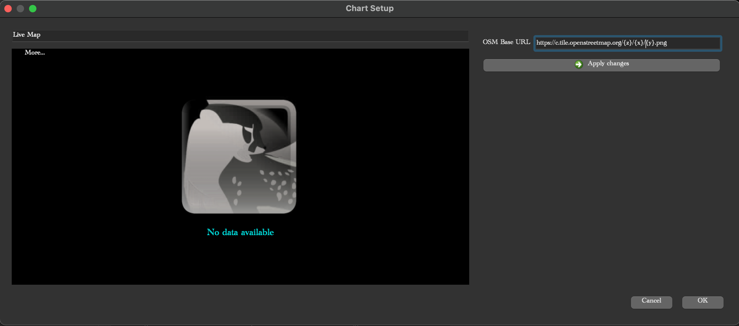
Here is a screesnhot of 1 of my attempts. (i've been trying all links from https://wiki.openstreetmap.org/wiki/Tile_servers)
Thanks in advance for your help with this !
Regards,
T.
Ale Martinez
Apr 25, 2021, 2:17:19 PM4/25/21
to golden-cheetah-users
El domingo, 25 de abril de 2021 a la(s) 14:39:03 UTC-3, Thomas Launois escribió:
Hi everyone and thanks to the developpers and helpers for providing such a nice tool!I was wondering if the add chart --> "live map" feature was also supposed to currently work on Mac OS ?
Yes
I've tried many tiles without success so far ?Does the trainer need to be paired / switched on for the tiles to be displayed ?
No
Does the workout need to be started for the tiles to be displayed ?
No
Here is a screesnhot of 1 of my attempts. (i've been trying all links from https://wiki.openstreetmap.org/wiki/Tile_servers)
“No data available” indicates you have not selected a workout yet, or the selected workout doesn’t include GPS data.
Thomas Launois
Apr 25, 2021, 2:20:52 PM4/25/21
to golden-cheetah-users
Hi,
Thanks for the fast answer. I'll keep playing with different versions of the gpx (or tacx) file that allowed me to generate the workout then, until it works. Thanks again !
Regards,
T.
Thomas Launois
Apr 29, 2021, 8:17:36 AM4/29/21
to golden-cheetah-users
Hi,
Sorry for the delayed answer : I had several other unsuccessful tries adding a live map.
I have the latest dev GC version, on a mac.
I tried importing different types of files (gpx, tacx, etc) under activity. It does find/show an itinerary, thus I guess it has lon/lat coordinates that GC can understand.
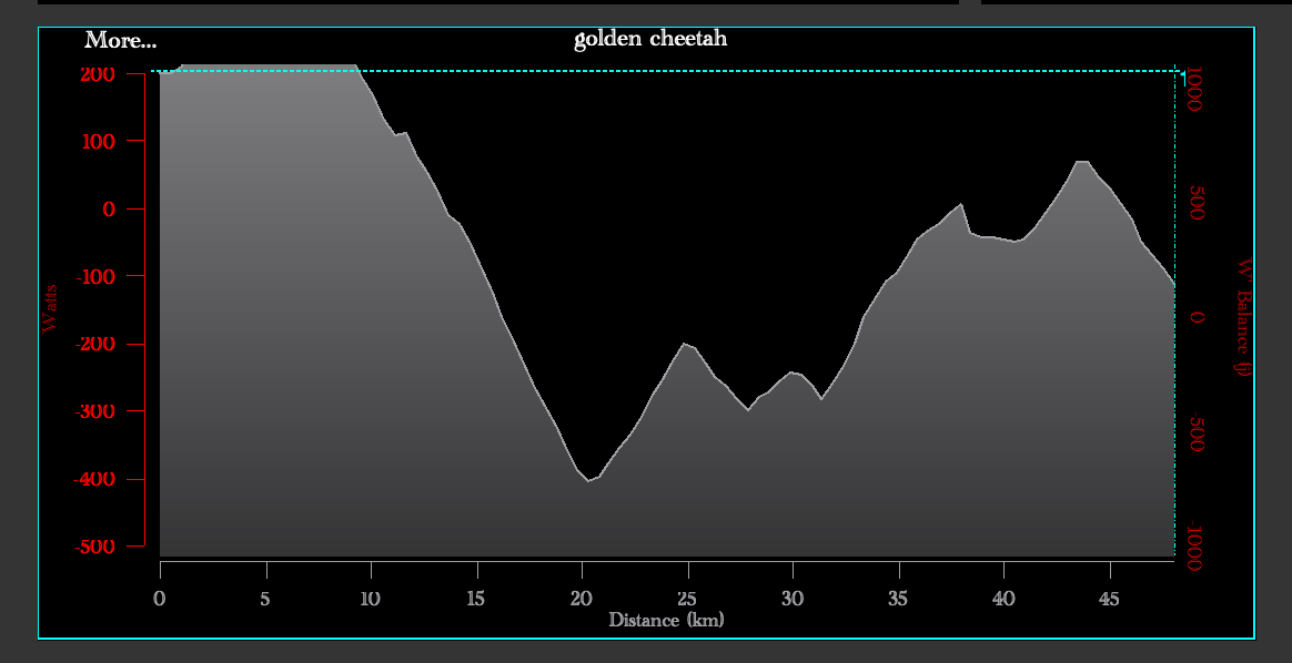
While the activity is selected, i go under train --> create workout via wizard. The wizard does show the elevation (and it appear in the profile window as well).
The workout is saved as ".crs"
So everything seems ok with the coordinates ? But even like this, when going under View --> Add chart --> Live map
and trying several tiles (http://{s}.tile.openstreetmap.org/{z}/{x}/{y}.png for example) I can only get this "no available data" answer.
I'd like to understand what I am doing wrong. (I tried to detail as much as possible, but let me know if you need anything else).
Maybe you have an activity file that you know worked for you, that I can try to create a workout from ?
Maybe the tile address I enter is wrong ?
Thanks in advance for the help !
Thomas Launois
Apr 29, 2021, 9:05:09 AM4/29/21
to golden-cheetah-users
I'm noticing that the wizard shows the elevation in meters, but opening the train.crs, the "workout" panel shows the elevation in Watts.
Might be linked, but there is nothing that I can play with, between the wizard correct display of the elevation and the file saving.
Ale Martinez
Apr 29, 2021, 9:10:40 AM4/29/21
to golden-cheetah-users
El jueves, 29 de abril de 2021 a la(s) 09:17:36 UTC-3, Thomas Launois escribió:
Hi,Sorry for the delayed answer : I had several other unsuccessful tries adding a live map.I have the latest dev GC version, on a mac.I tried importing different types of files (gpx, tacx, etc) under activity. It does find/show an itinerary, thus I guess it has lon/lat coordinates that GC can understand.While the activity is selected, i go under train --> create workout via wizard. The wizard does show the elevation (and it appear in the profile window as well).The workout is saved as ".crs"So everything seems ok with the coordinates ? But even like this, when going under View --> Add chart --> Live mapand trying several tiles (http://{s}.tile.openstreetmap.org/{z}/{x}/{y}.png for example) I can only get this "no available data" answer.
Right, CRS files don’t have coordinates.
I'd like to understand what I am doing wrong. (I tried to detail as much as possible, but let me know if you need anything else).Maybe you have an activity file that you know worked for you, that I can try to create a workout from ?
In FAQs there is a link to free workouts with coordinates and video.
If you want to Train on the course of an activity file, you can export it as JSON (or GPX) and then import as a workout to have coordinates.
Before export you may need to smooth altitude for a better experience, look for a previous thread on this.
Maybe the tile address I enter is wrong ?
No, tiles form the background map, even without them you see the track when there are coordinates.
Ale Martinez
Apr 29, 2021, 1:53:09 PM4/29/21
to golden-cheetah-users
For future references, I've added more information to the wiki entry: https://github.com/GoldenCheetah/GoldenCheetah/wiki/UG_ChartTypes_Train#live-map
El jueves, 29 de abril de 2021 a la(s) 10:10:40 UTC-3, Ale Martinez escribió:
If you want to Train on the course of an activity file, you can export it as JSON (or GPX) and then import as a workout to have coordinates.Before export you may need to smooth altitude for a better experience, look for a previous thread on this.
Perhaps we could integrate this 3 steps in a new Workout Wizard options.
Thomas Launois
Apr 29, 2021, 5:52:01 PM4/29/21
to Ale Martinez, golden-cheetah-users
Thanks for the clarification, it worked when exporting an activity, then importing it again as a workout indeed (and indeed, I thought the "direct" transformation was already possible).
I now can correctly see the advancement on the map, the slope/speed/distances are all correctly set, etc
(the steeper it is, the slower I go for the same power, it all makes sense)
The only thing that I don't see to get working is the control of the resistance through the exercise. Even if the slope is correctly displayed, it doesn't change the hometrainer (Elite Suito-T) resistance. It is connected via Bluetooth (detected as 4.0 apparently).
Is this functionality already supported (via bluetooth, with this model) ?
Thanks again for your time, and I promise that should be my last question
Regards,
T.
--
_______________________________________________
Golden-Cheetah-Users mailing list
golden-che...@googlegroups.com
http://groups.google.com/group/golden-cheetah-users?hl=en
---
You received this message because you are subscribed to a topic in the Google Groups "golden-cheetah-users" group.
To unsubscribe from this topic, visit https://groups.google.com/d/topic/golden-cheetah-users/NxLYYIPwFko/unsubscribe.
To unsubscribe from this group and all its topics, send an email to golden-cheetah-u...@googlegroups.com.
To view this discussion on the web visit https://groups.google.com/d/msgid/golden-cheetah-users/69d0f3e0-ca91-41d5-b6de-4205d001db1en%40googlegroups.com.
Ale Martinez
Apr 29, 2021, 6:21:33 PM4/29/21
to golden-cheetah-users
El jueves, 29 de abril de 2021 a la(s) 18:52:01 UTC-3, Thomas Launois escribió:
Thanks for the clarification, it worked when exporting an activity, then importing it again as a workout indeed (and indeed, I thought the "direct" transformation was already possible).I now can correctly see the advancement on the map, the slope/speed/distances are all correctly set, etc(the steeper it is, the slower I go for the same power, it all makes sense)The only thing that I don't see to get working is the control of the resistance through the exercise. Even if the slope is correctly displayed, it doesn't change the hometrainer (Elite Suito-T) resistance. It is connected via Bluetooth (detected as 4.0 apparently).Is this functionality already supported (via bluetooth, with this model) ?
Not yet, if you want to control this trainer you have to connect it via ANT+
Reply all
Reply to author
Forward
0 new messages