India shape with state and dist boundary
54 views
Skip to first unread message

Nandlal Mishra
Jul 27, 2021, 4:44:48 PM7/27/21
to data...@googlegroups.com
Dear fellows,
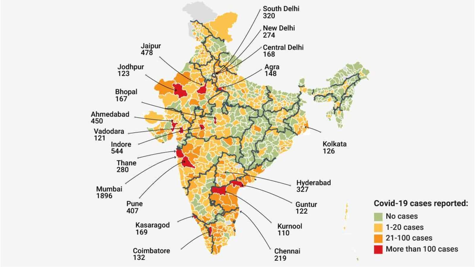
I have separate shape files of districts and states of India. Can someone please help me to create one GeoJSON or TopoJSON file with State as well as district boundaries depicted with different color and curve-width in same file, as attached image.
Thanking you!
Regards
Nandlal Mishra

rigved1...@gmail.com
Jul 28, 2021, 2:06:15 AM7/28/21
to datameet
You can do this very easily using layer properties in QGIS.
Connect with me if you need a quick video call tutorial.
Connect with me if you need a quick video call tutorial.
Reply all
Reply to author
Forward
0 new messages