Questions about importing .kurviger or .gpx files
100 views
Skip to first unread message

WolfgangS
Dec 14, 2022, 3:36:16 AM12/14/22
to Cruiser Users
Good Morning Emux,
on the way to become a Cruiser user, questions arise ...
In the future, I will continue to plan my routes exclusively in kurviger.de and import them via Dropbox into Cruiser GL. To compensate for the small disadvantage of routing through BRouter instead of Kurviger, I set more shaping points. This changes at most a small section (to the next waypoint) if I initiate a recalculation, which happens extremely rarely.
I leave the setting of the additional shaping points to gpxshaping.de, because I am a lazy dog. I used to provide the resulting .gpx file to my TomTom/Garmin fellow riders anyway. Now I import it again into kurviger.de and create a more comprehensive .kurviger file.
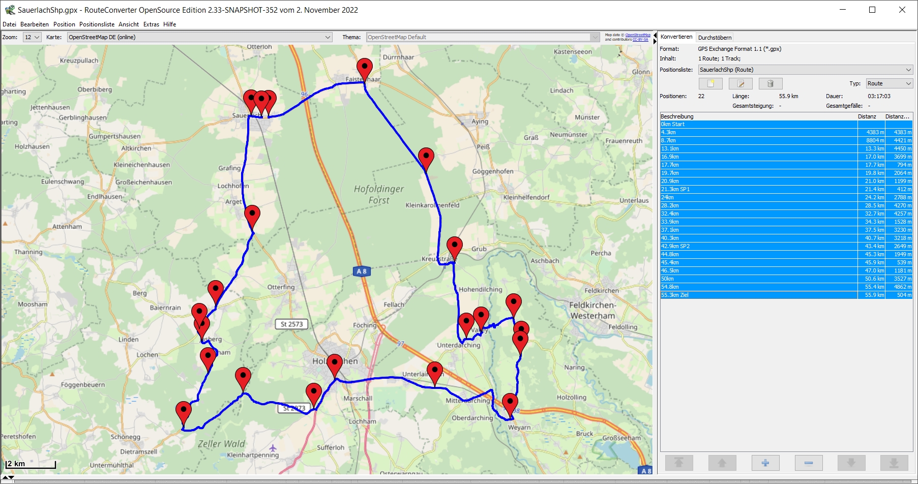
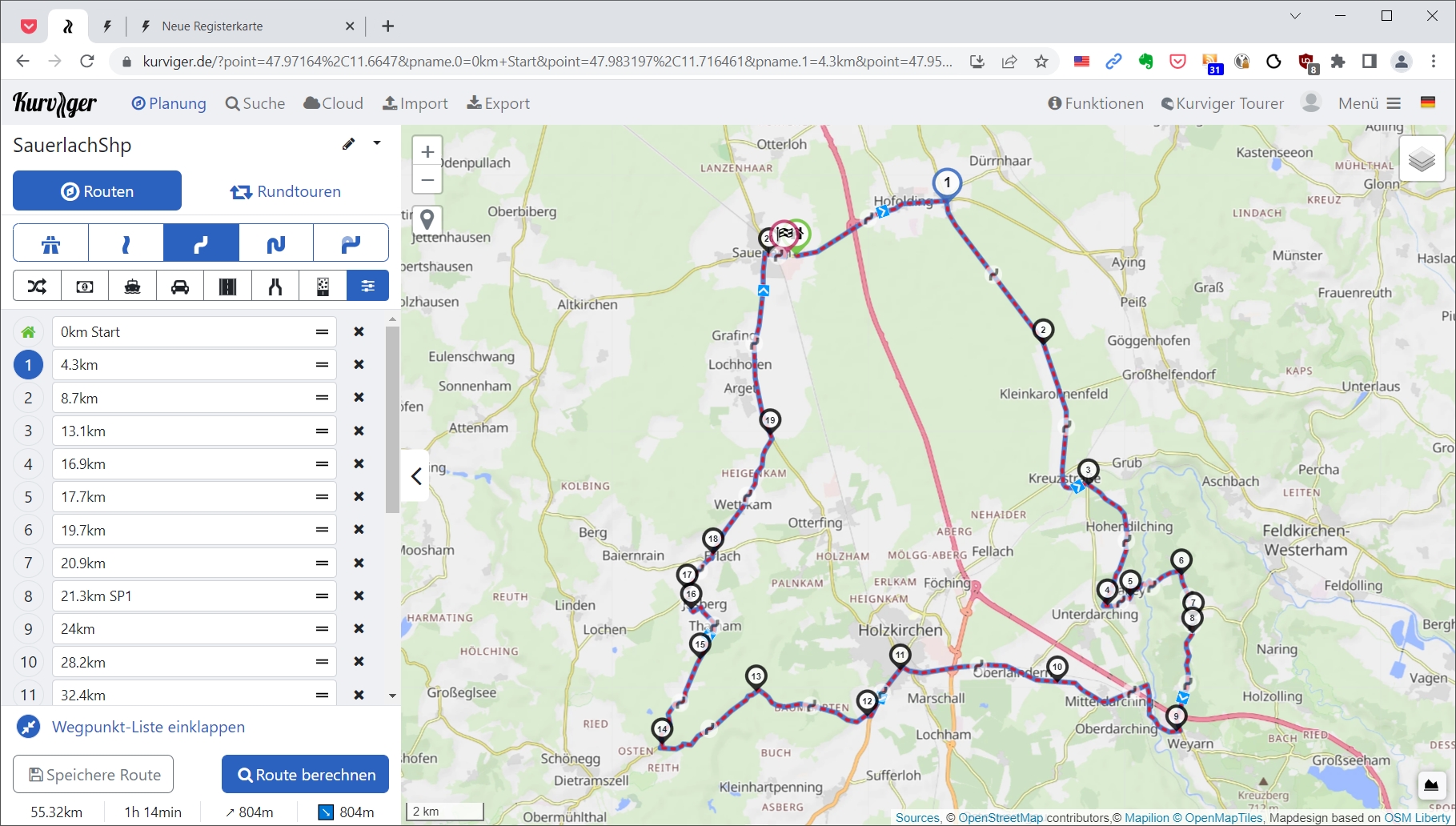
Now I thought, why actually? The .gpx file and the .kurviger file are absolutely identical (see attachments), then I could take the .gpx file right away when importing the cruiser. But no - while the .kurviger variant imports perfectly, there are discrepancies in the .gpx - presumably due to the recalculation of the entire route.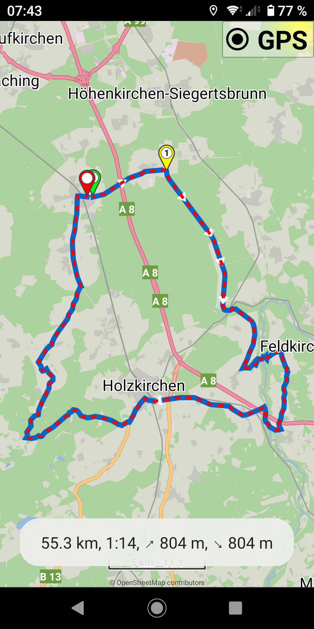
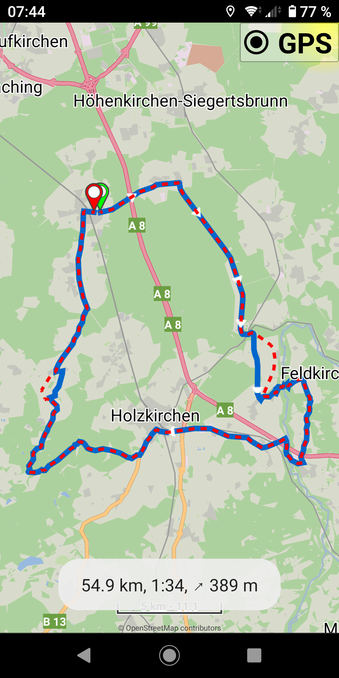
Now (finally) the questions: Why does the route have to be recalculated in the .gpx case, even though a route exists? Can I change that behavior with the import options? And why can the recalculation be omitted for .kurviger?
It is not a problem! I can live with my current approach, just would like to understand it; almost academic - right?
Thanks for an explanation!
on the way to become a Cruiser user, questions arise ...
In the future, I will continue to plan my routes exclusively in kurviger.de and import them via Dropbox into Cruiser GL. To compensate for the small disadvantage of routing through BRouter instead of Kurviger, I set more shaping points. This changes at most a small section (to the next waypoint) if I initiate a recalculation, which happens extremely rarely.
I leave the setting of the additional shaping points to gpxshaping.de, because I am a lazy dog. I used to provide the resulting .gpx file to my TomTom/Garmin fellow riders anyway. Now I import it again into kurviger.de and create a more comprehensive .kurviger file.
Now I thought, why actually? The .gpx file and the .kurviger file are absolutely identical (see attachments), then I could take the .gpx file right away when importing the cruiser. But no - while the .kurviger variant imports perfectly, there are discrepancies in the .gpx - presumably due to the recalculation of the entire route.
Now (finally) the questions: Why does the route have to be recalculated in the .gpx case, even though a route exists? Can I change that behavior with the import options? And why can the recalculation be omitted for .kurviger?
It is not a problem! I can live with my current approach, just would like to understand it; almost academic - right?
Thanks for an explanation!


Emux
Dec 14, 2022, 4:53:17 AM12/14/22
to cruise...@googlegroups.com
Thanks for the support!
I created the kurviger format first in the app, so the app can save / restore offline the last route.
Then we offered it as an extra format in export / import, so users can save / restore their routes.
Cruiser can export and import offline Kurviger files.
A "regular" gpx file with the wpt / rte / trk sections only contains:
- Track geometry in <trk> section (as coordinates)
- Waypoints in <wpt> and <rte> sections
See also: https://en.wikipedia.org/wiki/GPS_Exchange_Format
However navigation needs much more data to work, like turn instructions, distances / times, etc.
So any routing app that imports "regular" gpx, in order to convert it to a route for navigation,
it needs to calculate the missing data, i.e. generate turn instructions, distances / times, etc.
BUT there is the GPX navigation track, an offline format compatible with GPX schema.
It is already used by many apps and websites, like Locus app and in RouteYou website.
With the GPX navigation format, can save / load offline the routes,
and provide them to other apps / devices, they read it as any GPX.
Cruiser can export and import offline GPX navigation files.
Select "Navigation" in the GPX export / import dialogs (see also here).
--
Emux
Dec 14, 2022, 5:03:50 AM12/14/22
to cruise...@googlegroups.com
Import offline your kurviger
file and export offline as GPX navigation file (attached).
Then can import offline the GPX navigation file and navigate without recalculation!
(select "Navigation" in GPX import / export dialogs)
Then can import offline the GPX navigation file and navigate without recalculation!
(select "Navigation" in GPX import / export dialogs)
--
Emux
Emux
WolfgangS
Dec 14, 2022, 6:37:39 AM12/14/22
to Cruiser Users
Thanks a lot Emux and Willy,
again what learned!
again what learned!
In the navigation-gpx are still waypoints - will these be used in case of (initiated) re-calculations if off the given track? I guess: yes!
Is such a navigation-gpx compatible with TomTom/Garmin devices? I guess: no?
Emux
Dec 14, 2022, 6:57:35 AM12/14/22
to cruise...@googlegroups.com
> In the navigation-gpx are still
waypoints - will these be used in case of (initiated)
re-calculations if off the given track?
Indeed, navigation gpx files contain everything navigation needs:
waypoints, route, turn instructions, etc.
So any re-calculation in navigation will use these waypoints.
So any re-calculation in navigation will use these waypoints.
> Is such a navigation-gpx compatible with TomTom/Garmin devices?
Reply all
Reply to author
Forward
0 new messages