New Silver Star unimproved LZ, photos.
20 views
Skip to first unread message

Michael Coppock
Jul 17, 2018, 2:14:55 AM7/17/18
to Cascade Paragliding Club
Please refer to previous post with GE elevations, "LZ" issues, and
distances [hiking up on road, not Cascade trail.]
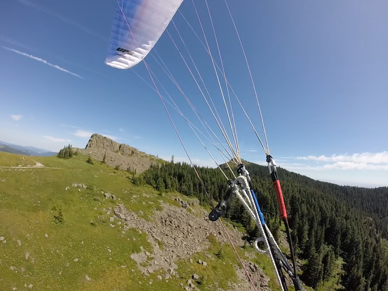
1.Light lift off of 4100' launch.
2.In descending order on left [west ridge], road junction, upper meadow
bail out [beyond large band of trees,] small circular meadow LZ above
parking, parking LZ hidden behind fringe of trees on north edge of
meadow LZ, the Quarry,and the new LZ directly N of Quarry. Note these
all represent possible bailouts if lift inadequate, but all are
potentially negatively impacted by wind direction, thermal activity, and
rotor risk.
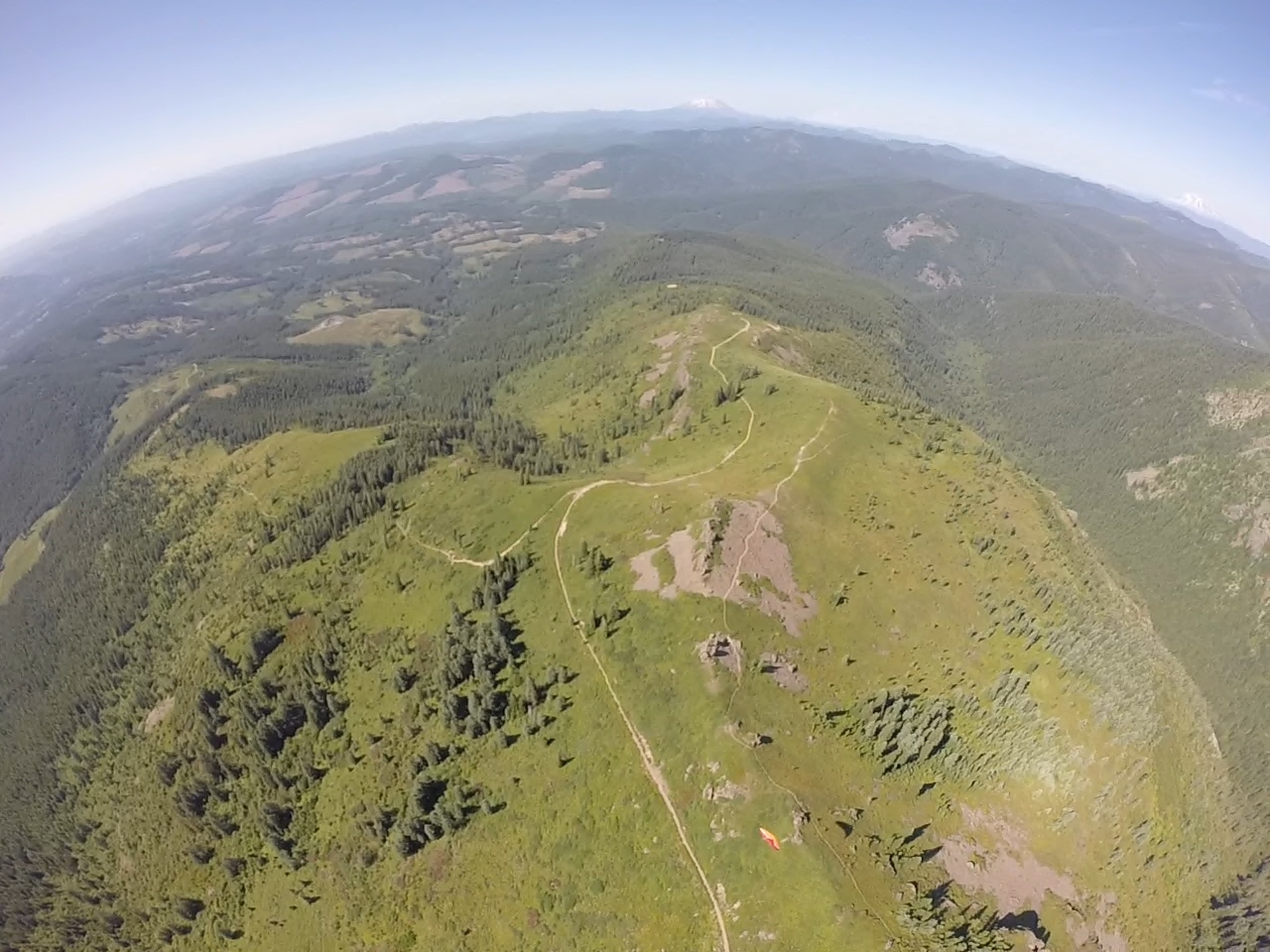
3.On R, access road meeting road L-1100[where gate is closed,] new LZ
bottom R center just right of trees adjacent to road, optimal landing
site bare spot near road, Quarry, parking LZ, meadow LZ.
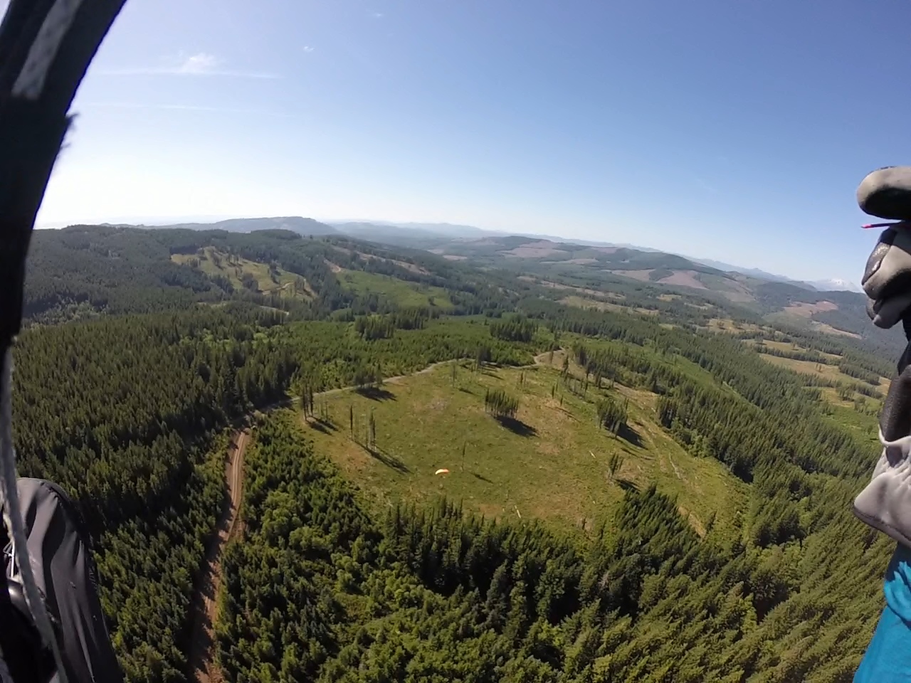
4.Pete on short final new LZ, new logging road to left.
5.Short final new LZ, note large trench, then bare spot near road
[optimal to land just beyond trench, conditions permitting.] Note lack
of trees to N and NW [usual wind direction when flying Silver Star.]
Michael
distances [hiking up on road, not Cascade trail.]
1.Light lift off of 4100' launch.
2.In descending order on left [west ridge], road junction, upper meadow
bail out [beyond large band of trees,] small circular meadow LZ above
parking, parking LZ hidden behind fringe of trees on north edge of
meadow LZ, the Quarry,and the new LZ directly N of Quarry. Note these
all represent possible bailouts if lift inadequate, but all are
potentially negatively impacted by wind direction, thermal activity, and
rotor risk.
3.On R, access road meeting road L-1100[where gate is closed,] new LZ
bottom R center just right of trees adjacent to road, optimal landing
site bare spot near road, Quarry, parking LZ, meadow LZ.
4.Pete on short final new LZ, new logging road to left.
5.Short final new LZ, note large trench, then bare spot near road
[optimal to land just beyond trench, conditions permitting.] Note lack
of trees to N and NW [usual wind direction when flying Silver Star.]
Michael

Bill Briskey
Jul 17, 2018, 10:12:01 AM7/17/18
to mcopp...@gmail.com, Cascade Paragliding Club
Nice pics and description. I hope to get there one day.
Michael
--
You received this message because you are subscribed to the Google Groups "Cascade Paragliding Club" group.
To unsubscribe from this group and stop receiving emails from it, send an email to cpcl+unsubscribe@googlegroups.com.
For more options, visit https://groups.google.com/d/optout.
Michael Coppock
Jul 17, 2018, 11:06:38 AM7/17/18
to Cascade Paragliding Club
Thanks Bill, would love to show you around and fly with you there. There may not be a long sword winery at the end, but it more than makes up for that ,with it’s isolation and verdant beauty. M.
Reply all
Reply to author
Forward
0 new messages