Skip to first unread message
Omar Shehata
Jan 30, 2020, 3:18:59 PM1/30/20
to cesium-dev
Hey everyone!
We just released Cesium Stories! This lets you build and share 3D geospatial presentations and stories on the web without writing any code. Check out the announcement blog:
Cesium Stories makes it easy to fuse various datasets, create annotation slides and views and most importantly share your stories with others. The slides are completely interactive so the user can fully explore the scene. It can also be a great way to fuse and geolocate multiple assets in the same scene.
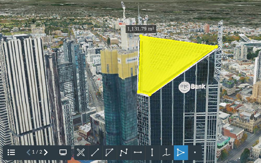
One really exciting thing is that Cesium Stories has measurement tools built-in! So you can make distance, height, and area measurements on any of your data on Cesium ion.

The example above is from the Melbourne photogrammetry tileset which you can play with in the Cesium Stories tutorial (https://cesium.com/docs/tutorials/stories-introduction/).
This is currently in an open preview, so we'd love to hear your feedback and suggestions, and just generally see what you build with it!
Rajat Shinde
Jan 30, 2020, 3:59:28 PM1/30/20
to cesiu...@googlegroups.com
Dear Team,
This is simply superb. I did not go through the complete tutorial but I couldn't resist the appreciation for the 3D presentation available on the shared blog. I am planning to build a story very soon. Thanks!
Kind regards,
Rajat
--
You received this message because you are subscribed to the Google Groups "cesium-dev" group.
To unsubscribe from this group and stop receiving emails from it, send an email to cesium-dev+...@googlegroups.com.
To view this discussion on the web visit https://groups.google.com/d/msgid/cesium-dev/609b54e1-cc75-40e7-99b6-357e7321a836%40googlegroups.com.
citrus...@gmail.com
Mar 17, 2020, 7:43:22 PM3/17/20
to cesium-dev
Is it possible to password protect a shared Cesium story? Or otherwise make it available only internally?
Omar Shehata
Mar 18, 2020, 9:05:27 AM3/18/20
to cesium-dev
Right now if you disable sharing, the present link will only work if you're logged into your account (as the author you're the only who has access to it).
We've definitely been considering adding either a password, or the ability to share it with other specific Cesium ion users.
Reply all
Reply to author
Forward
0 new messages
