Skip to first unread message

beno...@gmail.com
Mar 12, 2020, 6:27:49 AM3/12/20
to cesium-dev
1. A concise explanation of the problem you're experiencing.
Hello everyone,
I'm using tilers from the enterprise package that Cesium offers. Tiling an asset (file) gives me a cesium 3dtiles dataset, as expected.
What I'de like to do is extracting bounding volume and center in WGS84 coordinates from the generated tileset.
When browsing 3dtiles specification I find that every node has a bouding volume (box in my case) matrix and a transform matrix. https://docs.opengeospatial.org/cs/18-053r2/18-053r2.html
My guess is that it should be possible with some calculations between those 2 matrices to obtain WGS84 coordinates about the center and region of the tileset.
The goal is to access location information about a tileset without loading the cesium viewer (wich occurs later in the app).
I think CesiumJS wrap the math somewhere, but I don't know exactly where to look.
Has anyone tried to do this ?
Any advice or idea ?
Thank you for the help !
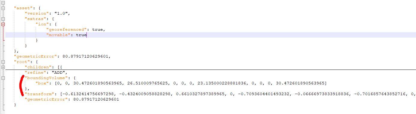
P.S. :here is the location of these matrices in tileset.json files :

Omar Shehata
Mar 16, 2020, 1:30:39 PM3/16/20
to cesium-dev
You can see the logic for how to compute the world location from the bounding volume here:
Let me know if this helps.
beno...@gmail.com
Mar 17, 2020, 6:13:11 AM3/17/20
to cesium-dev
Yes it helps, thanks !
Reply all
Reply to author
Forward
0 new messages