Cross Country Bike Ride Preliminary Maps for the 1st Half...
20 views
Skip to first unread message

Steve ORourke
Jan 10, 2022, 4:00:13 PM1/10/22
to Steve ORourke
I thought I'd share with you a few alternative 'concept' maps for the cross-country ride as far as I've sketched them out. The plan is to start rolling in early May from New England.
I've a lot of background motivations for some portions of the ride as I've thought about it so far. Basically, to start where some of my ancestors landed in the new world 360 years ago and then hit a couple other spots relating to some semi-relevant history. Also I want to minimize population centers or busy traffic corridors. Also, I generally want to refrain from Adventure Cycling routes and who knows what else?
My preferences in the eastern half of the country are Township roads and quiet county highways as well as small towns. I prefer to not get too far from humanity. Just keep a happy medium with low traffic. West of the Missouri River, roads tend to be fewer and far between. Choices tend to narrow.
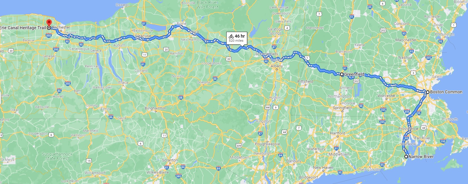
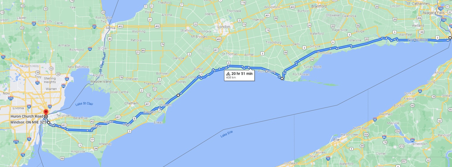
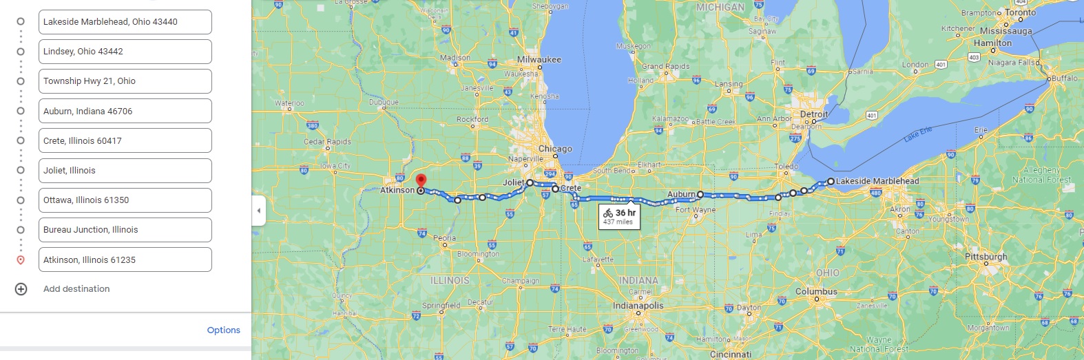
The Erie Canal corridor seems likely to be a good route across New York. I suspect there will be plenty of tenting opportunities along there. The cross into Canada and follow the north shore of Lake Erie. Very rural and looks like quieter roads. Then take a ferry back down into Ohio and cross the heartland. In Illinois I would probably cross the state using the canals/tow paths that I took nine years ago ( http://www.crazyguyonabike.com/doc/IllnoisStagecoachAndCanals2012 ). Then cross Iowa and northern Nebraska and into Southern Wyoming. I'll work on more general route alternatives in the next couple weeks.
The big challenge is to get out of the more populous east with the least complications. Population density is a bear...
Anyway, the maps are more conceptual than literal. I just want to come up with some basic ideas from which I can deviate as whim and circumstances come along.
A ride isn't a ride until it begins. But first, it has to start in one's head.
I'll keep you posted,
Steve
Steve O'Rourke
P.O. Box 538Baldwin, WI 54002
Bicycle Trips: http://www.crazyguyonabike.com/ScoutSteve
Blogspot: https://scoutsteve.blogspot.com/
"Whatever you can do or dream you can, begin it. Boldness has genius, power and magic in it!"
---Goethe quoted in The Scottish Himalayan Expedition by Murray

Bob Carlson
Jan 10, 2022, 4:34:17 PM1/10/22
to Steve ORourke, Touring
The Erie Canal was easy riding for sure. There are some really interesting canal features along the way, like a 4 way intersection and a I remember a place where 2 canals cross at different levels, I think. We only spent a couple of days on it, but you can cross NY with it.
N shore of Erie is really nice. Do not skip Niagara. Riding up to it from up river was a highlight of our cross country trip.
With the right information I have found that there is usually a pretty good way into/out of even big US cities. (In Europe it’s a piece of cake.) I know Chicago N shore pretty well so I could do that from personal knowledge. Same with SF peninsula and Marin or Portland, OR.
Strava Heat map is an excellent source.
-Bob
Tucson AZ
On Jan 10, 2022, at 13:59, Steve ORourke <stev...@gmail.com> wrote:
<CrossCountryProject2022_SecondLeg_CanadianOption_Preliminary03.jpg>
Reply all
Reply to author
Forward
0 new messages