Data region definions
43 views
Skip to first unread message

David Taylor
Aug 14, 2021, 4:07:08 PM8/14/21
to Apps4Av Forum
What are the data region definitions for the USA terrain and IFR data sets?
The labels suggest they may be organized in the same way that the chart supplements are (NE, SW, etc.),
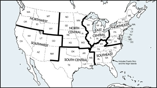
However, (for example) I find the low IFR chart for the Avare's SW region has an eastern boundary somewhere in UT/AZ. Colorado is not part of the SW data set as suggested by the region definition for SW Chart supplements.
Let's read the in-app help:
"... and online FAA chart reference maps to help you select Downloads in Avare."
Ok, here is the FAA's chart coverage definitions for the low IFR charts:
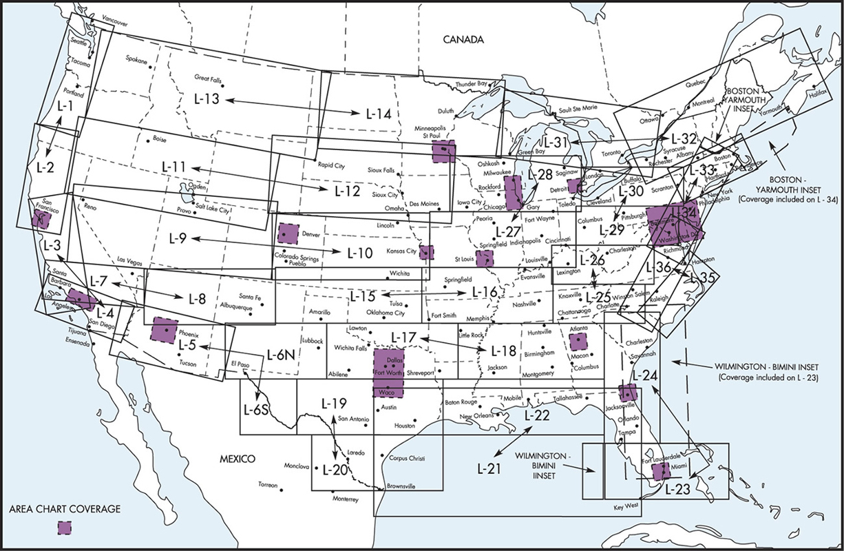
No hint of tidy boundaries based on compass points as the Avare data regions are named.
Any guidance to offer? Where are the Avare data boundaries documented?
Thanks!
Dave

Zubair Khan
Aug 14, 2021, 8:42:37 PM8/14/21
to dgt....@gmail.com, apps4a...@googlegroups.com
Hi Dave
The boundaries are defined in code. See the code at GitHub project Avare sec/main/java/com.ds.avare/place/Boundaries.java
Sent from ProtonMail mobile
-------- Original Message --------
The boundaries are defined in code. See the code at GitHub project Avare sec/main/java/com.ds.avare/place/Boundaries.java
Sent from ProtonMail mobile
-------- Original Message --------
--
You received this message because you are subscribed to the Google Groups "Apps4Av Forum" group.
To unsubscribe from this group and stop receiving emails from it, send an email to apps4av-foru...@googlegroups.com.
To view this discussion on the web visit https://groups.google.com/d/msgid/apps4av-forum/57b44390-5d6c-4423-9b36-f520a9b37da0n%40googlegroups.com.
David Taylor
Aug 15, 2021, 3:16:24 PM8/15/21
to Apps4Av Forum
Ooh, point data! I can work with that. Let's see, there's a GIS developer hat around here somewhere...
Anyone may use these images as they wish. Maybe they could be incorporated into the app or help material?
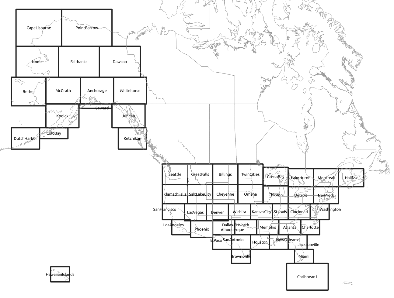
Here's a generic index for: en route high/low, elevations & shaded relief.
Here's the Canada grid index:
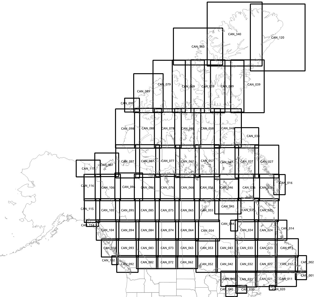
Here's the Sectional index:
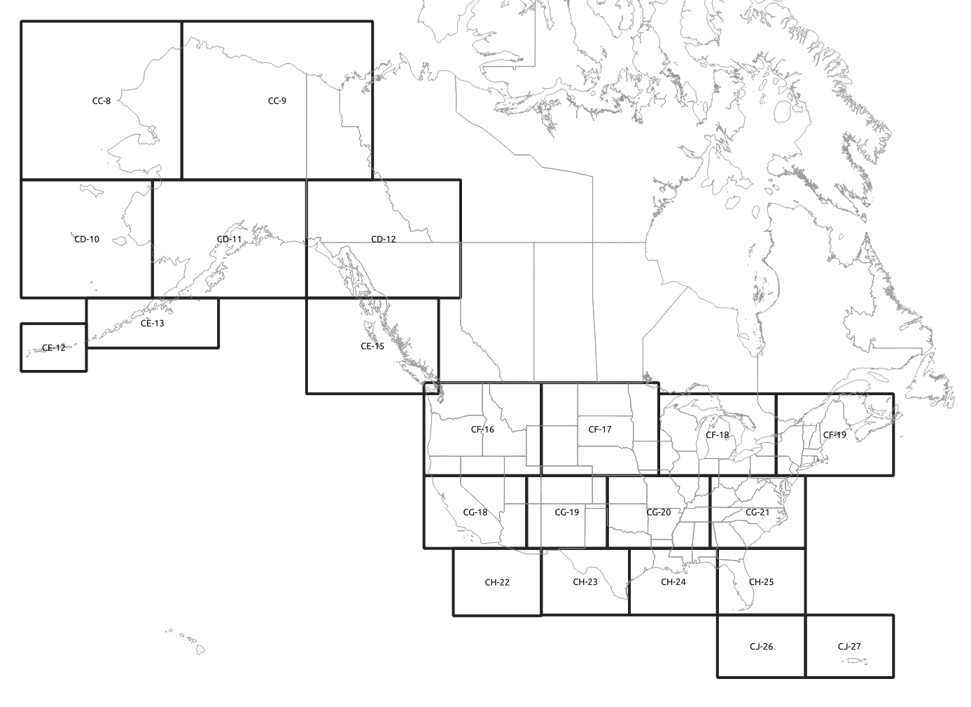
Here's the WAC index:
David Taylor
Aug 15, 2021, 3:36:44 PM8/15/21
to Apps4Av Forum
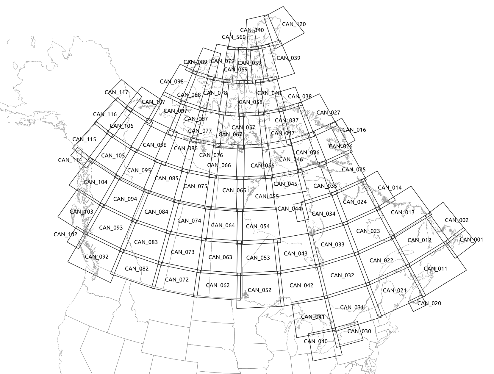
Here's a Canada grid index with a Lambert projection. Less distortion at high latitudes.

Zubair Khan
Aug 15, 2021, 7:49:13 PM8/15/21
to dgt....@gmail.com, apps4a...@googlegroups.com
Great. Will be added to the next build.
Thanks a lot.
Sent from ProtonMail mobile
-------- Original Message --------
Thanks a lot.
Sent from ProtonMail mobile
-------- Original Message --------
On Aug 15, 2021, 3:36 PM, David Taylor < dgt....@gmail.com> wrote:
Here's a Canada grid index with a Lambert projection. Less distortion at high latitudes.
--
You received this message because you are subscribed to the Google Groups "Apps4Av Forum" group.
To unsubscribe from this group and stop receiving emails from it, send an email to apps4av-foru...@googlegroups.com.
To view this discussion on the web visit https://groups.google.com/d/msgid/apps4av-forum/c803eee3-2589-4c87-b7e6-2fe1cdaa0df3n%40googlegroups.com.
Reply all
Reply to author
Forward
0 new messages